Marine Biodiversity Science Center

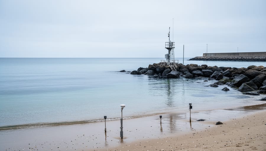
Mean sea level (MSL) is the average height of the ocean’s surface, measured over a period long enough to smooth out tidal fluctuations, waves, and short-term weather variations. For maritime governance and ocean management, MSL serves as the baseline from which nations measure their territorial seas, exclusive economic zones, and continental shelf claims under international law. Yet as our climate warms and sea levels rise at an accelerating pace, this seemingly stable reference point has become anything but fixed, creating urgent legal and practical challenges for blue economy governance and coastal communities worldwide.
Traditionally, MSL is calculated by averaging tide gauge readings over 19-year cycles, the period required to account for all significant lunar and solar tidal cycles. These measurements establish not only nautical charts and navigation safety zones but also the legal boundaries that determine which nation controls fishing rights, mineral extraction, and conservation responsibilities in ocean waters. The United Nations Convention on the Law of the Sea (UNCLOS) anchors these maritime zones to coastal baselines, which in turn reference MSL at the time boundaries were established.
The problem? Global mean sea level has risen approximately 21 centimeters since 1880, with the rate of rise doubling since 2006. Small island nations face potential submersion, while low-lying coastal states watch their territorial waters shift. Do maritime boundaries move inland with rising seas, or do they remain fixed to historical baselines? This question carries profound implications for marine biodiversity protection, fisheries management, and the sovereignty of nations whose very existence depends on the answer. Understanding MSL and its evolving role in ocean governance has never been more critical for anyone working to protect our marine ecosystems.
What Mean Sea Level Is and Why It Matters for Maritime Governance
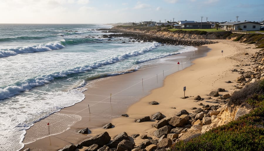
The Science Behind MSL Calculation
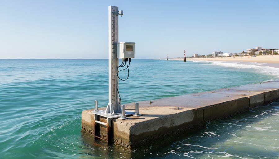
Scientists calculate mean sea level by averaging ocean surface heights over extended periods, typically 19 years or longer. This timeframe captures the complete 18.6-year lunar nodal cycle that influences tidal patterns, ensuring the measurement reflects true average conditions rather than temporary fluctuations.
Tide gauges form the traditional foundation of MSL measurement. These instruments, installed along coastlines and on stable offshore structures, record water levels continuously. Modern digital gauges measure sea surface height every few seconds, creating detailed records that scientists process to filter out tides, storm surges, and wave action. The data reveals the underlying trend: the average sea surface height at that location.
Satellite altimetry revolutionized MSL calculation starting in the early 1990s. Satellites like Jason-3 and Sentinel-6 bounce radar pulses off the ocean surface from orbit, measuring the return time to calculate sea surface height with centimeter-level precision. These instruments scan vast ocean areas, providing global coverage that tide gauges alone cannot achieve. Scientists combine satellite and tide gauge data to create comprehensive MSL baselines.
Calculating MSL requires accounting for seasonal variations driven by water temperature changes, ocean currents, and atmospheric pressure patterns. Scientists also adjust for longer climatic cycles like El Niño events, which temporarily raise or lower regional sea levels. By averaging measurements across these cycles, they isolate the true mean level from natural variability, establishing the stable reference point needed for maritime boundary definition and tracking long-term sea level rise.
MSL as the Foundation of Maritime Boundaries
Under the United Nations Convention on the Law of the Sea, coastal states draw three critical governance zones outward from MSL-derived baselines. Territorial waters extend 12 nautical miles from the baseline, granting the coastal nation full sovereignty over resources, navigation, and conservation regulations within those waters, essentially the same authority it exercises over land territory. Beyond that lies the contiguous zone, stretching to 24 nautical miles, where the state can enforce customs, immigration, and sanitary laws. Most significant for marine biodiversity is the exclusive economic zone, or EEZ measured from baselines extending 200 nautical miles from MSL. Within the EEZ, the coastal nation holds sovereign rights to exploit, conserve, and manage all living and non-living resources, from fisheries to offshore oil deposits.
These boundaries carry profound consequences. A single meter of sea level rise can shift baselines inland, potentially shrinking territorial waters and reducing the area where a nation can enforce fishing quotas or establish marine protected areas. For small island states, this isn’t academic, rising MSL threatens to erase entire EEZs, stripping nations of their resource rights and conservation authority. Even modest baseline changes can trigger boundary disputes, complicate fisheries management, and undermine decades of marine spatial planning designed to protect coral reefs, spawning grounds, and migratory corridors.
Which Nations and Agencies Are Responsible for MSL Measurement
National Sovereignty and Technical Standards
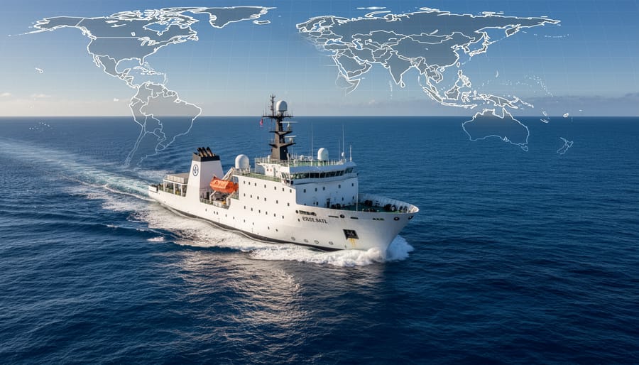
Under the United Nations Convention on the Law of the Sea (UNCLOS), each coastal nation holds primary responsibility for establishing and maintaining its own maritime baselines. This sovereignty extends to determining the low-water line along the coast from which territorial seas and other zones are measured. However, nations cannot simply draw lines where they wish, UNCLOS Article 5 requires that baselines follow “the low-water line along the coast as marked on large-scale charts officially recognized by the coastal State.”
To ensure global consistency, coastal nations must adhere to technical standards set by the International Hydrographic Organization. These standards specify minimum requirements for tidal observation periods, typically requiring at least 19 years of continuous tide gauge data to account for the 18.6-year lunar nodal cycle that influences mean sea level calculations. Charts must use recognized vertical datums, and baseline coordinates must be deposited with the UN Secretary-General for international verification.
This framework balances national control with international accountability. While each country determines its own baselines, the technical requirements prevent arbitrary claims that could infringe on international waters or neighboring states’ rights. Nations must publish their baseline coordinates and supporting documentation, allowing other states to challenge measurements that appear inconsistent with UNCLOS provisions or accepted surveying practices.
International Oversight and Coordination
While individual nations maintain sovereign authority over their baselines, international bodies ensure global consistency in MSL measurement and interpretation. The International Hydrographic Organization (IHO) establishes technical standards for hydrographic surveys and chart datum systems that coastal states use to calculate their baselines. These standards prevent arbitrary measurements and maintain comparability across jurisdictions.
The United Nations Division for Ocean Affairs and the Law of the Sea maintains the official repository of maritime claims under UNCLOS, tracking baseline coordinates and zone declarations from member states. When nations submit baseline changes, this division verifies compliance with treaty requirements and publishes updates for international transparency.
The Intergovernmental Oceanographic Commission coordinates global tide gauge networks and satellite altimetry programs, providing the scientific infrastructure nations rely on for accurate MSL determination. This UNESCO body also facilitates data sharing among national meteorological services and research institutions.
When sea level rise creates boundary disputes, particularly between neighboring states or over contested resources, the International Tribunal for the Law of the Sea offers binding arbitration. However, no international mechanism currently mandates baseline updates as seas rise, leaving the timing and legal interpretation of shifting boundaries largely unresolved in international law.
How to Access and Apply Official MSL Data for Policy and Conservation Work
Accessing National and Global MSL Databases
Obtaining official MSL data starts with three primary global resources. The Permanent Service for Mean Sea Level (PSMSL), operated by the UK’s National Oceanography Centre, maintains the world’s most comprehensive archive of monthly and annual mean sea level measurements from over 2,000 tide gauge stations spanning more than a century. Their website () offers free downloads of quality-controlled datasets in multiple formats, searchable by station name, country, or geographic coordinates.
NOAA’s Center for Operational Oceanographic Products and Services provides real-time and historical tide gauge data across U.S. coastal waters, the Great Lakes, and Pacific territories through its Tides and Currents portal (). Users can generate custom graphs, download hourly water levels, and access metadata on station locations and datum references, essential for baseline mapping.
For satellite-based measurements, NASA’s Physical Oceanography Distributed Active Archive Center (PO.DAAC) hosts altimetry data from missions like Jason-3 and Sentinel-6, revealing global sea surface height changes since 1992. These datasets complement tide gauge records by covering open ocean areas beyond coastal monitoring networks.
Each database includes technical documentation explaining vertical datums, tidal constituents, and data processing methods. Conservationists applying MSL data to marine spatial planning often cross-reference these sources to validate baselines and model future boundary shifts, work that strengthens the sustainability pillars supporting adaptive ocean governance frameworks.
Applying MSL Data to Marine Conservation Planning

Once you’ve accessed MSL data, the real work begins: translating baseline measurements into conservation action. Marine planners routinely use MSL-derived boundaries to define where marine protected areas can be established under national jurisdiction. For instance, a coral reef system straddling the edge of a nation’s 12-nautical-mile territorial sea requires precise MSL baselines to determine which waters fall under domestic conservation authority versus international governance. This clarity proves essential when coordinating with fisheries council management bodies that regulate extraction within those zones.
Climate modelers overlay MSL projections with bathymetric maps to predict where critical habitats will migrate as seas rise. A mangrove forest currently protecting a coastline may shift landward by hundreds of meters over the next three decades, crossing property lines and administrative boundaries. Conservation planners use these projections to pre-emptively secure migration corridors and adjust protected area boundaries before habitats disappear.
Dr. Elena Cardoso, a marine biologist working on coastal resilience in the Philippines, describes how her team used historical MSL data to map seagrass meadow losses. “We compared 1980s baselines with current measurements and realized we’d lost 40 percent of nursery habitat as waters rose and sediment patterns shifted,” she explains. “That data convinced local governments to adopt floating baseline policies, our MPAs now move with the habitat, not arbitrary old coordinates.” Her advocacy led to adaptive zoning frameworks that track ecological reality rather than static lines on outdated charts, protecting biodiversity even as the ocean itself changes shape.
Rights, Obligations, and Legal Implications Under UNCLOS
What Coastal States Can Enforce in Each Zone
Under the United Nations Convention on the Law of the Sea, coastal states hold distinct enforcement powers in each maritime zone measured from their MSL baseline. In territorial waters (extending 12 nautical miles from the baseline), states exercise nearly complete sovereignty. They can regulate or prohibit all foreign fishing, control mineral extraction, enforce environmental laws, require permits for scientific research, and designate marine protected areas with binding restrictions. Foreign vessels enjoy “innocent passage” through these waters, but the coastal state can suspend that right if passage threatens security or the marine environment.
The contiguous zone (extending to 24 nautical miles) grants more limited authority. Here, states can enforce customs, immigration, fiscal regulations, and sanitary laws, but they cannot regulate fishing or shipping as freely as in territorial waters.
Within the exclusive economic zone (stretching 200 nautical miles from the baseline), coastal states hold sovereign rights over natural resources. They control all fishing, oil and gas extraction, and renewable energy development. They can establish catch limits, require foreign fishing licenses, designate no-take reserves, and prosecute illegal fishing. However, other nations retain freedom of navigation and overflight. Scientific research requires coastal state consent, giving nations leverage to shape conservation priorities through ocean policy enforcement.
These powers create critical tools for marine biodiversity protection, but enforcement capacity varies widely. Many coastal nations lack patrol vessels or monitoring technology to police vast EEZs effectively.
Obligations to Update and Report Baseline Changes
Under the United Nations Convention on the Law of the Sea, coastal states bear responsibility for depositing their maritime baseline charts and geographical coordinates with the UN Secretary-General, who publishes this information for international recognition. When nations adjust their baselines, whether due to coastal erosion, land reclamation, or sea level changes, UNCLOS Article 16 requires they provide “due publicity” to these modifications and deposit updated charts with the UN. This notification system ensures predictability in maritime boundaries and prevents unilateral territorial expansion.
The convention, however, remains silent on whether baselines should remain fixed at their original locations or shift landward as seas rise, a question that has sparked intense legal debate. Some nations, particularly Pacific small island states like Tuvalu and the Marshall Islands, advocate for “fixing” their baselines at current coordinates even as their coastlines retreat or disappear entirely. This would preserve their exclusive economic zones and the associated fishing rights and seabed resources that sustain their economies. Others argue baselines must follow the physical coastline as it moves, an “ambulatory” interpretation that could shrink or eliminate maritime zones as islands submerge.
For nations facing complete inundation, the stakes extend beyond resources to statehood itself. International law has no clear precedent for countries that lose all territory yet claim ongoing rights to their maritime zones, a governance crisis that UNCLOS drafters never anticipated.
Where to Get Help: Agencies, Tools, and Resources for MSL and Maritime Governance Questions
Volunteer and Citizen Science Opportunities
Volunteers play a crucial role in filling data gaps and supporting maritime governance research. The NOAA Tide Watch program invites citizens to adopt local tide gauges, reporting anomalies and contributing observational data that supplements automated systems. CoastWatch volunteers across the U.S., Canada, and Australia conduct monthly beach profiling surveys, tracking erosion patterns and baseline shifts that inform regional MSL assessments.
For those interested in technology-driven conservation, the Global Ocean Observing System runs citizen science initiatives where volunteers help calibrate satellite altimetry readings against ground-truth measurements, strengthening the accuracy of sea level datasets used in maritime boundary decisions. These efforts connect directly to broader efforts using marine security tech to monitor ocean boundaries and illegal activities.
The Marine Biodiversity Science Center welcomes volunteers for its Coastal Futures Project, where participants collect shoreline position data, photograph erosion markers, and help map vulnerable habitats facing boundary reclassification due to rising seas. No technical background is required, training sessions cover GPS use, data recording protocols, and the legal frameworks connecting local observations to international governance outcomes.
How to Apply or Complete the Process
Accessing and using MSL data for maritime governance does not require formal applications from most users. Researchers, conservationists, and educators can freely download historical tide gauge records from the Permanent Service for Mean Sea Level (PSMSL) website by selecting a station and data format. For satellite altimetry, NASA’s Physical Oceanography Distributed Active Archive Center (PO.DAAC) provides MSL datasets after creating a free Earthdata account. If you need official baseline coordinates for legal or policy purposes, contact the relevant coastal nation’s hydrographic office, most publish their UNCLOS baselines through their maritime authority or defense ministry websites.
For nations updating or challenging baselines due to sea level rise, the process involves surveying new low-water lines, calculating updated coordinates, depositing charts with the UN Secretary-General under UNCLOS Article 16, and notifying neighboring states. This technical work typically falls to national hydrographic services working with legal experts in ocean conservation leadership and maritime law. Individual researchers do not apply for this process but can access the deposited charts through the UN’s Division for Ocean Affairs and the Law of the Sea.
What to Watch For
When interpreting MSL data for conservation planning or policy advocacy, pay close attention to the measurement period and methodology used to establish a baseline. Not all MSL calculations are directly comparable, tide gauge records spanning decades may conflict with shorter-term satellite altimetry data, and local subsidence or tectonic uplift can skew regional measurements away from global trends. If you’re mapping marine protected areas or fisheries zones against official baselines, verify whether those baselines have been updated to reflect recent sea level rise or whether they remain anchored to historical measurements from the 1970s or 1980s.
For small island nations and low-lying coastal states, watch for legal challenges and international negotiations around baseline fixation. Some countries are now depositing their current maritime coordinates with the United Nations and asserting that these boundaries should remain permanent regardless of future sea level rise, a position with profound implications for resource access, sovereignty, and biodiversity protection. Understanding these legal maneuvers is essential for anyone working on transboundary marine conservation or climate adaptation policy.
Common Questions About MSL and Maritime Zones
What’s the difference between mean sea level and tidal datums?
Mean sea level represents the average ocean height over years or decades, smoothing out tides and seasonal variation. Tidal datums are specific reference heights like mean high water or mean lower low water used for navigational charts and coastal engineering, calculated from shorter observation periods at individual locations.
How often do coastal nations update their maritime baselines?
Most nations update baselines irregularly, often only when conducting major hydrographic surveys or responding to significant coastal changes. Some haven’t revised baselines in decades, creating growing discrepancies as sea level rises and coastlines shift.
Can a small island nation actually lose its exclusive economic zone as sea level rises?
Under traditional interpretations of UNCLOS, if an island becomes submerged or uninhabitable, its EEZ could disappear. Several Pacific island nations are now arguing that baselines should remain fixed at their original coordinates regardless of sea level rise, preserving their maritime zones and sovereignty.
How does satellite altimetry improve MSL measurement for boundary determination?
Satellites provide global sea surface height coverage, filling gaps between sparse tide gauge networks and revealing regional variations in sea level that affect where baselines should be drawn. This data helps validate coastal measurements and detect long-term trends that inform whether boundaries need updating.
These technical questions reflect the practical concerns of researchers and conservationists working at the intersection of ocean science and international law. For those managing marine protected areas, understanding baseline stability matters enormously. If a nation’s baseline shifts landward as seas rise, the seaward boundary of an MPA defined as a fixed distance offshore would also migrate, potentially leaving previously protected habitat outside the conservation zone. Conversely, advocating for fixed baselines, as many vulnerable island nations now do, preserves both national sovereignty and the geographic extent of protected waters, even as physical coastlines retreat. Conservation organizations can support these nations by documenting ecological value within existing maritime zones, providing scientific evidence that stable boundaries protect irreplaceable biodiversity, and participating in international forums where baseline policy is debated.
Accurate MSL measurement isn’t just a technical exercise, it’s the foundation of every maritime boundary that protects our oceans. The baseline from which we measure territorial seas and exclusive economic zones determines where nations can enforce fishing regulations, establish marine protected areas, and safeguard critical habitats from exploitation. As sea level rises, these carefully drawn lines face an existential challenge. Coastal nations risk losing sovereign waters. Marine protected areas may shrink or disappear from legal maps even as the ecosystems they shelter remain biologically intact. Small island states could see their entire EEZs vanish beneath the waves, erasing not just territory but the ability to protect surrounding ocean life.
We can’t afford to treat this as someone else’s problem. The science is clear, the legal frameworks exist, but they need our support and active participation to adapt and endure. Get involved with citizen science programs that monitor coastal change. Support international efforts to establish fixed baselines that preserve maritime zones regardless of where the waterline moves. Volunteer with the Marine Biodiversity Science Center to contribute data, advocate for adaptive governance, and help build resilience in coastal communities.
Our oceans are changing. The question is whether our commitment to protecting them will rise to meet the challenge.

jessica
Ava Singh is an environmental writer and marine sustainability advocate with a deep commitment to protecting the world's oceans and coastal communities. With a background in environmental policy and a passion for storytelling, Ava brings complex topics to life through clear, engaging content that educates and empowers readers. At the Marine Biodiversity & Sustainability Learning Center, Ava focuses on sharing impactful stories about community engagement, policy innovations, and conservation strategies. Her writing bridges the gap between science and the public, encouraging people to take part in preserving marine biodiversity. When she’s not writing, Ava collaborates with local initiatives to promote eco-conscious living and sustainable development, ensuring her work makes a difference both on the page and in the real world.