Marine Biodiversity Science Center

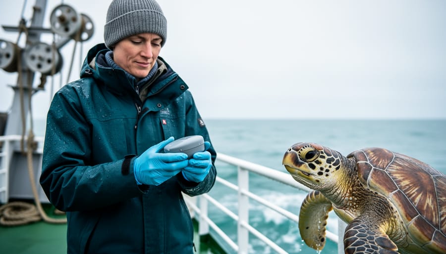
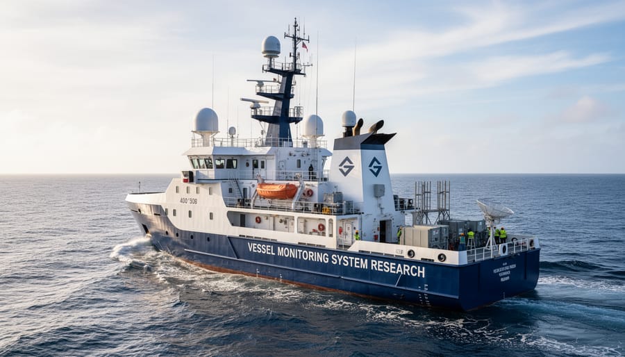
A Vessel Monitoring System (VMS) tracks tagged marine animals through satellite or acoustic technology, transmitting location data that allows researchers to verify survival, movement patterns, and habitat use after release. The implementation process typically takes 2-4 weeks from equipment acquisition to active monitoring, requires intermediate technical skills, and delivers crucial data that can inform conservation decisions for years after a single animal is tagged.
For marine conservation professionals engaged in post-release monitoring VMS has become an indispensable tool. Unlike visual surveys or occasional resightings, this technology provides continuous or near-continuous location data that reveals where animals travel, how they use different habitats, and whether rehabilitation or translocation efforts have succeeded. When a rescued sea turtle returns to the ocean or a tagged shark swims away from a research vessel, VMS transforms that moment from a hopeful goodbye into the beginning of a documented journey.
The stakes are high. Conservation programs invest substantial resources in rescuing, rehabilitating, and releasing marine animals, yet without robust monitoring, we cannot know if these efforts truly work. VMS closes that knowledge gap. A 2025 study tracking released loggerhead turtles in the Mediterranean found that 23% returned to high-risk fishing zones within three weeks, information that would have remained invisible without continuous monitoring and that directly shaped new protected area boundaries.
This guide walks you through the complete VMS implementation process, from selecting appropriate tags and receivers to deploying equipment, collecting data, and verifying system effectiveness. Whether you’re a researcher planning your first tracking study, a conservation manager evaluating monitoring options, or a field technician preparing for deployment, you’ll find the practical steps and troubleshooting insights needed to build a reliable monitoring program. The technology has matured significantly, costs have dropped, and the learning curve, while real, is entirely manageable for teams willing to invest the preparation time.
What You’ll Need: Essential Equipment and Resources
Satellite Tags and Transmitters
Selecting the right satellite tag is crucial for successful VMS-based monitoring of marine animals. Three primary tag types serve different tracking needs: satellite tags transmit location data directly to orbiting satellites when animals surface, making them ideal for air-breathing species like sea turtles, seals, and whales. Acoustic tags emit ultrasonic pings detected by underwater receivers, working best for fish and species that remain submerged for extended periods. Archival tags record environmental data internally, requiring physical recovery but offering the richest datasets for deep-diving species.
When choosing tags for VMS integration, consider your target species’ physiology and behavior. Tag weight shouldn’t exceed 2-3% of the animal’s body mass to prevent drag and stress. Transmission intervals typically range from hourly updates for high-resolution tracking to daily for long-term studies, balancing battery life against data detail.
Most modern satellite tags use the Argos system, which provides global coverage and integrates seamlessly with VMS platforms. Newer models incorporate GPS for higher positional accuracy (within 10 meters versus 150-1000 meters for Argos-only tags). Ensure your chosen tags transmit in formats compatible with your VMS software, proprietary systems may require specific tag models or data conversion protocols.
Battery longevity varies from months to several years depending on transmission frequency and tag type, directly influencing monitoring duration.
Data Collection and Analysis Tools
Once your tags transmit location data, you’ll need robust software to turn raw signals into actionable insights. Most VMS programs rely on cloud-based platforms like Movebank, Wildlife Computers Portal, or Ocean Tracking Network, which automatically receive satellite transmissions and organize them into downloadable datasets. These platforms handle data validation, filtering erroneous positions caused by signal bounce or atmospheric interference, and provide basic visualization through interactive maps.
For deeper analysis, marine biologists typically export data to specialized tools. R packages such as `aniMotum` and `foieGras` correct location errors and model movement paths between transmissions. QGIS and ArcGIS integrate VMS tracks with oceanographic layers, sea surface temperature, chlorophyll concentration, bathymetry, revealing how animals respond to environmental gradients. If you’re studying habitat use, programs like Geospatial Modelling Environment calculate home ranges and identify high-use areas.
Database management matters for long-term studies. Many research teams use PostgreSQL with PostGIS extensions to store years of tracking records, enabling queries across multiple species and seasons. Cloud storage through AWS or institutional servers ensures your data remains secure and accessible to collaborators, while version control prevents analysis errors from corrupted files.
Safety and Ethical Considerations Before You Begin
Animal Welfare and Tagging Protocols
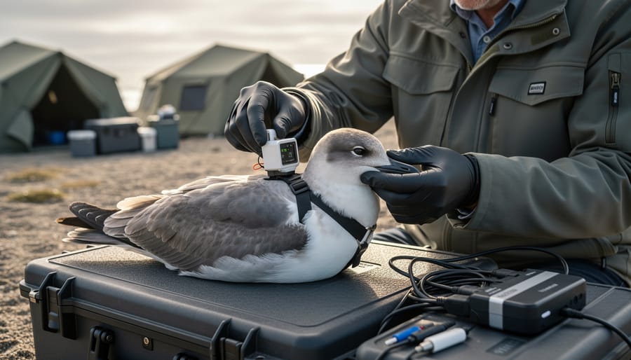
Humane tagging requires meticulous attention to minimize stress and injury throughout every stage of the process. Before any tag deployment, ensure your team includes trained veterinary professionals or experienced marine biologists who understand the physiology and behavior of your target species. The handling time should be as brief as possible, ideally under five minutes for most species, to prevent exhaustion, hyperthermia, or capture myopathy.
Species-specific protocols are non-negotiable. Sea turtles, for instance, require different attachment methods than sharks or marine mammals. For sea turtles, epoxy-attached tags on the carapace work well, while sharks may need tags secured to dorsal fins using titanium bolts under local anesthetic. Always match tag size to animal body mass; a general rule is that tags should weigh less than 5% of the animal’s body weight to avoid affecting swimming efficiency or behavior.
Monitor tagged animals immediately post-release for signs of distress, abnormal behavior, or infection at attachment sites whenever possible.
Legal and Regulatory Requirements
Tagging and tracking marine animals requires navigating a complex web of legal requirements before you can deploy a single device. In the United States, researchers must obtain permits from the National Marine Fisheries Service (NMFS) under the Marine Mammal Protection Act for marine mammals, or from the U.S. Fish and Wildlife Service for sea turtles and other protected species. These permits specify which animals you can tag, allowable handling procedures, and reporting obligations.
Institutional Animal Care and Use Committee (IACUC) approval is mandatory for any research involving live animals at universities and research institutions. Your IACUC protocol must detail tagging methods, justification for sample sizes, and measures to minimize stress and injury.
International waters present additional challenges. The Convention on Migratory Species and regional fisheries management organizations impose their own requirements for tagging activities. If your monitoring extends across national boundaries, coordinate with relevant authorities in each jurisdiction well before fieldwork begins. Processing permits often takes six to twelve months, so plan accordingly and maintain meticulous records of all approvals throughout your monitoring program.
Step-by-Step: Implementing VMS for Marine Animal Tracking
Step 1: Define Your Monitoring Objectives
Before deploying any vessel monitoring system, you need a clear roadmap that guides every technical decision ahead. Start by articulating your core research questions: Are you investigating post-release survival rates? Migration corridors? Foraging behavior? Habitat preferences? Each question demands different tag specifications and monitoring durations.
Next, identify your target species with precision. A juvenile green sea turtle requires vastly different VMS parameters than an adult great white shark, body size, dive depth, movement speed, and expected range all shape your technology choices and vessel deployment patterns.
Define your geographic monitoring zone realistically. Will you track animals within coastal waters, across an entire ocean basin, or along known migration routes? Your spatial scope determines receiver placement, vessel coverage areas, and satellite uplink requirements. Be honest about your operational capacity; an overly ambitious zone spreads resources too thin and creates data gaps.
Finally, establish your monitoring timeline. Short-term studies (weeks to months) can use higher-frequency transmissions and intensive vessel tracking, while multi-year programs need energy-efficient tags and sustainable data collection protocols. Align these parameters with your conservation goals, whether informing marine protected area boundaries, assessing rehabilitation success, or identifying critical habitats, so every data point serves a clear purpose.
Step 2: Select and Program Appropriate Tags
Selecting the right tag transforms raw technology into actionable conservation data. Start by matching tag type to your species’ physical characteristics: satellite tags work well for large pelagic animals like sharks and sea turtles that surface regularly, while acoustic tags suit smaller species or those in coastal waters where receiver arrays exist. Check your target animal’s dive depth, tags must withstand pressure at maximum recorded depths, typically rated from 200 meters for shallow-diving species to 2,000+ meters for deep divers like beaked whales.
Size matters critically. The tag should not exceed 2% of the animal’s body weight or disrupt natural swimming mechanics. A 400-kilogram loggerhead turtle can carry a 150-gram satellite tag comfortably, but the same tag would impair a juvenile hawksbill.
Programming requires precision. Set transmission intervals based on monitoring goals and battery life trade-offs: hourly pings provide detailed movement data but drain batteries within weeks, while 12-hour intervals extend deployments to several years. Configure your tags to transmit on frequencies compatible with your VMS receivers, most conservation programs use Argos satellite system frequencies (401.650 MHz) for broad-scale tracking. Enter species-specific behavior filters to reduce false locations caused by erratic surfacing patterns, and enable smart-power-management features that activate transmissions only when satellites are overhead, maximizing battery efficiency without sacrificing data quality.
Step 3: Deploy Tags on Marine Animals
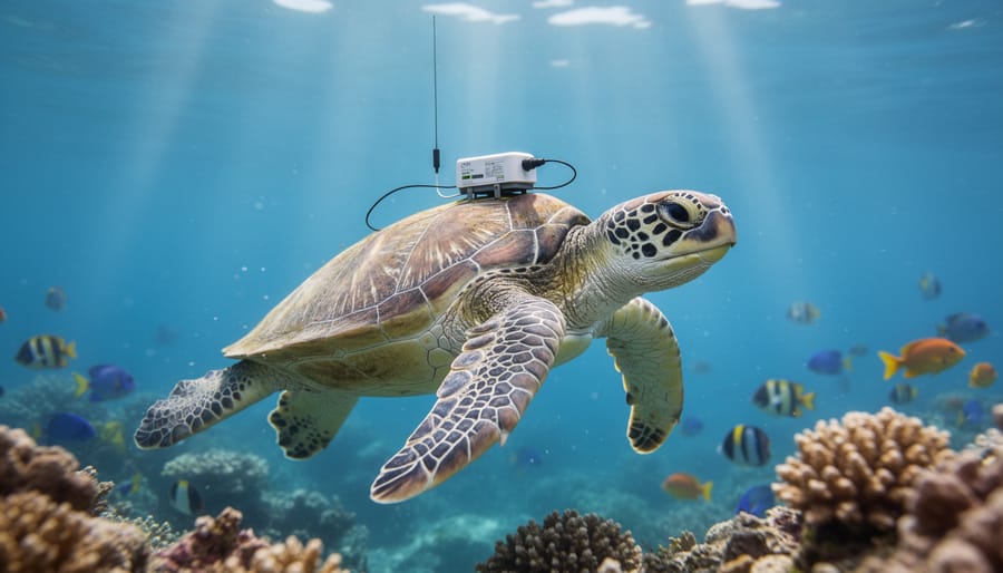
Deploying tags requires precision timing and species-appropriate attachment methods to ensure both animal welfare and effective tracking. The deployment moment, whether during an active rescue, controlled research capture, or rehabilitation release, dictates your approach and available time.
For sea turtles, attach satellite tags to the carapace using marine-grade epoxy or fiberglass resin after thoroughly cleaning and lightly sanding the attachment site. Position tags posterior to the midline to minimize hydrodynamic drag. Large pelagic sharks require sturdy dorsal fin attachments using corrosion-resistant bolts or specialized clamps, while smaller coastal species may accept externally-mounted tags with nylon tethers.
Marine mammals present unique challenges. Pinnipeds tolerate head-mounted tags glued to fur between molting periods, but cetaceans require suction-cup attachments or minimally-invasive implantable tags depending on study duration and species regulations.
Timing is critical: tag animals when they’re calm and physiologically stable, ideally just before release when handling stress is already minimized. For rehabilitation releases, coordinate with veterinary staff to ensure animals have recovered sufficiently that tag weight won’t compromise swimming efficiency. Document attachment procedures thoroughly, photographs and detailed notes become invaluable when interpreting later movement data or troubleshooting transmission issues.
Step 4: Configure VMS Receivers and Monitoring Network
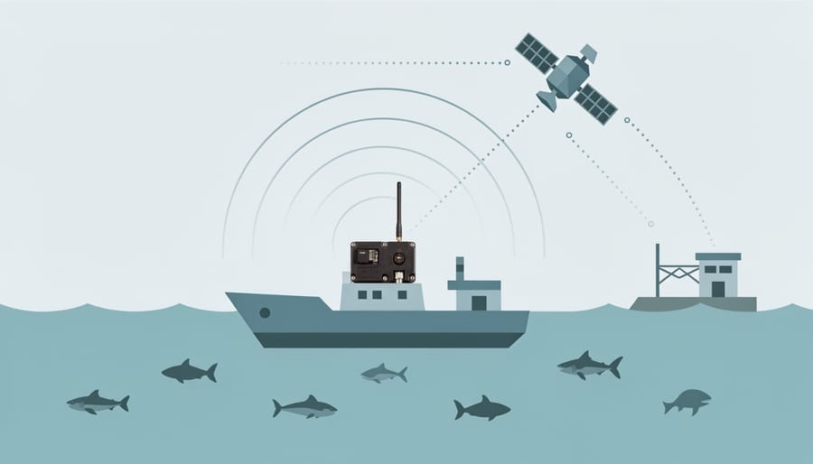
Setting up your VMS monitoring network requires coordinating multiple receiver types to maximize tag detection coverage. Begin by installing vessel-based receivers equipped with VHF or UHF antennas on boats that regularly patrol your study area, fishing vessels, research ships, and conservation patrol boats make excellent platforms. Mount antennas at the highest practical point to extend reception range, typically 5-10 kilometers depending on sea conditions and tag depth.
For areas with consistent animal movement patterns, deploy fixed monitoring stations at strategic coastal points, island passages, or known migration corridors. These autonomous stations record detections continuously and either transmit data via cellular networks where available or store it for manual retrieval during service visits. Solar panels and robust weatherproof housings ensure year-round operation.
Configure satellite uplink systems for tags designed to transmit when animals surface. Partner with established satellite data services like Argos or ICARUS that receive signals from low-Earth orbit satellites and route them to your designated data management platform. Set up automated data feeds to push incoming detections directly into your central database, establishing quality control filters that flag suspicious signals while preserving raw data for later verification.
Step 5: Collect and Process Real-Time Data
Once tags are transmitting and your VMS network is active, real-time data collection becomes an ongoing operational task requiring vigilance and systematic processing. Your central monitoring station will receive satellite uplinks or acoustic detections as tagged animals move through the study area, typically displaying their positions on mapping software within minutes to hours of transmission.
Establish a routine check schedule, at least twice daily, to review incoming signals and confirm tags are reporting as expected. Compare actual transmission intervals against programmed settings; gaps longer than anticipated may indicate tag malfunction, animal mortality, or the creature moving beyond receiver range. Flag any anomalous data points, such as positions that suggest impossible movement speeds (indicating signal drift or reflection errors), and cross-reference with oceanographic conditions that might affect signal quality.
Coordinate vessel patrols to maintain coverage in areas where animals concentrate, adjusting routes based on real-time position updates to maximize detection probability while avoiding disturbance to tagged individuals.
Step 6: Analyze Movement Patterns and Behavior
Once you’ve collected VMS data from your tagged animals, the real conservation value emerges through systematic analysis. Start by importing position fixes into GIS software like ArcGIS or QGIS to visualize movement trajectories and identify patterns. Look for habitat hotspots by calculating kernel density estimates that reveal where animals spend most of their time, these areas often indicate critical feeding, breeding, or nursery grounds requiring protection.
Migration routes become apparent when you plot successive locations and calculate movement rates. Filter your data by season, time of day, and environmental variables like sea surface temperature or chlorophyll concentration to understand what drives animal behavior. Modern AI smart monitoring platforms can automatically detect behavioral state changes, distinguishing between traveling, foraging, and resting periods based on speed and turning angles.
Don’t analyze individual tracks in isolation. Compare movement patterns across multiple animals to identify population-level trends versus individual variation. Calculate home range sizes using minimum convex polygons or Brownian bridge models, and test whether tracked animals avoid certain areas like shipping lanes or pollution zones. These insights directly inform marine spatial planning, fisheries management zones, and the design of marine protected areas tailored to actual animal use rather than assumption.
How VMS Integrates with Other Post-Release Monitoring Techniques
VMS delivers the most powerful conservation insights when combined with complementary tracking methods rather than used in isolation. While satellite tags provide broad-scale movement data across ocean basins, acoustic telemetry fills in fine-scale behavioral details near coastlines and critical habitats where animals concentrate. Photo-identification adds individual life history context, reproductive status, social associations, injury patterns, that raw location coordinates can’t reveal. Together, these approaches create a three-dimensional picture of post-release survival and adaptation.
Aerial surveys validate VMS data by confirming animals are actually present in predicted locations and provide population-level context your tagged individuals represent. If your satellite-tagged sea turtles cluster in a specific foraging zone, aerial counts determine whether that area hosts ten turtles or ten thousand. Environmental DNA sampling verifies habitat use patterns VMS suggests, detecting species presence even when visual confirmation proves difficult. When a tagged whale shark’s VMS track shows repeated returns to a reef system, eDNA analysis confirms whether the animal is actively feeding there or simply transiting through.
This integrated approach also addresses the practical limitations each method faces. VMS excels at tracking pelagic movements but struggles in shallow coastal waters where satellite transmission fails. Acoustic receivers stationed in these gaps capture what satellites miss. Photo-identification works brilliantly for surface-active species but can’t track animals during deep dives, exactly where archival tags attached via VMS vessels provide depth and temperature profiles. The combination compensates for individual weaknesses while building redundancy that strengthens your conclusions.
Resource sharing makes multi-method programs more feasible than they initially appear. Research vessels deploying VMS tags can simultaneously collect water samples for eDNA analysis and conduct photo-ID surveys during approach. The same permits covering satellite tagging often extend to acoustic receiver deployment. Data from rehabilitated animals being released, including records of animal nutrition needs met during recovery, gains far greater scientific value when post-release VMS tracking connects pre-release health status to long-term survival outcomes that other methods help document.
Verifying Success: How to Confirm Your VMS System Is Working
Confirming your VMS system functions reliably requires systematic validation before you depend on it for conservation decisions. Start verification within the first 24 hours of tag deployment, when animals typically remain near the release site and you can compare VMS location data against known positions.
Check that incoming transmissions match expected intervals, if you programmed tags to report every six hours, confirm signals arrive consistently within that window. Gaps longer than the transmission schedule plus a reasonable delay (usually 30-60 minutes for satellite uplinks) indicate potential tag malfunction, animal mortality, or receiver coverage issues. Cross-reference VMS coordinates with vessel GPS logs if you’re tracking an animal from a research boat, or compare satellite-derived positions against visual sightings during aerial surveys conducted simultaneously.
Ground-truthing provides the strongest validation. When you spot a tagged animal at the surface, record its exact GPS coordinates and timestamp, then compare this against the VMS-reported location from the nearest transmission. Discrepancies beyond 500 meters for satellite tags or 100 meters for acoustic systems warrant investigation into tag calibration or environmental interference.
Essential verification steps include:
- Confirm transmission frequency matches programmed intervals with no unexplained gaps
- Validate location accuracy against independent GPS references or visual confirmations
- Check signal strength indicators to ensure tags are transmitting at expected power levels
- Verify data completeness, each transmission should include coordinates, timestamp, and sensor readings
- Test data processing pipelines by running recent transmissions through your analysis software
- Review battery voltage readings to confirm tags have adequate power for the monitoring duration
Address common issues promptly. Erratic locations that show impossible movement speeds often result from poor satellite geometry during uplink rather than tag failure, apply movement filters in your processing software to flag biologically implausible data points. If multiple tags on different animals show simultaneous drop-offs, suspect receiver problems or satellite service interruptions rather than coordinated tag failures.
Next Steps: Long-Term Monitoring and Data Application
Once your VMS system is tracking reliably, the real conservation work begins. Long-term monitoring demands consistent data collection over months or years, depending on your species and research questions. Schedule regular checks of tag battery status and signal strength, and budget for replacement tags as animals outgrow attachments or batteries deplete. Establish a maintenance calendar for vessel receivers and shore-based stations to prevent gaps in coverage that can compromise entire datasets.
Scaling operations often means recruiting additional vessels or partnering with fishing fleets, research institutions, and tourism operators willing to carry VMS receivers. This collaborative approach expands your monitoring footprint without proportional cost increases. Train all participants in data protocols and tag identification to maintain quality standards across your network.
Share your findings promptly with regional conservation databases, IUCN working groups, and government agencies managing marine protected areas. Raw movement data becomes actionable when combined with habitat maps, fishing pressure assessments, and climate models. Your VMS results might reveal previously unknown migration corridors that warrant protection or identify critical foraging areas threatened by development.
Translate discoveries into policy by presenting clear visualizations, heat maps of animal movements, seasonal distribution patterns, and overlap analyses with human activities. Decision-makers respond to evidence that directly informs spatial planning, fishing regulations, and shipping lane modifications. Some programs have even documented recovery progress in animals that received behavioral therapy before release, linking rehabilitation success to post-release survival. Keep stakeholders updated through accessible reports that bridge scientific findings and conservation action, ensuring your VMS investment drives measurable protection outcomes.
Real Stories from the Field: VMS Success in Marine Conservation
Dr. Elena Cortez still remembers the moment her team’s VMS data revealed something unexpected: a rehabilitated leatherback turtle they’d released off Costa Rica had traveled 4,200 kilometers to foraging grounds near the Galápagos in just six weeks. “We thought we understood their migration patterns, but the satellite tags showed us entirely different corridors than predicted,” she explains. That discovery, made possible by integrating VMS with traditional monitoring techniques led to the designation of two new marine protected areas along the route.
In Australian waters, marine biologist Tom Whitfield faced a different challenge: tracking whale sharks after tagging events while maintaining vessel-based research operations. “The VMS receivers on our research vessels picked up acoustic signals we would’ve missed with fixed stations alone,” he notes. His team documented previously unknown aggregation sites where juvenile whale sharks gathered seasonally, information that proved crucial when mining companies proposed development in those exact areas. The data helped halt permits.
Not every deployment succeeds immediately. Conservation officer Maria Santos recalls losing signal from three tagged monk seals within days of release due to premature tag detachment. “We adjusted our attachment protocols, consulted veterinary specialists, and tested new adhesives,” she says. The next cohort of ten seals transmitted for an average of eighteen months, revealing critical pupping habitat that fishing regulations now protect. “Failures taught us as much as successes,” Santos reflects. “Each challenge refined our methods and strengthened the conservation outcomes we could achieve.”
Common Questions About Using VMS for Marine Animal Monitoring
How much does a VMS-based monitoring program typically cost?
Initial setup costs vary widely depending on tag type and study scale, ranging from $2,000 to $8,000 per satellite tag plus vessel equipment and data subscriptions. Acoustic tags offer a more affordable option at $200-$600 each, though they require more intensive vessel-based monitoring effort.
How long do tags remain functional on marine animals?
Battery-powered satellite tags typically transmit for 6 to 18 months, while some advanced models last up to three years. Acoustic tags can function for five years or longer, and biologging tags may detach naturally after programmed periods ranging from weeks to months.
Which marine species are suitable for VMS tracking?
VMS works best for larger marine animals that surface regularly, including sea turtles, sharks, rays, seals, dolphins, and whales. Smaller species or those that rarely surface may require acoustic telemetry instead of satellite-based systems.
Can volunteers participate in VMS monitoring efforts?
Yes, many programs welcome volunteers for vessel-based receiver operations, data entry, public outreach, and beach monitoring for tag recoveries. Some initiatives also engage citizen scientists in reporting tagged animal sightings to supplement electronic tracking data.
Beyond these common questions, researchers new to VMS often wonder about data accessibility. Most conservation programs make anonymized tracking data publicly available through platforms like Movebank or regional ocean observing systems, though real-time locations may be restricted to protect vulnerable populations from poaching or disturbance. This balance between scientific transparency and animal protection remains an ongoing discussion in the marine conservation community.
Troubleshooting transmission gaps presents another frequent challenge. Tags may fail to communicate due to biofouling, extended deep dives, signal interference in coastal areas, or the animal moving beyond satellite or receiver coverage zones. Experienced researchers build redundancy into their monitoring networks, deploying multiple receiver stations and maintaining backup tagging protocols. When a tag goes silent, cross-referencing with other monitoring methods like photo-identification helps determine whether the silence indicates equipment failure, animal mortality, or simply movement outside the coverage area.
For those concerned about tag impact on animal behavior, extensive research shows that properly attached tags cause minimal disruption to most marine species. Hydrodynamic designs reduce drag, attachment methods are species-specific to minimize irritation, and researchers carefully match tag size to animal body mass. Ongoing welfare monitoring during the initial days post-release helps identify any individuals showing signs of stress, allowing intervention if needed.
Vessel monitoring systems have revolutionized our ability to protect marine animals after they return to the wild. The data these technologies provide, revealing migration corridors, critical habitats, and behavioral patterns, directly shapes marine protected areas, fishing regulations, and species recovery plans. What once required guesswork now rests on solid evidence, and conservation decisions carry greater confidence because of it.
You don’t need a research vessel or advanced degree to contribute. Citizen science programs increasingly welcome volunteers to help with beach-based receiver maintenance, data entry, and public outreach surrounding VMS-tracked species. Organizations like the Ocean Tracking Network and regional marine centers actively recruit participants who bring enthusiasm and commitment to the table.
Supporting VMS initiatives extends beyond fieldwork. Advocating for funding, sharing research findings with your community, and raising awareness about tagged animals in your local waters all amplify conservation impact. Every shared story about a tracked sea turtle’s journey or a monitored whale shark’s survival connects people emotionally to marine biodiversity.
The collective power of technology, scientific expertise, and public engagement creates lasting change. As VMS networks expand globally, each new tag deployed and each dataset analyzed brings us closer to safeguarding the ocean’s most vulnerable inhabitants for generations ahead.

jessica
Ava Singh is an environmental writer and marine sustainability advocate with a deep commitment to protecting the world's oceans and coastal communities. With a background in environmental policy and a passion for storytelling, Ava brings complex topics to life through clear, engaging content that educates and empowers readers. At the Marine Biodiversity & Sustainability Learning Center, Ava focuses on sharing impactful stories about community engagement, policy innovations, and conservation strategies. Her writing bridges the gap between science and the public, encouraging people to take part in preserving marine biodiversity. When she’s not writing, Ava collaborates with local initiatives to promote eco-conscious living and sustainable development, ensuring her work makes a difference both on the page and in the real world.