Marine Biodiversity Science Center
Maritime digitalization refers to the integration of advanced digital technologies, including sensors, artificial intelligence, satellite communications, and data analytics, into shipping operations, port management, and ocean monitoring systems to improve efficiency, safety, and environmental performance.
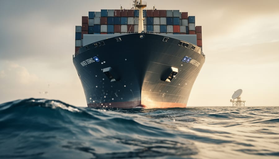
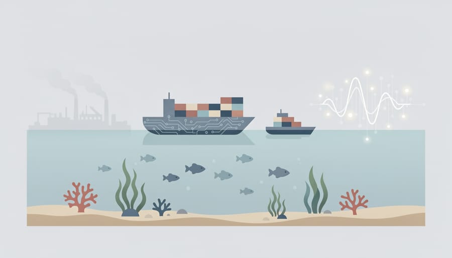
This technological transformation matters profoundly for ocean conservation. The global shipping industry accounts for nearly three percent of greenhouse gas emissions and poses persistent threats to marine ecosystems through ballast water discharge, underwater noise pollution, and potential oil spills. But the same vessels crossing our oceans can become platforms for environmental monitoring when equipped with digital sensors that track water quality, temperature shifts, microplastic concentrations, and marine mammal activity. What once required dedicated research expeditions can now happen continuously, gathering conservation data across shipping routes that cover 90 percent of global trade.
The promise extends beyond data collection. Digital systems enable ships to optimize routes that avoid whale migration corridors, adjust speeds to reduce collision risks with endangered species, and minimize fuel consumption through AI-powered navigation. Port authorities use real-time monitoring to detect illegal fishing activities and track vessel compliance with emissions regulations. These aren’t theoretical applications. Marine biologist Dr. Elena Korsakova, who collaborated with a Scandinavian shipping company in 2024, describes installing acoustic sensors on container ships: “We documented previously unknown fin whale populations in the North Atlantic simply because these vessels travel routes research ships rarely take. The data quality rivals our dedicated hydrophone arrays.”
This article explains how maritime digital technologies function, examines the specific tools reshaping ocean monitoring, and explores practical ways these innovations support marine conservation efforts. You’ll discover how volunteer citizen scientists contribute to digital marine programs and what these changes mean for ocean health in the coming decade.
Understanding Maritime Digitalization: A Clear Definition
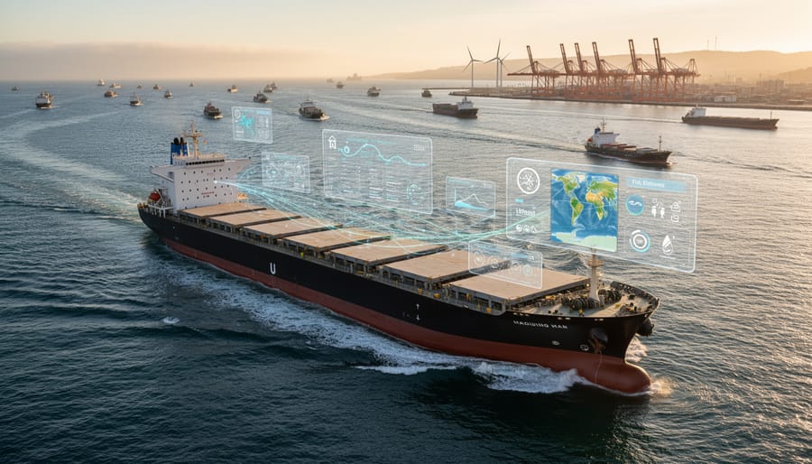
Maritime digitalization represents the shift from paper charts, manual inspections, and isolated ship operations to interconnected systems where vessels, ports, and monitoring stations exchange information in real time. At its core, this transformation means equipping ships and marine infrastructure with sensors, satellite connectivity, and software that collect, transmit, and analyze data about everything from engine performance to ocean temperature. Instead of a captain relying solely on experience and basic instruments, modern maritime operations can draw on live weather feeds, automated collision warnings, and predictive maintenance alerts that anticipate equipment failure before it happens.
The technology rests on several foundational concepts that work together to create this digital ecosystem:
- IoT Sensors
- Internet-connected devices installed on vessels and buoys that continuously measure variables like fuel consumption, water quality, GPS position, and marine mammal acoustic signatures. These sensors form the data-gathering backbone of digitalization.
- Artificial Intelligence
- Machine learning algorithms that identify patterns in maritime data, enabling systems to predict optimal routes, detect illegal fishing activity, or recognize whale calls that signal the need for speed reduction in sensitive zones.
- Big Data Analytics
- The processing of vast datasets from thousands of ships and monitoring points to extract insights about shipping efficiency, pollution hotspots, and ecosystem trends that would be impossible to spot manually.
- Digital Twins
- Virtual replicas of physical vessels or marine environments that allow operators to test scenarios, optimize performance, and predict impacts without conducting real-world trials that could disturb ecosystems.
- Automated Systems
- Software that can execute decisions without human intervention, such as adjusting a ship’s speed when entering a marine protected area or rerouting around detected whale populations.
This transition from analog to digital doesn’t just make shipping more efficient, it creates new possibilities for understanding and protecting the ocean. When a cargo ship’s navigation system integrates real-time data about endangered species locations, that vessel can automatically alter course to avoid critical habitat. When port authorities monitor vessel emissions through connected sensors rather than periodic inspections, they catch pollution violations immediately rather than months later. The practical result is a maritime industry that operates with unprecedented awareness of its environmental footprint.
How Maritime Digitalization Works in Practice
Data Collection and Monitoring
At the heart of maritime digitalization lies a network of data-gathering tools that continuously monitor the ocean environment. Modern vessels deploy arrays of sensors that track everything from engine performance and fuel consumption to water temperature and salinity levels. These devices measure variables like pH balance, critical for detecting ocean acidification, and dissolved oxygen concentrations that indicate ecosystem health.
Satellites orbiting overhead capture vessel movements across entire ocean basins, creating a real-time picture of maritime traffic patterns. This bird’s-eye view reveals shipping lanes that intersect with whale migration routes or cross protected marine areas. Meanwhile, underwater acoustic sensors detect marine mammal calls and ship-generated noise, mapping sound pollution hotspots.
Autonomous buoys and ocean gliders drift through remote waters, collecting data on currents, chlorophyll levels, and microplastic concentrations. These roving monitors reach areas traditional research vessels rarely visit, filling crucial gaps in our understanding of open-ocean conditions.
Together, this sensing infrastructure generates terabytes of environmental data daily, forming the foundation for informed conservation decisions and more sustainable maritime operations.
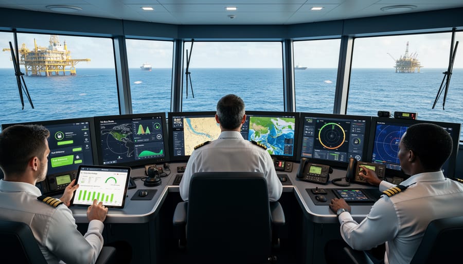
Analysis and Decision-Making
Once sensor data reaches shore-based systems or vessel computers, advanced algorithms take over. Modern ocean data analytics platforms process millions of data points simultaneously, identifying patterns invisible to human observers. Machine learning models compare current conditions against historical databases to predict weather shifts, detect unusual marine mammal movements, or flag equipment inefficiencies before they escalate into problems.
For ship operators, these systems generate specific recommendations: alternative routes that save fuel while avoiding whale feeding grounds, optimal speeds for current sea states, or maintenance alerts triggered by abnormal vibration patterns. Conservationists receive different outputs from the same data streams, heat maps showing biodiversity hotspots, alerts when vessels approach protected areas, or trend analyses revealing ecosystem changes over seasons.
The transformation from raw numbers to decisions happens in seconds. A temperature anomaly detected by an underwater sensor can trigger automatic rerouting suggestions within minutes, protecting both coral reefs and vessel efficiency. This speed matters because ocean conditions change rapidly, and delayed responses mean missed opportunities to prevent harm.
Core Components and Types of Maritime Digital Technologies
Smart Sensors and IoT Devices
Smart sensors and Internet of Things (IoT) devices form the nervous system of digitalized maritime operations. These compact, connected instruments continuously measure critical variables, from fuel consumption rates and engine performance to real-time emissions data. Modern vessels can deploy dozens of sensors across their systems, each transmitting information to central databases for analysis.
For marine conservation, the most significant sensors monitor environmental parameters: water temperature, pH levels indicating ocean acidification, salinity, and dissolved oxygen content. Acoustic sensors detect marine mammal vocalizations, alerting vessels to whale presence in their path. Some advanced systems even identify specific species by their unique call patterns.
The “Internet of Things” aspect means these devices communicate wirelessly, creating an interconnected network. A temperature sensor detecting unusual warming can trigger alerts across multiple systems simultaneously. This constant stream of environmental data helps researchers identify pollution events, track ecosystem changes, and verify that protected areas remain undisturbed, all without requiring ships to deviate from their routes or scientists to maintain constant physical presence.
AI and Machine Learning Systems
AI and machine learning systems analyze vast datasets from ships, satellites, and ocean sensors to make predictions that protect marine life. These algorithms process information about water temperature, currents, weather patterns, and vessel movements to optimize routes that avoid whale migration corridors and spawning grounds. Machine learning models can predict where endangered species are likely to congregate based on historical data and environmental conditions, alerting vessels to reroute in real time.
Weather forecasting powered by AI helps ships plan fuel-efficient paths that reduce emissions while avoiding storms. Pattern recognition algorithms detect subtle changes in ocean health, like early signs of coral bleaching or unusual marine mammal behavior, that human observers might miss. These systems learn continuously, becoming more accurate as they process additional data. By identifying correlations between shipping activity and ecosystem stress, AI guides more sustainable maritime practices that balance operational efficiency with conservation priorities.
Autonomous and Remote-Operated Vessels
Unmanned vessels are revolutionizing how we study and protect marine environments without the physical presence of human crews. Autonomous Surface Vehicles (ASVs) navigate ocean surfaces using GPS and sensors, conducting surveys and monitoring shipping lanes to identify wildlife activity. These craft operate quietly and efficiently, reducing fuel consumption by up to 90% compared to traditional research vessels.
Beneath the waves, Remotely Operated Vehicles (ROVs) and Autonomous Underwater Vehicles (AUVs) explore depths too dangerous for divers. ROVs remain tethered to support ships, allowing real-time control for delicate tasks like coral health assessments. AUVs operate independently on pre-programmed missions, mapping seafloors and tracking deep-sea species over weeks without human intervention.
These technologies eliminate crew-related emissions and minimize disturbance to sensitive habitats. A single AUV can gather months of data in marine protected areas where boat traffic would disrupt breeding grounds or feeding zones, making them invaluable for conservation research.
Digital Twins and Simulation
Digital twins create virtual replicas of ships, equipment, or entire marine ecosystems by combining sensor data with computer modeling. These simulations mirror real-world conditions in real-time, allowing operators to test changes, such as hull design modifications or route adjustments, without physical trials that could harm marine life.
In conservation applications, digital twins model how ship operations affect specific habitats. Scientists can simulate vessel noise propagation through whale feeding grounds or predict how altered shipping lanes might reduce sediment disturbance on coral reefs. The technology enables “what-if” scenarios: How would slowing ship speeds by 10 knots impact fuel consumption versus whale collision risk?
Port authorities use digital twins to optimize harbor operations, reducing vessel idle time and emissions. Researchers create virtual ocean environments to test monitoring equipment placement before deploying physical sensors, minimizing seabed disruption. This approach cuts costs while protecting ecosystems from trial-and-error experimentation that traditional methods require.
Conservation Applications: How Digitalization Protects Marine Ecosystems
Reducing Ship Strikes and Noise Pollution
Ship strikes remain one of the leading causes of death for large whales worldwide, while underwater noise from vessel traffic disrupts marine mammal communication, navigation, and feeding. Digital technologies now offer practical solutions to these urgent problems. AI-powered ship and whale tracking systems combine real-time satellite data on vessel positions with acoustic monitoring and predictive models of whale movements. When whales enter busy shipping lanes during migration, these systems alert vessels to slow down or adjust course, simple changes that dramatically reduce strike risk. Route optimization software also identifies the quietest paths through sensitive habitats, minimizing acoustic disturbance during critical periods like calving season. Several ports now require vessels to use these digital tools in designated zones, turning what was once guesswork into data-driven protection. The technology works because it responds to actual conditions rather than static seasonal maps, adapting as whale populations shift their patterns in response to changing ocean conditions.
Minimizing Emissions and Ocean Acidification
Maritime digitalization offers powerful tools for tracking and reducing the shipping industry’s greenhouse gas emissions, a critical step in protecting marine life from the dual threats of climate change and ocean acidification. Smart fuel management systems use real-time data from engine sensors and weather forecasts to optimize consumption, automatically adjusting speed and route to minimize carbon output. Emissions monitoring platforms installed on vessels continuously measure CO₂, sulfur oxides, and nitrogen compounds, providing captains with immediate feedback and helping companies meet international environmental standards.
These digital systems often work alongside transitional fuels, including sustainable algae biofuels to further cut emissions. Machine learning algorithms analyze historical voyage data to identify inefficient practices, such as excessive idling in port or suboptimal trim settings, that increase fuel burn. One container shipping company reduced its fleet’s carbon footprint by 12% in eighteen months simply by implementing AI-driven route planning and fuel optimization software.
The conservation benefit extends beyond carbon reduction. Lower emissions mean less nitrogen deposition in coastal waters, which contributes to dead zones, and reduced black carbon settling on Arctic ice. For marine ecosystems already stressed by warming and acidification, every tonne of CO₂ prevented matters.
Enhanced Research and Monitoring Capabilities
Digital technologies have transformed how marine scientists gather information about ocean ecosystems. Autonomous underwater vehicles equipped with high-resolution cameras now survey coral reefs for hours without disturbing marine life, capturing detailed footage that would take human divers weeks to collect. Satellite-connected sensors track tagged species across thousands of miles, revealing migration patterns and critical habitats that were previously unknown.
One breakthrough involves environmental DNA sampling, where eDNA enhances ecosystem monitoring by detecting traces of genetic material that fish and other organisms leave in seawater. This method identifies which species inhabit an area without capturing or observing them directly, making biodiversity assessments faster and less invasive. AI algorithms analyze acoustic recordings to count whale populations and track dolphin behaviors, processing sound data that would take researchers months to review manually.
Cloud platforms now allow scientists worldwide to share real-time ocean data, accelerating collaborative research. A marine biologist in Kenya can access temperature readings from sensors off California’s coast within seconds, spotting global patterns that inform conservation strategies and help predict ecosystem changes before they become crises.
Personal Stories: Marine Biologists Using Digital Tools
Dr. Sarah Chen remembers the moment everything changed. As a whale researcher off the coast of British Columbia, she’d spent years recording humpback vocalizations manually, a painstaking process that limited her ability to track population movements. When her team deployed an underwater acoustic monitoring network connected to AI analysis software in 2024, they could suddenly process months of data in hours. The system flagged unusual migration patterns that revealed a previously unknown feeding ground, leading to its designation as a protected area. “We went from analyzing maybe 5% of our recordings to 100%,” she says. “That’s thousands of whales we can now monitor and protect.”
Similar breakthroughs are happening worldwide as marine data scientists combine traditional fieldwork with digital tools. Dr. James Okafor in Nigeria uses satellite-linked sensors to track sea turtle nesting sites along the Gulf of Guinea. The real-time alerts notify his team when turtles come ashore, allowing immediate protection from poachers, something impossible with monthly beach surveys. His project has increased hatchling survival rates by 40% since implementation.
In the Mediterranean, marine biologist Elena Rossi deployed underwater drones equipped with image recognition software to survey Posidonia seagrass meadows. The autonomous vehicles can cover in two weeks what would take her team two years of diving. More importantly, they operate in depths and conditions too dangerous for human divers, revealing degradation patterns that prompted new fishing restrictions.
These researchers emphasize that technology amplifies, rather than replaces, human expertise. The digital tools handle the scale and repetition, freeing scientists to focus on interpretation, strategy, and the irreplaceable work of conservation advocacy.
Challenges and Considerations for Sustainable Implementation
While maritime digitalization offers tremendous conservation benefits, implementing these technologies sustainably presents real challenges that require thoughtful solutions.
Cost remains the most immediate barrier. Advanced sensors, AI systems, and satellite connectivity demand significant upfront investment. Smaller research organizations, developing nations, and conservation groups often lack funding for cutting-edge equipment, creating a digital divide where wealthy regions accelerate ahead while others fall behind. This gap means critical biodiversity hotspots in less-developed coastal areas may miss out on monitoring and protection that digitalization enables.
Electronic waste poses an environmental paradox. Sensors and monitoring devices have limited lifespans, and marine environments accelerate hardware degradation through salt corrosion. When equipment fails, improper disposal creates toxic waste. The conservation community must prioritize manufacturers who design for longevity, repairability, and responsible recycling programs rather than contributing to the global e-waste crisis.
Data centers processing maritime information consume enormous energy. If powered by fossil fuels, the carbon footprint of storing and analyzing ocean data can partially offset the emissions reductions achieved through optimized shipping routes. Moving toward renewable energy for data infrastructure becomes essential for genuine sustainability.
Despite these obstacles, solutions are emerging. Open-source platforms allow data sharing across organizations, reducing redundant costs. Modular, upgradeable equipment extends hardware life. Solar-powered ocean sensors minimize energy dependence. International partnerships are bridging the digital divide through technology transfers and shared research platforms.
The path forward requires acknowledging these challenges while maintaining momentum. Responsible deployment means balancing innovation with environmental accountability, ensuring digitalization truly serves ocean health rather than simply generating new problems while solving old ones.
Common Questions About Maritime Digitalization
Is maritime digitalization too expensive for smaller conservation groups?
Not necessarily. While custom AI systems and fleets of autonomous vessels require significant investment, many digital tools, including satellite tracking platforms, open-source data analysis software, and affordable sensor kits, are increasingly accessible to organizations with modest budgets. Cloud-based services have dramatically reduced infrastructure costs.
How effective are these technologies at protecting marine life?
Evidence shows measurable impact: ships using AI-powered routing have reduced whale strikes by significant margins in protected corridors, and real-time monitoring systems have enabled faster response to illegal fishing activities. The effectiveness depends on proper deployment, consistent use, and integration with traditional conservation methods rather than replacement of them.
What about cybersecurity risks with connected marine systems?
Maritime digitalization does introduce cyber vulnerabilities, particularly for navigation and control systems. The industry is responding through encrypted communications, regular security audits, and international protocols for protecting maritime data infrastructure. Conservation applications face lower security threats than commercial shipping but still require careful data protection.
How can individuals support or engage with maritime digitalization for conservation?
You don’t need to be a technologist to contribute. Citizen science programs use digital platforms where volunteers can help analyze ocean imagery, tag marine species in photos, or report sightings through apps. You can also support research institutions implementing these systems, advocate for funding in your community, or invest in ocean-tech startups developing conservation-focused solutions.
These technologies become more accessible each year as costs decline and partnerships expand. Universities, nonprofits, and government agencies often collaborate on digital monitoring projects that welcome volunteer participation. Some ports implementing ocean-friendly ports provide public data dashboards where anyone can track emissions reductions and vessel compliance in real time. Educational institutions increasingly offer workshops on using digital conservation tools, making technical skills more widely available to people passionate about marine protection regardless of their background.
Maritime digitalization represents one of our most powerful tools for protecting ocean ecosystems at scale. When deployed thoughtfully, these technologies enable us to navigate, monitor, and understand our seas with unprecedented precision while minimizing our footprint on marine life. The combination of real-time data, predictive analytics, and automated systems gives conservationists capabilities that were science fiction just decades ago.
Yet technology alone won’t save our oceans. It requires human commitment, funding, and collective action to ensure these digital tools serve conservation rather than merely efficiency. The most promising path forward connects marine scientists with technologists, policymakers with citizen advocates, and established organizations with passionate volunteers.
You can contribute to this transformation regardless of your technical background. Marine conservation organizations worldwide need volunteers for data collection, citizen science projects, and coastal monitoring programs that feed into digital systems. Supporting groups that prioritize sustainable maritime practices amplifies their impact. Staying informed about how shipping routes affect marine habitats empowers you to advocate for protective policies in your community.
The challenges facing our oceans, from warming temperatures to biodiversity loss, demand urgent, coordinated responses. Maritime digitalization, guided by conservation principles and supported by engaged communities, offers a realistic path toward coexistence between human maritime activity and thriving marine ecosystems. Every action, whether donating time, sharing knowledge, or supporting research, contributes to protecting the extraordinary biodiversity beneath our waves for generations ahead.
jessica
Ava Singh is an environmental writer and marine sustainability advocate with a deep commitment to protecting the world's oceans and coastal communities. With a background in environmental policy and a passion for storytelling, Ava brings complex topics to life through clear, engaging content that educates and empowers readers. At the Marine Biodiversity & Sustainability Learning Center, Ava focuses on sharing impactful stories about community engagement, policy innovations, and conservation strategies. Her writing bridges the gap between science and the public, encouraging people to take part in preserving marine biodiversity. When she’s not writing, Ava collaborates with local initiatives to promote eco-conscious living and sustainable development, ensuring her work makes a difference both on the page and in the real world.