Marine Biodiversity Science Center

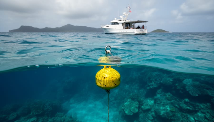
Establishing a protected zone within a marine protected area requires designating a specific geographic boundary, selecting the appropriate protection level, securing legal authority, and implementing enforcement mechanisms. The process typically takes 18 to 36 months from initial planning to full implementation, depending on stakeholder engagement, regulatory complexity, and available resources. Protected zones serve as the functional building blocks of effective marine protected area management transforming broad conservation goals into enforceable restrictions that shield critical habitats and species from human pressures.
The distinction matters because not all marine protected areas offer equal protection. A 2025 global assessment revealed that fewer than 3% of MPAs worldwide maintain fully protected zones where extractive activities are completely prohibited. The remaining areas operate under partial restrictions that often fail to deliver measurable conservation outcomes. Protected zones change this equation by creating spatial refuges where ecosystems can function without fishing pressure, coastal development, or resource extraction.
Dr. Elena Vargas, a marine spatial planner who has designed protected zones across the Pacific, puts it plainly: “We spent years debating conservation targets in meetings while fish populations continued declining. The moment we drew clear boundaries and backed them with real enforcement, recovery began within two breeding cycles.”
This guide walks through the practical steps required to establish a protected zone, from initial site selection and stakeholder consultation through legal designation and long-term monitoring. Whether you’re a conservation manager tasked with upgrading an existing MPA or a community group advocating for local ocean protection, understanding this process empowers you to turn conservation intentions into tangible habitat security.
Understanding Protected Zones: The Foundation of Effective Marine Conservation
Protected zones are geographically defined areas within marine reserves where specific human activities are regulated or prohibited to safeguard critical habitats, protect vulnerable species, and allow ecosystems to recover from overexploitation. These zones form the practical backbone of marine conservation, translating broad MPA objectives into enforceable spatial rules that directly reduce fishing pressure, anchor damage, pollution, and other threats. Unlike marine reserves that may allow some controlled use throughout their boundaries, protected zones create layers of protection tailored to ecological sensitivity and conservation priorities.
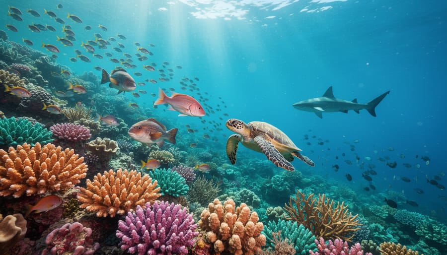
The ecological purpose of protected zones centres on rebuilding marine biomass, preserving spawning aggregations, and maintaining ecosystem functions that benefit areas far beyond the zone boundaries. When fishing ceases in a no-take zone, predator populations rebound, herbivores control algae growth, and structural complexity increases as corals or kelp forests mature undisturbed. This ecological rebuilding generates spillover effects: adult fish migrate to adjacent waters, larvae drift to surrounding reefs, and the zone effectively seeds recovery across the broader seascape. Protected zones also serve as living reference sites, allowing scientists to measure what healthy ecosystems look like and track degradation in unprotected areas.
Marine reserves typically employ three main MPA zone protection levels each serving distinct conservation functions. No-take zones prohibit all extractive activities, including fishing, collecting, and mining, creating ecological refuges where natural processes dominate. These core areas usually target spawning sites, nursery habitats, or biodiversity hotspots that need complete protection to function. Restricted-use zones allow limited activities under strict controls, perhaps catch-and-release fishing, scientific research with permits, or seasonal access that avoids critical breeding periods. Buffer zones surround core protected areas, permitting sustainable uses like traditional fishing with approved gear while filtering external pressures before they reach sensitive habitats.
Within broader MPA management frameworks, protected zones integrate with ecosystem-based management by addressing multiple conservation goals simultaneously. A well-designed zone network protects representative habitats across depth gradients, connects migratory corridors, and accounts for oceanographic patterns that disperse larvae. Rather than drawing arbitrary lines, effective zone planning considers ecological connectivity, human use patterns, and adaptive capacity to respond as conditions change.
Essential Tools and Resources for Protected Zone Planning
Before establishing protected zones, marine managers need a robust toolkit spanning scientific, legal, and community dimensions. The right resources transform conservation ambitions into actionable management plans grounded in ecological reality and stakeholder support.
Scientific and Mapping Tools
Geographic Information Systems (GIS) form the backbone of zone design. Platforms like QGIS (free and open-source) or ArcGIS allow managers to layer habitat maps, species distribution data, human use patterns, and oceanographic features. Satellite imagery from sources like Landsat or Sentinel provides current baseline conditions, while bathymetric charts reveal underwater topography crucial for understanding ecosystem connectivity. Marine spatial planning software such as Marxan helps optimize zone boundaries by balancing conservation targets with socioeconomic factors.
Biodiversity assessment requires both existing databases and field survey capacity. OBIS (Ocean Biodiversity Information System) and FishBase offer species occurrence records, though local surveys typically reveal site-specific patterns these global datasets miss. Underwater cameras, ROVs for deeper areas, and eDNA sampling kits enable cost-effective monitoring when dedicated research vessels aren’t available. Citizen science platforms like iNaturalist extend data collection capacity through trained volunteers.
Essential Planning Resources
- National and international legal frameworks governing marine protection (IUCN guidelines, national MPA legislation, regional fisheries agreements)
- Socioeconomic baseline studies documenting fishing effort, tourism activity, and traditional use patterns
- Stakeholder contact databases including fishers’ associations, indigenous community leaders, and tourism operators
- Ecological connectivity models showing larval dispersal patterns and migration corridors
- Enforcement cost estimates and available patrol resources (coast guard, park rangers, community monitors)
- Public engagement platforms for consultations (online forums, meeting scheduling tools, feedback collection systems)
Don’t overlook institutional partnerships. Universities often provide research support, while NGOs like The Nature Conservancy or local marine conservation groups offer planning templates and case studies from similar regions. These collaborative relationships stretch limited budgets and bring expertise that single agencies rarely possess internally. Assembling this resource foundation early prevents costly delays once implementation begins.
Critical Considerations and Warning Signs Before Implementation
Before launching a protected zone, marine managers must recognize that well-intentioned efforts can fail, sometimes spectacularly, when critical groundwork is missing. Rushing implementation without addressing key vulnerabilities wastes resources and can permanently damage stakeholder trust, making future conservation efforts nearly impossible.
The most common pitfall is inadequate baseline data. Without thorough baseline ecological data needs documenting species populations, habitat conditions, and existing pressures, you cannot design effective boundaries or measure success later. Some managers establish zones based on political expediency or convenience rather than ecological science, resulting in mismatched protection that misses critical spawning grounds or migration corridors while restricting access to areas of minimal conservation value.
Stakeholder conflict represents another major risk. Fishers who suddenly lose access to traditional grounds without consultation, adequate compensation pathways, or clear ecological justification will resist compliance. This resistance can manifest as illegal fishing, vandalism of monitoring equipment, or political campaigns to dismantle protections. Tourism operators excluded from planning may similarly undermine zones through non-compliance or legal challenges.
Enforcement capacity must match zone ambitions. A large no-take zone in remote waters without patrol vessels, surveillance technology, or community monitoring partnerships becomes a paper park. Budget constraints often emerge after designation, leaving zones unmonitored and violations unpunished.
Finally, watch for ecological mismatches between protection levels and actual threats. A no-take zone cannot address upstream pollution or climate impacts, and restricted zones may still allow gear types that damage sensitive habitats. Honest assessment of these limitations during planning prevents false promises and helps target interventions where they’ll genuinely work.
Step-by-Step Process for Establishing Protected Zones
Conducting Baseline Ecological Assessments
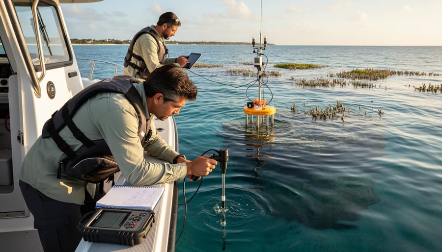
Start your baseline assessment by surveying the full spectrum of marine life in your proposed protected zone. Work with marine biologists to conduct rapid ecological assessments that document fish populations, invertebrates, marine mammals, seabirds, and vegetation. Use underwater visual census methods, baited remote underwater video systems, or acoustic monitoring depending on your target species and budget.
Critical habitats require special attention. Map spawning aggregation sites, nursery grounds, coral reefs, seagrass meadows, and kelp forests using GPS coordinates and depth contours. These biodiversity hotspots often determine where no-take zones should sit. Don’t overlook seasonal patterns, some species only use certain areas during migration or breeding.
Document ecosystem connectivity by tracking how larvae disperse, where predators hunt, and how nutrients flow. This shows which areas need protection to maintain healthy populations beyond your zone’s boundaries.
Record all existing pressures: fishing intensity, pollution sources, coastal development, vessel traffic, and climate stressors like warming waters or ocean acidification. Photo documentation, fisher interviews, and water quality testing build a complete picture.
Engage citizen scientists to expand your survey capacity. Trained volunteers can conduct species counts, photo quadrat surveys, and marine debris assessments. Their involvement builds community ownership while generating valuable data you couldn’t collect alone.
Engaging Stakeholders and Building Community Support
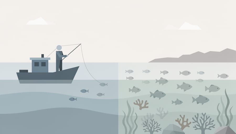
Once ecological data is gathered, the next critical step involves meaningful dialogue with everyone who uses or depends on the marine area. Start by identifying all stakeholder groups, commercial and artisanal fishers, dive operators, coastal communities, indigenous peoples, recreational users, and local businesses. Schedule separate initial meetings with each group to understand their specific concerns, economic dependencies, and traditional practices without the pressure of negotiating compromises.
Create opportunities for fishers to share seasonal patterns, spawning grounds they’ve observed, and areas of historical importance. Tourism operators can provide insights about visitor behavior and economic cycles. Indigenous communities often hold generations of ecological knowledge about species movements, habitat changes, and sustainable harvest practices that scientific surveys might miss. Document this local expertise systematically, it frequently reveals critical details that shape more effective zone boundaries.
Address economic anxieties directly rather than dismissing them. If a proposed no-take zone overlaps with productive fishing grounds, work with economists to model alternative income sources, such as ecotourism partnerships or restoration jobs. Some MPAs have successfully piloted compensation programs during transition periods or prioritized locals for monitoring positions. Transparency about trade-offs builds trust more effectively than overpromising conservation benefits.
Build ongoing community support by establishing advisory committees with rotating stakeholder representation, creating feedback mechanisms for zone adjustments, and publicly reporting how local input shaped final decisions. When people see their knowledge respected and concerns addressed, they become advocates rather than opponents of protection measures.
Designing Zone Boundaries and Protection Levels
Effective zone boundary design balances ecological requirements with practical enforcement realities. Start by determining minimum viable areas for target species based on home range data and reproductive patterns. Core no-take zones typically need at least 4-6 square kilometers to protect resident fish populations, though larger areas significantly improve outcomes for wide-ranging species like sharks and rays.
Place boundaries along natural features such as depth contours, reef edges, or current boundaries rather than arbitrary lines. This makes zones easier to mark with buoys and simpler for users to recognize. Consider larval dispersal connectivity between sites. Protected areas spaced 10-20 kilometers apart often maintain genetic flow for many reef species, creating resilient networks rather than isolated patches.
Design buffer zones that transition gradually from strict protection to managed use. A typical configuration might include a central no-take core surrounded by a 500-meter restricted fishing zone where only non-extractive activities occur, then an outer area permitting sustainable harvest with gear restrictions. This gradation reduces conflict by providing access options while protecting the most critical habitats. Always map existing use intensity and avoid placing strict boundaries through traditional fishing grounds unless absolutely necessary for conservation targets.
Securing Legal Designation and Enforcement Mechanisms
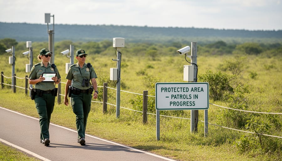
Once you’ve designed your zones and secured stakeholder support, the next crucial step is translating that vision into enforceable law. This means navigating the regulatory maze specific to your jurisdiction, whether that’s national legislation, regional ordinances, or international agreements like UNCLOS for transboundary reserves.
Start by identifying the appropriate legal pathway. In many countries, this involves submitting a formal proposal to environmental or fisheries departments, complete with ecological justification, stakeholder consultation records, and enforcement plans. Budget 6-18 months for review and approval, depending on bureaucratic complexity.
Simultaneously, establish your monitoring framework. Deploy a mix of remote sensing (satellite imagery for vessel tracking), field patrols (boat or drone surveys), and community-based monitoring where locals report violations. Set clear metrics: patrol frequency, response times to infractions, and percentage of zone area covered.
Enforcement requires partnerships. Coordinate with coast guard, marine police, and fisheries officers to conduct patrols and issue citations. Train these partners on zone boundaries and regulations. Equally important: recruit community guardians, fishers who know local waters and can serve as eyes on the water. Pair authority enforcement with social pressure from within user groups, which often proves more effective than fines alone.
Implementing Education and Outreach Programs
Education and outreach form the backbone of protected zone compliance and long-term success. Without community understanding and buy-in, even the most scientifically robust zones struggle with enforcement challenges and user conflicts.
Start by developing targeted messaging for different user groups. Fishers need clear explanations of how no-take zones rebuild fish stocks that spill over into adjacent fishing areas. Recreational boaters want simple maps showing where they can anchor without damaging seagrass beds. Tour operators benefit from training on how protected zones enhance wildlife viewing experiences. Tailor your materials to answer each group’s specific questions rather than distributing generic brochures.
Launch multilingual signage at popular access points, combining regulations with compelling visuals of the marine life being protected. Include QR codes linking to detailed zone maps and species guides that visitors can access on their phones.
Create hands-on training workshops where fishers and dive operators learn to identify protected species and understand zone boundaries using GPS coordinates. Partner with local fishing cooperatives and tourism associations to deliver these sessions through trusted community leaders rather than external authorities.
Establish volunteer monitoring programs that transform community members into zone stewards. Train volunteers to record wildlife sightings, document violations, and lead guided snorkel tours that showcase conservation success stories. This active participation builds ownership and creates a network of informed advocates who naturally spread awareness through their social circles.
Verifying Success and Adaptive Management Next Steps
Successful protected zones require continuous verification to ensure they’re delivering measurable conservation benefits. Within the first 12 to 18 months after implementation, establish a baseline monitoring program that tracks three critical dimensions: ecological health, human compliance, and community wellbeing.
Start with ecological indicators that directly measure biodiversity recovery. Survey fish populations quarterly using underwater visual census methods, comparing abundance and species diversity inside protected zones to reference sites outside. Document changes in coral cover, seagrass density, or kelp forest structure depending on your ecosystem. Track reproductive success by monitoring spawning aggregations and juvenile recruitment, which often increase within two to five years of protection. These biological signals tell you whether marine life is responding positively to reduced human pressure.
Complement ecological data with compliance metrics that reveal how well regulations are being followed. Use patrol logs, violation reports, and GPS tracking (where legally appropriate) to quantify illegal fishing or unauthorized entry. Interview fishers and tourism operators to gauge understanding of zone boundaries and rules. High compliance rates, typically above 80 percent, suggest your education efforts and enforcement mechanisms are working effectively.
Socioeconomic assessments complete the picture by measuring impacts on coastal communities. Conduct annual surveys with fishers to document catch rates in adjacent fishing grounds, tourism revenue from protected zone diving, and overall satisfaction with the management process. These metrics help identify unintended hardships that may require zone adjustments or compensation programs.
Key performance indicators and verification methods include:
- Fish biomass increases of 200-400% within no-take zones after five years
- Species richness improvements of 20-50% compared to baseline surveys
- Compliance rates above 80% measured through patrol observations
- Stakeholder satisfaction scores from annual community consultations
- Spillover benefits detected in adjacent fishing areas through catch monitoring
When monitoring reveals that conservation targets aren’t being met, adaptive management becomes essential. Review your data every two to three years in structured cycles that include stakeholders, scientists, and managers. If fish populations plateau or decline despite protection, investigate whether poaching is widespread, boundaries exclude critical habitat, or climate impacts require expanded protection. Adjust zone size, shift boundaries to capture seasonal migrations, or strengthen enforcement partnerships based on evidence rather than assumptions. This iterative approach acknowledges that marine systems are dynamic and management strategies must evolve accordingly.
Common Questions About Protected Zone Management
Protected zones raise practical questions for everyone involved in marine conservation, from managers coordinating implementation to community members whose livelihoods connect to these waters. Here are answers to the concerns we hear most often.
How long does it take to see ecological results from a protected zone?
Initial recovery signs like increased fish abundance often appear within 3-5 years in well-enforced no-take zones, but full ecosystem restoration, including age structure, predator-prey balance, and habitat complexity, typically requires 10-20 years or more depending on the species and habitats involved.
What happens to fishers who lose access to traditional fishing grounds?
Successful protected zones include transition support such as alternative livelihood training, preferential access to buffer zones, or employment in monitoring and tourism roles. Communities involved in the planning process from the start generally experience smoother economic transitions and often see spillover benefits as fish populations rebuild.
How do you enforce protection in remote areas without constant patrols?
Effective enforcement combines technology (satellite monitoring, acoustic sensors), community guardianship programs where locals report violations, and strategic visible patrols during high-risk periods. The most successful zones build a culture of compliance through education rather than relying solely on punitive measures.
Can protected zones adapt if conditions change or initial boundaries prove ineffective?
Adaptive management is essential, zones should be reviewed every 3-5 years using monitoring data on ecological health and compliance. Boundaries, regulations, and enforcement strategies can be adjusted based on evidence, though major changes require the same stakeholder consultation process as initial establishment.
Beyond these common concerns, managers often ask about minimum viable size for protection. While this varies by ecosystem and target species, research consistently shows that larger zones produce disproportionately better results. A 100-square-kilometer no-take zone typically achieves far more than ten separate 10-square-kilometer zones because of edge effects and the space requirements of mobile species.
The question of stakeholder roles deserves special attention. Successful protected zones don’t just inform communities, they actively involve them. Indigenous groups and traditional users bring generations of ecological knowledge that scientific surveys miss. Tourism operators become ambassadors who educate visitors. Former fishers transition into guardians who know exactly where and when violations are likely. This shift from top-down enforcement to shared stewardship transforms protected zones from external restrictions into community assets.
Well-designed protected zones represent one of the most powerful tools we have for reversing biodiversity loss and restoring ocean health. When implemented with scientific rigor and community partnership, these zones create refuges where marine life can recover, reproduce, and rebuild depleted populations. The benefits extend far beyond zone boundaries, spillover effects strengthen adjacent fisheries, restored habitats buffer coastal communities against storms, and thriving ecosystems support tourism and education opportunities that build long-term conservation support.
The work doesn’t end with designation. Protected zones require ongoing monitoring, adaptive management, and sustained community engagement to fulfill their conservation promise. That’s where individual action makes a real difference.
The Marine Biodiversity Science Center offers hands-on volunteer opportunities for people passionate about marine conservation. Whether you’re helping with underwater surveys, participating in beach cleanups, contributing to citizen science projects, or supporting education programs, your involvement directly strengthens protected zone effectiveness. Every data point collected, every student inspired, every community member engaged adds momentum to this critical work.
Dr. Elena Vasquez, who has established protected zones in three countries, puts it simply: “I’ve watched decimated reefs come back to life within a decade of protection. The transformation reminds me why this work matters and why we can’t give up. When science, policy, and people align, oceans heal faster than we dare hope.”
Together, we’re creating a future where healthy oceans sustain both marine life and human communities for generations to come.

jessica
Ava Singh is an environmental writer and marine sustainability advocate with a deep commitment to protecting the world's oceans and coastal communities. With a background in environmental policy and a passion for storytelling, Ava brings complex topics to life through clear, engaging content that educates and empowers readers. At the Marine Biodiversity & Sustainability Learning Center, Ava focuses on sharing impactful stories about community engagement, policy innovations, and conservation strategies. Her writing bridges the gap between science and the public, encouraging people to take part in preserving marine biodiversity. When she’s not writing, Ava collaborates with local initiatives to promote eco-conscious living and sustainable development, ensuring her work makes a difference both on the page and in the real world.