Marine Biodiversity Science Center
# Hydrodynamic Modeling: Unlocking the Ocean’s Hidden Patterns to Protect Marine Life
Picture a marine biologist standing on a windswept coastline, watching waves crash against rocky shores. Beneath that churning surface lies an invisible world of currents, eddies, and temperature gradients—forces that determine where fish spawn, where nutrients concentrate, and which coral reefs will thrive or struggle. Understanding these underwater highways has long been marine conservation’s greatest challenge. Enter hydrodynamic modeling: a powerful tool that transforms ocean physics into visual maps, predictions, and actionable conservation strategies.
Hydrodynamic modeling uses mathematical equations and computer simulations to recreate how water moves through marine environments. Think of it as creating a digital twin of the ocean—one that reveals current patterns, predicts how pollutants disperse, and shows where marine species are most likely to congregate. These models combine real-world measurements—water temperature, salinity, wind speed, tidal data—with fundamental physics principles to simulate everything from microscopic plankton drift to massive oceanic circulation patterns.
For marine conservationists, this technology has become indispensable. It answers critical questions: Where should we establish marine protected areas for maximum impact? How will coastal development affect fish nurseries? Which migration corridors need protection as ocean temperatures shift? Dr. Maria Chen, a marine biologist who has used hydrodynamic modeling across fifteen Pacific island nations, describes it simply: “We’ve gone from educated guesses to evidence-based decisions. We can now see the invisible forces shaping marine ecosystems.”
This article demystifies hydrodynamic modeling—exploring how it works, why it matters for protecting ocean biodiversity, and how even citizen scientists can contribute to this conservation revolution.
What Hydrodynamic Modeling Actually Means (Without the Jargon)
Think of hydrodynamic modeling as creating a detailed weather forecast—but for the ocean. Just as meteorologists use computer simulations to predict whether you’ll need an umbrella tomorrow, marine scientists use hydrodynamic models to simulate and predict how water moves through our seas. These sophisticated tools are essentially digital twins of ocean environments, helping us understand the invisible highways and neighborhoods beneath the waves.
At its core, hydrodynamic modeling tracks the fundamental forces that shape marine life: ocean currents, water temperature, salinity levels, and wave action. Imagine trying to find the perfect neighborhood to raise your family—you’d consider factors like transportation routes, climate, air quality, and community resources. Marine organisms face similar choices, but their “neighborhoods” are defined by water movement patterns. A sea turtle needs warm currents to migrate along, while cold-water corals require specific temperature ranges and nutrient-rich flows to survive.
These models work by dividing the ocean into a three-dimensional grid—picture a massive checkerboard extending from the surface down to the seafloor, with each square monitoring how water behaves. The computer then calculates how forces like wind, tides, Earth’s rotation, and temperature differences push water from one square to the next, creating a dynamic picture of ocean circulation. Much like marine weather models, these simulations can project both current conditions and future scenarios.
Why does understanding water movement matter so profoundly for conservation? Because water movement is life itself in the ocean. Currents deliver food and oxygen to stationary creatures like corals and sponges. Temperature boundaries create invisible walls that certain species cannot cross. Salinity gradients influence where fish spawn and where their larvae can successfully settle. Wave action determines which organisms can cling to rocky shores versus sandy bottoms.
Dr. Sarah Chen, a marine biologist who has worked with hydrodynamic models for fifteen years, puts it simply: “If you want to protect a seahorse population, you can’t just protect the seagrass bed they live in today. You need to understand the water flows that brought their larvae there in the first place, and whether those patterns will persist as our climate changes.”
This understanding transforms conservation from guesswork into strategic planning, helping us identify critical habitats worth protecting and predict where vulnerable species might relocate as ocean conditions shift.
Why Ocean Currents Matter More Than You Think for Marine Habitats
Ocean currents are far more than the invisible highways that ships navigate—they’re the lifeblood of marine ecosystems, orchestrating a complex dance of survival beneath the waves. Understanding how water moves through our oceans is fundamental to protecting the habitats that countless species call home.
Think of ocean currents as nature’s delivery system. These flowing waters transport essential nutrients from the depths to sunlit surface waters, fueling the phytoplankton that form the foundation of marine food webs. When currents weaken or shift, entire ecosystems can struggle. The upwelling zones along California’s coast, for instance, bring cold, nutrient-rich water to the surface, supporting everything from microscopic algae to massive blue whales. Without these predictable current patterns, the abundance of life in these regions would collapse.
Currents also serve as vital oxygen highways. In areas where water circulation is strong, dissolved oxygen levels remain high, supporting vibrant coral reefs and fish populations. Conversely, when currents stagnate, oxygen-depleted “dead zones” can form, creating uninhabitable waters. The Gulf of Mexico experiences this phenomenon annually, demonstrating how critical water movement is to habitat quality.
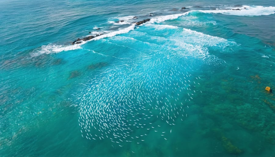
Perhaps most fascinating is the role currents play in species reproduction. Many marine creatures release their eggs and larvae into the water column, trusting the currents to carry their offspring to suitable nursery habitats. Sea turtles, for example, depend on specific current patterns to guide their hatchlings from nesting beaches to feeding grounds. Caribbean spiny lobsters rely on particular flow patterns to transport their larvae between deep ocean waters and shallow coastal habitats where juveniles mature.
Temperature regulation represents another crucial function. Currents create distinct thermal zones that many species require for survival. Kelp forests, which provide habitat for hundreds of species, thrive only where cold currents maintain temperatures below certain thresholds. When climate change disrupts these patterns, entire habitat systems shift or disappear.
Marine biologist Dr. Sarah Chen, who has spent fifteen years studying current-dependent ecosystems, shares: “I’ve watched coral larvae drift hundreds of miles to colonize new reefs. It’s humbling to realize that protecting these habitats means understanding water movement at scales both vast and microscopic.”
For volunteers participating in habitat restoration projects, understanding hydrodynamics transforms how we approach conservation—revealing that protecting marine life means protecting the very currents that sustain them.
From Data to Discovery: How Scientists Build Ocean Models
Gathering the Puzzle Pieces: Data Collection
Hydrodynamic models are only as reliable as the data feeding them, making data collection the foundation of accurate marine habitat assessment. Scientists draw from a diverse toolkit of sources to capture the ocean’s complex behavior.
Satellite observations provide the broadest perspective, tracking sea surface temperatures, ocean color (indicating phytoplankton concentrations), and wave heights across vast areas. These space-based sensors offer continuous monitoring that would be impossible from ships alone. Meanwhile, underwater sensors—including autonomous vehicles, fixed moorings, and drifting buoys—measure currents, salinity, temperature, and oxygen levels at various depths, revealing the three-dimensional structure of marine environments.
Research vessels remain essential for collecting detailed measurements that satellites cannot capture. During expeditions, scientists deploy specialized instruments like Acoustic Doppler Current Profilers (ADCPs) to measure water velocity and CTD sensors (measuring conductivity, temperature, and depth) to profile water column characteristics. Historical records, some spanning decades, provide crucial context about seasonal patterns and long-term changes.
Dr. Maria Santos, a marine biologist studying coral reef systems, recalls a challenging field season collecting data off Indonesia’s coast. “We spent three weeks deploying sensors around remote reefs, working through storms and equipment malfunctions,” she shares. “One morning, watching our team coordinate between the research vessel and divers below, I realized we were creating a snapshot of this ecosystem that would live on in models—helping protect these reefs long after we left.” That data now informs hydrodynamic models guiding local marine protected area management.
For those inspired to contribute, numerous citizen science programs welcome volunteers to collect coastal observations, helping fill data gaps that strengthen these vital conservation tools.
Building the Virtual Ocean
Creating a virtual ocean begins with gathering vast amounts of environmental data—water temperatures, salinity levels, current speeds, bathymetry (seafloor topography), and tidal patterns. Scientists feed this information into specialized hydrodynamic modeling software like ROMS (Regional Ocean Modeling System) or FVCOM (Finite Volume Community Ocean Model). These platforms use complex mathematical equations to simulate how water moves through marine environments in three dimensions.
Think of it as building a digital twin of the ocean. The software divides the study area into thousands or even millions of small grid cells, calculating conditions within each one. Water flows between cells according to physical laws, creating a dynamic representation that captures currents, eddies, and stratification patterns—all factors that determine where nutrients concentrate and where marine species thrive.
But building the model is just the beginning. Marine biologist Dr. Sarah Chen explains: “We spend months validating our models against real-world data. If our simulation says a current should flow at two knots past a coral reef, we compare that prediction with actual measurements from moored instruments or drifters deployed in the water.”
This validation phase is crucial. Scientists deploy sensors, conduct field surveys, and examine historical records to ensure their virtual ocean behaves like the real one. When discrepancies appear—and they always do initially—researchers adjust model parameters, refine the grid resolution, or incorporate additional data sources. This iterative process, combined with spatial analysis tools, continues until the model reliably reproduces observed conditions.
The refinement never truly ends. As new data becomes available or computing power increases, models improve. Some conservation organizations now engage citizen scientists to collect validation data, creating opportunities for volunteers to contribute temperature readings or current observations that help perfect these essential tools. Each improvement enhances our ability to protect vulnerable marine habitats through better-informed conservation decisions.
Real-World Wins: Hydrodynamic Modeling in Action
Designing Marine Protected Areas That Actually Work
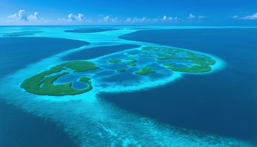
Creating effective Marine Protected Areas requires more than drawing boundaries on a map—it demands understanding how marine life actually moves through ocean waters. This is where hydrodynamic modeling becomes invaluable, helping conservationists identify locations where protection will have the greatest impact.
These models predict larval dispersal patterns, essentially tracking where baby fish and invertebrates travel on ocean currents from spawning sites to settlement areas. By understanding these invisible highways, scientists can design MPAs that protect not just individual habitats, but entire networks of connected ecosystems. The models also identify areas where nutrient-rich currents converge, creating hotspots of productivity that support diverse marine communities.
A compelling example comes from the Channel Islands Marine Reserves off California’s coast. Before establishing these protected areas in 2003, researchers used hydrodynamic modeling to map larval connectivity between islands and the mainland. The models revealed that certain islands acted as “source” populations, exporting larvae to other areas, while others served as “sinks” receiving larvae from elsewhere.
Dr. Sarah Chen, a marine biologist who worked on the project, recalls the breakthrough: “When we overlaid the connectivity data with existing habitat maps, the optimal reserve locations became clear. We weren’t just protecting isolated patches—we were safeguarding an interconnected system.”
The results have been remarkable. Fish populations within the reserves have increased by over 50% in some areas, and genetic studies confirm that these protected populations are successfully replenishing nearby fishing grounds—exactly as the models predicted. For volunteers participating in monitoring programs at these reserves, witnessing this recovery firsthand has been transformative, demonstrating how science-informed conservation truly works.
Predicting Climate Change Impacts Before They Happen
One of the most powerful applications of hydrodynamic modeling lies in its ability to act as a crystal ball for our oceans. By incorporating climate projections—such as rising temperatures, changing current patterns, and ocean acidification—these models simulate how marine habitats might transform over the coming decades. This forward-looking capability allows conservationists to move from reactive to proactive management, anticipating threats before they fully materialize.
Consider the case of cold-water coral reefs off Norway’s coast. Researchers used hydrodynamic models to predict how warming waters and shifting currents would affect these delicate ecosystems through 2050. The models revealed that certain reef systems would face dramatically reduced nutrient flow, while others might actually benefit from redirected currents. Armed with this knowledge, marine protected area planners prioritized conservation efforts on the most vulnerable sites and identified potential climate refugia—areas likely to remain stable even as surrounding habitats change.
Similarly, models are tracking the projected migration of kelp forests along the California coastline. As ocean temperatures rise, these foundational ecosystems are expected to shift northward, profoundly affecting the hundreds of species they support. Dr. Sarah Chen, a marine ecologist with the Pacific Marine Conservation Alliance, explains: “We’re essentially mapping the future ocean. This allows us to identify where new marine protected areas should be established and where restoration efforts will have the longest-lasting impact.”
These predictive tools also integrate with AI-powered modeling approaches to create even more sophisticated forecasts. For endangered species like North Atlantic right whales, models project how changing ocean conditions will alter the distribution of their zooplankton prey, helping managers anticipate critical feeding areas decades in advance.
Citizen scientists contribute to this effort by participating in long-term monitoring programs that validate model predictions and help refine future scenarios, turning theoretical projections into actionable conservation strategies.
The Challenges We’re Still Working to Overcome
While hydrodynamic modeling has transformed how we understand marine habitats, we must acknowledge that this powerful tool still faces important limitations—ones that scientists around the world are actively working to overcome.
**Computational demands** remain one of our biggest hurdles. High-resolution models that capture fine-scale coastal features require enormous computing power and can take days or even weeks to run. Dr. Sarah Chen, a marine modeler at the Pacific Conservation Institute, puts it plainly: “We’re often forced to choose between covering larger areas with less detail or zooming in on smaller regions. It’s like trying to photograph an entire coral reef with a camera that can either capture wide angles or close-ups, but not both simultaneously.” Fortunately, advances in cloud computing and machine learning are helping researchers process complex simulations more efficiently than ever before.
**Data scarcity in remote regions** presents another significant challenge. While we have detailed oceanographic measurements for well-studied coastlines, vast stretches of our oceans—particularly in the Arctic, deep sea environments, and around developing nations—lack the monitoring infrastructure needed to validate and calibrate models. This is where collaborative international efforts become crucial. Volunteer divers and citizen scientists are increasingly contributing vital observations that help fill these gaps, making models more accurate and representative.
**Uncertainty in predictions** is an inherent reality we must navigate carefully. Ocean systems are incredibly complex, influenced by everything from climate change to microscopic plankton behavior. Models can tell us what’s likely to happen, but they can’t predict the future with perfect certainty. The integration of complementary approaches, including genomic data integration, helps reduce this uncertainty by adding biological dimensions to physical predictions.
Perhaps most challenging is understanding how species will actually respond to changing conditions. Physical models excel at predicting water movement, but translating those currents into biological outcomes requires ongoing research and field validation. The good news? This challenge is driving unprecedented collaboration between modelers, field biologists, and conservation practitioners, strengthening our collective understanding with each project.
How You Can Be Part of This Conservation Revolution
The beauty of modern conservation science lies in its accessibility—you don’t need a PhD in fluid dynamics to contribute meaningfully to hydrodynamic modeling efforts and the marine conservation work it supports.
**Citizen Science: Your Data Makes a Difference**
One of the most direct ways to engage is through citizen science programs that feed crucial data into hydrodynamic models. Organizations worldwide need observers to record water temperatures, document current patterns from shore, photograph coastal changes, and report marine species sightings. Dr. Maria Chen, a marine biologist with fifteen years of field experience, emphasizes that “citizen scientists have helped us validate model predictions in remote areas we simply couldn’t monitor ourselves. Their contributions are invaluable.”
The Marine Biodiversity Science Center offers several accessible entry points. Their Coastal Observer Program trains volunteers to collect oceanographic measurements using simple equipment—data that enhances model accuracy for habitat assessments. You’ll receive training materials, data collection protocols, and become part of a community working alongside professional researchers.
**Learn and Share**
For educators and students, numerous free resources can deepen your understanding of hydrodynamic modeling and related advanced conservation technologies. The Marine Biodiversity Science Center’s e-network provides webinars, case studies, and downloadable teaching modules that translate complex modeling concepts into classroom-ready content. These resources help build the next generation of ocean advocates and scientists.
**Support Research That Protects Our Oceans**
Financial support directly enables modeling projects that inform marine protected area design, restoration efforts, and climate adaptation strategies. Many organizations offer transparent reporting on how donations fund specific modeling initiatives and conservation outcomes.
**Join the Conversation**
Connect with the Marine Biodiversity Science Center’s online community to stay informed about emerging projects, volunteer opportunities, and success stories. Share insights from your local coastline, ask questions, and learn from marine conservation professionals and fellow enthusiasts.
Whether you’re collecting temperature data from your favorite beach, supporting research financially, or simply spreading awareness about science-based conservation, your involvement matters. Hydrodynamic modeling is powerful, but it’s people—curious, committed individuals like you—who transform models into meaningful ocean protection.
We stand at a remarkable threshold in marine conservation history. For the first time, we possess the technological capability to peer beneath the ocean’s surface not just to observe, but to predict, model, and understand the intricate forces shaping marine habitats before irreversible damage occurs. Hydrodynamic modeling has emerged as our crystal ball—one grounded in rigorous science rather than speculation—allowing us to test conservation strategies virtually, identify vulnerable ecosystems proactively, and make decisions backed by data rather than guesswork alone.
This isn’t just about computers and equations; it’s about hope. Every simulation that reveals how larvae travel through ocean currents brings us closer to designing marine protected areas that actually work. Every model predicting how pollution disperses helps us prevent disasters rather than merely respond to them. As Dr. Maria Sánchez, a marine biologist who uses hydrodynamic modeling to protect Caribbean coral reefs, shares: “Twenty years ago, we were always fighting fires. Now we can see the sparks before they ignite.”
The power of this technology multiplies when combined with collective action. Whether you’re a student learning to interpret oceanographic data, an educator bringing these concepts to your classroom, or a citizen scientist contributing observations that validate models, you have a role to play. Conservation organizations worldwide need volunteers to help collect the field data that makes models accurate. Your engagement matters—from supporting marine research initiatives to advocating for science-based policy decisions in your community.
The ocean’s future isn’t predetermined. Armed with hydrodynamic modeling and collaborative determination, we can write a different story—one where understanding precedes loss, where protection comes before extinction. The tools are ready. The question is: are we?
jessica
Ava Singh is an environmental writer and marine sustainability advocate with a deep commitment to protecting the world's oceans and coastal communities. With a background in environmental policy and a passion for storytelling, Ava brings complex topics to life through clear, engaging content that educates and empowers readers. At the Marine Biodiversity & Sustainability Learning Center, Ava focuses on sharing impactful stories about community engagement, policy innovations, and conservation strategies. Her writing bridges the gap between science and the public, encouraging people to take part in preserving marine biodiversity. When she’s not writing, Ava collaborates with local initiatives to promote eco-conscious living and sustainable development, ensuring her work makes a difference both on the page and in the real world.