Marine Biodiversity Science Center

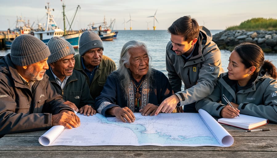
Marine spatial planning represents one of the most promising yet complex tools for balancing ocean use with conservation, but its success hinges entirely on whether it serves all people equitably or merely reinforces existing power structures. At its core, MSP is a public process of analyzing and allocating the spatial and temporal distribution of human activities in marine areas to achieve ecological, economic, and social objectives. Picture it as ocean zoning: deciding where fishing fleets can operate, where wind farms should stand, where shipping lanes cut through, and crucially, where marine life needs sanctuary from all human interference.
The stakes could not be higher. Over three billion people depend on marine and coastal biodiversity for their livelihoods, yet coastal communities, indigenous peoples, and small-scale fishers are frequently excluded from planning processes that fundamentally reshape their relationship with the sea. When done right, marine spatial planning becomes a powerful vehicle for environmental justice, ensuring that conservation efforts protect both ecosystems and the communities intertwined with them. When done poorly, it transforms into a tool that displaces traditional users while creating ocean real estate for industrial interests.
This tension between conservation goals and human rights makes understanding MSP’s equity dimensions essential for anyone working in marine conservation. The decisions we make today about who participates in ocean planning, whose knowledge counts as legitimate, and how benefits and restrictions are distributed will determine whether marine conservation becomes a force for justice or inequity for generations to come.
What Marine Spatial Planning Actually Means
The Basic Framework: How Ocean Space Gets Divided
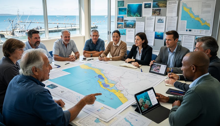
Think of marine spatial planning as creating a neighborhood zoning map, but for the ocean. Just as cities designate areas for residential, commercial, and park use, MSP divides ocean spaces into zones that serve different purposes while ensuring everyone can coexist.
The framework typically starts by mapping out existing ocean activities. Marine planners identify where commercial fishing fleets operate, trace shipping routes that transport goods between continents, locate areas rich with marine biodiversity that need protection, and pinpoint sites suitable for offshore wind farms or aquaculture facilities. This comprehensive inventory reveals how different communities and industries currently use the ocean.
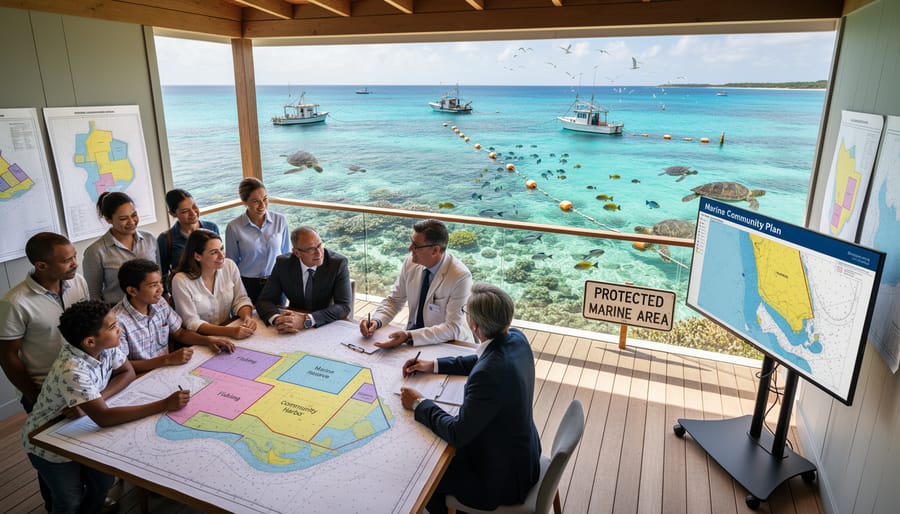
Next comes the collaborative part: bringing stakeholders together to negotiate how space should be allocated. A commercial fisher might explain why a particular reef is essential for their livelihood, while a marine biologist shares data about endangered species in the same area. Through this dialogue, planners create zones that balance competing needs.
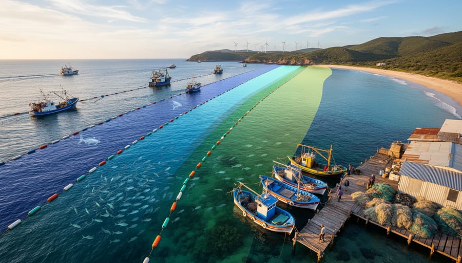
The resulting plan might designate certain areas as marine protected areas where fishing is restricted to allow ecosystems to recover. Adjacent zones could permit sustainable fishing with specific gear types. Shipping lanes get clearly marked to prevent vessel strikes on whales, while renewable energy zones are positioned where they won’t interfere with migration routes.
What makes this framework powerful is its flexibility. Plans aren’t permanent; they adapt as conditions change, new scientific data emerges, and communities evolve. This dynamic approach ensures ocean space serves both ecological health and human wellbeing.
Who Makes These Decisions?
Marine spatial planning doesn’t happen in a vacuum—it’s a collaborative process that brings together diverse voices, each with unique perspectives and stakes in ocean health. Government agencies typically lead MSP initiatives, setting regulatory frameworks and coordinating between different sectors. They work alongside marine scientists and researchers who provide essential data about ecosystem health, species migration patterns, and environmental thresholds that inform sustainable use limits.
Commercial fishing industries, shipping companies, tourism operators, and energy developers participate as key economic stakeholders, representing sectors whose livelihoods depend on ocean access. Conservation organizations contribute expertise on protecting biodiversity and maintaining ecological balance.
Perhaps most importantly, coastal communities and indigenous populations bring invaluable traditional knowledge and cultural connections to marine spaces. Their participation ensures that planning processes honor ancestral fishing grounds, sacred sites, and generations of ecological wisdom. Many successful MSP initiatives now include dedicated seats for community representatives at decision-making tables.
This multi-stakeholder approach aims to balance competing interests while safeguarding marine environments. However, the real question isn’t just who sits at the table—it’s whether all voices carry equal weight in shaping outcomes that affect their futures.
The Hidden Problem: When Ocean Planning Leaves People Behind
Economic Equity: Who Wins and Who Loses Access
Marine spatial planning doesn’t impact everyone equally. When governments and stakeholders map out ocean zones for different uses, some economic groups gain valuable access while others may face restrictions or displacement. Understanding these disparities is essential for creating truly equitable ocean management.
Industrial fishing fleets, offshore energy corporations, and shipping companies typically bring significant economic power to MSP processes. Their financial resources often translate into stronger representation during planning discussions, potentially securing priority access to prime ocean areas. Meanwhile, artisanal fishers and small-scale operators frequently struggle to have their voices heard, despite their deep cultural connections and dependence on specific fishing grounds that have sustained community livelihoods for generations.
Consider coastal villages in Southeast Asia where families have practiced traditional fishing methods for centuries. When MSP designates their ancestral fishing zones for aquaculture development or tourism, these communities may lose not just income but their entire way of life. Without adequate compensation or alternative opportunities, they bear disproportionate burdens while wealthier stakeholders reap the benefits.
Fair MSP requires deliberate attention to equity. This means ensuring meaningful participation from marginalized groups, providing translation services and accessible meeting times, and recognizing traditional ecological knowledge alongside scientific data. Some regions have successfully implemented benefit-sharing mechanisms, where revenues from ocean industries support displaced fishing communities through training programs or microcredit initiatives.
The key question planners must ask is: who profits from ocean access, and who pays the price? Transparent decision-making processes, equity impact assessments, and adaptive management that responds to community feedback help ensure MSP doesn’t simply reinforce existing economic inequalities. When done right, spatial planning can actually redistribute ocean benefits more fairly, creating opportunities for historically disadvantaged groups while maintaining productive, sustainable marine ecosystems that serve everyone.
Social Justice: Ensuring Every Voice Is Heard
Marine spatial planning cannot achieve true equity without ensuring that all voices—particularly those historically excluded from decision-making—have genuine opportunities to participate. Traditional stakeholder meetings often favor those with resources, flexibility, and familiarity with formal processes, inadvertently silencing Indigenous communities, small-scale fishers, and coastal residents who depend most directly on marine resources.
Representation challenges run deep in MSP processes. Meetings scheduled during working hours exclude fishers at sea. Technical language creates barriers for communities without scientific training. Geographic distance prevents remote coastal villagers from attending centralized planning sessions. These structural obstacles mean that the people with the most intimate knowledge of marine ecosystems frequently have the least input in their management.
Indigenous and local communities hold invaluable traditional knowledge systems developed over generations of careful observation. This knowledge includes understanding of seasonal fish migrations, breeding grounds, and ecosystem relationships that scientific surveys might miss. Dr. Maria Santos, a marine biologist working with Pacific Island communities, shares how traditional navigators identified critical spawning areas that satellite data had overlooked. “Their knowledge filled gaps our technology couldn’t reach,” she explains. “True MSP integrates both ways of knowing.”
Inclusive decision-making requires active effort beyond standard consultation. Successful initiatives employ community liaisons who speak local languages, hold meetings in accessible locations at convenient times, and use visual tools rather than dense documents. Some programs offer stipends to compensate participants for time away from work, recognizing that participation itself carries costs.
Creating pathways for meaningful involvement—through community-based monitoring programs, local advisory committees, and culturally appropriate engagement methods—transforms MSP from a top-down process into genuine collaborative governance. When every voice shapes the plan, outcomes better reflect the diverse values and needs of all who share ocean spaces.
What Equitable Marine Spatial Planning Looks Like in Action
Success Stories from Coastal Communities
Around the world, coastal communities are proving that marine spatial planning can simultaneously protect ocean life and strengthen local economies when done inclusively. These success stories demonstrate the tangible benefits of bringing diverse voices to the planning table.
In Belize, the national MSP process transformed how fishing communities and conservationists work together. By mapping critical habitats for endangered hawksbill turtles and Nassau grouper alongside traditional fishing grounds, planners created zones that protected spawning aggregations while maintaining access for artisanal fishers. Within five years, grouper populations rebounded by 40 percent, and fishing communities reported more stable catches. Local fisher Maria Gonzales shared, “We worried the zones would hurt our families, but now we catch more fish in less time. The ocean is healthier, and so is our income.”
Scotland’s Shetland Islands offer another compelling example where cultural considerations shaped successful outcomes. Their MSP process incorporated traditional ecological knowledge from generations of fishers, identifying areas crucial for spawning cod and preserving community access to culturally significant fishing sites. The plan simultaneously designated protection zones for recovering seabird colonies, including endangered Arctic terns. Tourism focused on wildlife watching has since added 3 million pounds annually to the local economy.
In the Philippines, community-led MSP in the Verde Island Passage combined no-take marine reserves with sustainable tourism zones. Coral cover increased by 25 percent, whale shark sightings doubled, and local dive operators experienced a 60 percent revenue increase. Former fisherman turned dive guide Roberto Santos notes, “I earn three times more showing tourists our beautiful reefs than I ever did fishing. My children see a future here.”
These examples demonstrate that when communities participate meaningfully in planning, everyone benefits.
Lessons from Places That Got It Wrong
Not every marine spatial planning initiative gets it right from the start, and examining these cases reveals crucial insights. In Scotland’s initial marine planning efforts during the early 2010s, traditional fishing communities felt excluded from decision-making processes that prioritized large-scale renewable energy developments. The rushed consultations and technical language created barriers, leaving fishers feeling their generational knowledge was undervalued. The result? Delayed implementation, legal challenges, and initial mistrust that took years to rebuild.
Similarly, certain Caribbean nations implementing MSP to boost tourism inadvertently displaced small-scale fishers without adequate compensation or alternative livelihood programs. When communities lose access to fishing grounds that sustained them for generations without meaningful involvement in planning decisions, both social fabric and conservation goals suffer. Displaced fishers may resort to illegal fishing in protected areas or abandon sustainable practices altogether out of necessity.
A marine biologist who worked on rectifying one such project shared: “We realized that conservation blueprints drawn in offices, no matter how scientifically sound, crumble without community buy-in. The ocean doesn’t exist separately from the people who depend on it.”
These missteps taught planners invaluable lessons. Effective MSP requires early, genuine engagement with all stakeholders, especially marginalized groups. It demands transparent processes, accessible information, and recognition that local ecological knowledge complements scientific data. Most importantly, equity isn’t an afterthought—it’s foundational. When communities are excluded, marine conservation itself becomes unsustainable, as resentment and economic hardship undermine even the best environmental intentions.
Building Fairness Into Ocean Planning: Practical Approaches
Tools for Including Marginalized Communities
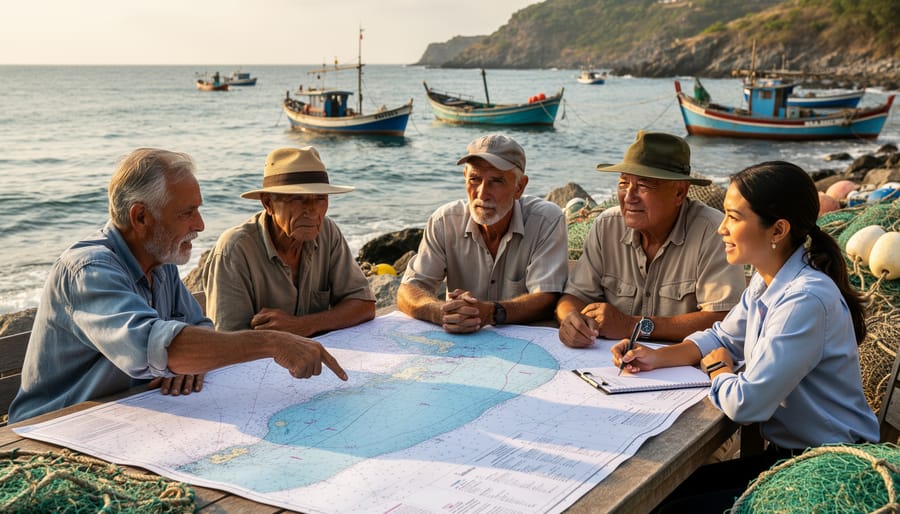
Effective marine spatial planning requires intentional tools that break down barriers and create genuine pathways for marginalized communities to participate. Participatory mapping stands out as a particularly powerful approach, allowing fishers, Indigenous communities, and coastal residents to mark their traditional fishing grounds, sacred sites, and resource-dependent areas directly onto planning maps. This visual method transcends literacy barriers and validates local knowledge alongside scientific data.
Successful community engagement also depends on practical accessibility measures. Holding workshops in community centers rather than government offices, scheduling meetings outside working hours, and providing childcare can dramatically increase participation. Translation services and multilingual materials ensure language barriers don’t exclude entire communities from decision-making processes.
Compensation represents another crucial tool often overlooked in conservation planning. When we ask community members to share generations of ecological knowledge or attend lengthy planning sessions, we’re requesting valuable expertise and time. Fair compensation acknowledges this contribution and enables participation from those who cannot afford unpaid involvement.
Mobile technology has opened new possibilities too. Some programs now use smartphone apps for data collection, allowing community members to report observations and concerns directly from their boats or coastal homes. Dr. Maria Santos, a marine planner working with Filipino fishing communities, shares that these digital tools have tripled participation rates while capturing real-time insights traditional surveys miss. The key is ensuring technology enhances rather than replaces face-to-face relationship building that forms the foundation of equitable planning.
Measuring Equity Outcomes
Measuring whether marine spatial planning truly delivers equitable outcomes requires tracking more than just fish populations and coral health. We need indicators that capture how different communities benefit from or are burdened by ocean management decisions.
Effective equity monitoring combines quantitative metrics with qualitative insights. Track economic indicators like changes in fishing income across different fleet sizes, employment opportunities in marine tourism, and access to traditional fishing grounds. Include participation metrics: Who attends planning meetings? Whose recommendations influence final decisions? Document this by fishing community, indigenous group, gender, and socioeconomic status.
Social impact assessments should be conducted before, during, and after MSP implementation. These go beyond numbers to capture lived experiences. Marine biologist Dr. Elena Rodriguez, who works with small-scale fishers in the Philippines, emphasizes the power of participatory monitoring: “When communities document their own catches, market prices, and time spent traveling to fishing grounds, they generate evidence that planners cannot ignore. It transforms them from subjects of planning to agents of change.”
Consider developing community wellbeing indicators that reflect local values, whether that’s food security, cultural continuity, or fair market access. Establish baseline conditions before zoning changes take effect, then track trends over time.
Transparency matters enormously. Make monitoring data publicly accessible and understandable. Create feedback mechanisms where communities can raise concerns about unfair impacts. When monitoring reveals inequities, adaptive management processes should allow for course corrections. This responsive approach, though challenging, builds trust and ensures that equity remains central to marine spatial planning rather than merely aspirational.
How This Connects to Marine Conservation Success
Marine spatial planning works best when it weaves together ecological protection and human well-being into a unified strategy. This integration isn’t just ethically important—it’s scientifically proven to deliver better conservation outcomes that last.
Research from coastal communities worldwide demonstrates that conservation measures gain stronger support and compliance when local people help shape them and benefit from them. When fishing communities participate in designing marine protected areas, for instance, they’re more likely to respect boundaries and report illegal activities. Dr. Maria Santos, a marine biologist working in the Philippines, shares how indigenous fishing communities became powerful conservation allies once their traditional knowledge and economic concerns were incorporated into spatial plans. “The moment fishers saw themselves as partners rather than obstacles, enforcement became nearly effortless,” she recalls.
This human-centered approach addresses a fundamental conservation challenge: protected areas only work if people respect them over decades. Plans that ignore socio-economic realities often face resistance, illegal use, or eventual abandonment when political winds shift. Conversely, MSP that provides alternative livelihoods, preserves cultural fishing grounds, or creates ecotourism opportunities builds constituencies who advocate for conservation’s continuation.
The science supports this connection. Studies analyzing marine reserve effectiveness consistently show that community support correlates with improved biodiversity outcomes. When coastal residents have economic reasons to maintain healthy ecosystems—whether through sustainable fishing quotas, tourism revenue, or climate resilience benefits—they become active stewards rather than passive bystanders.
For students and emerging conservationists, this represents an exciting frontier. Volunteer opportunities increasingly focus on participatory planning processes, where you can help facilitate community workshops, document traditional ecological knowledge, or analyze socio-economic data that informs spatial decisions. This work recognizes that marine conservation isn’t just about protecting fish and coral—it’s about creating systems where both nature and people can thrive together, ensuring that today’s conservation victories remain victories for generations to come.
How You Can Support Equitable Ocean Planning
Marine spatial planning doesn’t happen in boardrooms alone—it requires voices from every corner of our coastal communities, including yours. Whether you’re a student just discovering your passion for the ocean or a seasoned professional looking to expand your impact, there are meaningful ways to contribute to more equitable ocean planning processes.
For students and educators, start by integrating MSP concepts into your learning and teaching. Organize classroom discussions about how different communities depend on ocean resources, or develop service-learning projects that connect with local fishing communities or indigenous groups. These conversations plant seeds for the next generation of marine spatial planners who understand that equity isn’t optional—it’s essential.
Professionals in marine science, policy, and conservation can leverage their expertise by participating in public comment periods for MSP initiatives. Your technical knowledge, when paired with community perspectives, strengthens planning outcomes. Consider offering pro-bono consulting to underrepresented stakeholder groups who may lack resources to engage effectively in complex planning processes.
The Marine Biodiversity Science Center offers hands-on volunteer opportunities that directly support equitable ocean planning. Community engagement volunteers help facilitate dialogue between researchers and local stakeholders, ensuring diverse voices inform our understanding of marine ecosystems. Advocacy volunteers work on translating scientific findings into accessible materials that empower communities to participate meaningfully in planning decisions.
Even small actions matter. Share MSP stories from your region on social media, attend town halls about coastal development, or simply start conversations about who benefits from ocean decisions. Dr. Maria Santos, a marine biologist at the Center, reminds us: “Every person who asks ‘whose voices are missing from this conversation?’ pushes us toward more just and sustainable oceans.” Your engagement, whatever form it takes, contributes to a growing movement ensuring our oceans serve everyone.
The future of our oceans depends on planning processes that honor both ecological integrity and human dignity. Marine spatial planning, when designed with equity at its core, becomes far more than a management tool—it transforms into a pathway toward ocean justice. We’ve seen that when coastal communities have meaningful seats at the decision-making table, when traditional knowledge merges with scientific data, and when economic benefits flow to those who depend most directly on marine resources, everyone benefits. Thriving fishing communities protect their waters more effectively. Indigenous peoples maintain cultural practices that have sustained ecosystems for generations. And marine biodiversity flourishes when human needs are met sustainably.
The encouraging truth is that equitable MSP is already happening in pockets around the world, proving that we can chart a different course. But scaling these successes requires all of us—marine biologists, policy makers, educators, community leaders, and concerned citizens—to engage actively in these processes. Volunteer with organizations monitoring MSP implementation in your region. Share stories from your community about ocean connections that matter. Advocate for transparent, inclusive planning that genuinely values diverse voices.
The ocean connects us all, and so must our planning efforts. By demanding and participating in MSP processes that prioritize both ecological health and social equity, we’re not just managing marine spaces—we’re building a more just relationship with the blue planet that sustains us. The time to engage is now, and the opportunity to make a difference has never been clearer.

jessica
Ava Singh is an environmental writer and marine sustainability advocate with a deep commitment to protecting the world's oceans and coastal communities. With a background in environmental policy and a passion for storytelling, Ava brings complex topics to life through clear, engaging content that educates and empowers readers. At the Marine Biodiversity & Sustainability Learning Center, Ava focuses on sharing impactful stories about community engagement, policy innovations, and conservation strategies. Her writing bridges the gap between science and the public, encouraging people to take part in preserving marine biodiversity. When she’s not writing, Ava collaborates with local initiatives to promote eco-conscious living and sustainable development, ensuring her work makes a difference both on the page and in the real world.