Marine Biodiversity Science Center

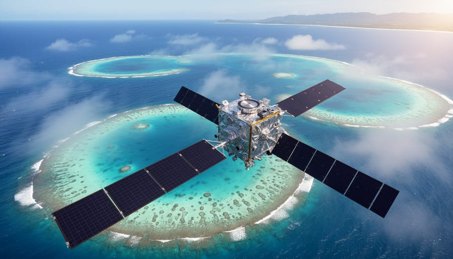
Picture a coral reef thousands of miles from the nearest research station, its health quietly deteriorating beneath the waves. Now imagine being able to monitor that reef’s condition, track bleaching events, measure water quality, and assess restoration progress—all from space. This is the power of remote satellite sensing, a revolutionary technology that has transformed how we understand and protect our oceans.
Remote satellite sensing uses specialized instruments aboard orbiting satellites to collect data about Earth’s marine environments without physical contact. These satellites measure everything from ocean temperature and chlorophyll concentrations to coral reef coverage and coastal erosion patterns. By capturing information across vast ocean expanses simultaneously, this technology provides marine conservationists with an unprecedented bird’s-eye view of ecosystem health that would be impossible to achieve through traditional boat-based surveys alone.
For marine restoration efforts, satellite sensing has become an indispensable tool. Scientists now track seagrass meadow recovery after restoration projects, identify optimal locations for artificial reefs, and monitor the spread of invasive species across entire coastlines. When coral bleaching events strike, satellites detect temperature anomalies days before visible damage occurs, giving restoration teams crucial time to respond. The technology has helped document the recovery of mangrove forests after community-led replanting initiatives and revealed hidden underwater habitats that warrant protection.
This marriage of space-age technology and hands-on conservation work demonstrates how innovation amplifies traditional restoration efforts. Whether you’re a student exploring marine science careers, a conservationist seeking effective monitoring tools, or a citizen passionate about ocean health, understanding remote satellite sensing reveals how modern technology creates opportunities for more informed, strategic, and ultimately successful marine restoration worldwide.
What Remote Satellite Sensing Actually Means for Our Oceans
The Eyes in the Sky We Never See
Hundreds of miles above the ocean’s surface, a constellation of satellites orbits Earth continuously, capturing data that has revolutionized how we understand and protect marine ecosystems. While we go about our daily lives, these technological marvels are quietly collecting information that helps scientists track everything from coral bleaching events to harmful algal blooms.
Three satellite systems stand out as champions of ocean observation. Landsat, a joint NASA-USGS program operating since 1972, represents the longest continuous record of Earth’s surface. Its ability to detect changes in coastal zones and shallow water environments makes it invaluable for monitoring seagrass beds and coastal wetlands over decades.
The European Space Agency’s Sentinel satellites have become game-changers since their launch in 2014. Sentinel-2 returns to photograph the same ocean area every five days, allowing scientists to catch rapid changes in water quality or sudden disturbances to marine habitats. This frequent revisit time is crucial for tracking time-sensitive restoration projects.
NASA’s MODIS sensors aboard the Terra and Aqua satellites offer a different advantage: they scan the entire planet daily. While their resolution is coarser than Landsat or Sentinel, this wide-angle view excels at tracking large-scale phenomena like ocean temperature patterns and phytoplankton blooms that form the foundation of marine food webs.
What makes these satellites special for ocean work is their ability to see beyond human vision, detecting specific wavelengths that reveal water chemistry, algae concentrations, and sediment levels invisible to our eyes.
From Space to Solutions: What Satellites Can Tell Us
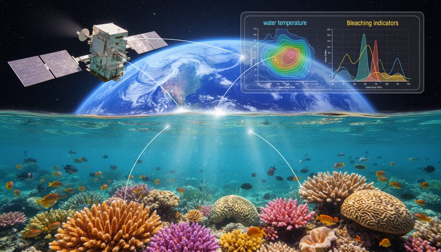
Orbiting hundreds of miles above Earth, satellites equipped with sophisticated sensors capture a wealth of information about our oceans that would be impossible to gather from the surface alone. These space-based instruments measure sea surface temperature, revealing warming patterns that stress marine ecosystems and signal shifts in ocean currents. They detect chlorophyll concentrations, providing a window into phytoplankton populations—the foundation of marine food webs. By analyzing water clarity and turbidity, satellites help scientists track sediment plumes from coastal erosion and identify areas where excessive nutrients fuel harmful algal blooms.
Perhaps most critically, satellites can spot the telltale signs of coral bleaching by detecting changes in reef coloration and temperature anomalies before damage becomes irreversible. They track pollution dispersal patterns, from oil spills to plastic accumulation zones, enabling rapid response efforts. Coastal monitoring reveals erosion rates, habitat loss, and the effectiveness of restoration projects over time.
Marine biologist Dr. Elena Vasquez shares, “What once took months of ship-based surveys, we can now observe weekly from space. This frequency transforms our ability to respond to threats.” This bird’s-eye perspective empowers conservationists to prioritize intervention sites and measure restoration success with unprecedented precision.
Why Marine Restoration Projects Can’t Afford to Ignore Satellite Data
Spotting Trouble Before It’s Too Late
One of satellite remote sensing’s most valuable contributions to marine conservation is its ability to detect environmental distress signals before damage becomes irreversible. Think of satellites as early warning systems, continuously scanning our oceans for subtle changes that indicate ecosystems under stress.
Take coral bleaching, for example. When water temperatures rise even slightly, corals expel their symbiotic algae, turning ghostly white. Satellites equipped with thermal sensors can detect these temperature anomalies days or even weeks before bleaching occurs, giving researchers and managers precious time to respond. Dr. Maria Santos, a marine biologist working with coral restoration teams in the Caribbean, explains: “When we receive satellite alerts about warming events, we can deploy our monitoring teams immediately and sometimes implement emergency cooling strategies in priority reef areas.”
Satellites also excel at spotting harmful algal blooms, which appear as distinct color changes visible from space. These toxic events can devastate marine life and close fisheries, but early detection allows authorities to issue warnings and protect coastal communities. Similarly, oil spills, sediment plumes from coastal development, and even illegal fishing activities leave signatures that satellites can capture in near real-time.
For tracking habitat degradation, satellite imagery reveals changes in seagrass meadows, mangrove forests, and kelp beds over time, supporting marine ecosystem recovery efforts by identifying areas most urgently needing intervention. This proactive approach transforms conservation from reactive crisis management into strategic, preventive action.
Choosing Where to Focus Limited Resources
Conservation budgets are finite, making every decision critical. Satellite data revolutionizes how organizations choose restoration sites by revealing which locations offer the highest probability of success. Through analyzing water quality patterns, current flows, and existing biodiversity indicators, conservationists can identify habitats where interventions will have cascading positive effects throughout the ecosystem. For example, satellite imaging might show that a degraded seagrass meadow still has favorable conditions for regrowth, making it a prime candidate for restoration rather than a more severely damaged site. This data-driven approach helps maximize the impact of limited funding and volunteer efforts. Marine biologist Dr. Elena Santos shares, “Before satellite technology, we relied heavily on intuition and local knowledge alone. Now we can pinpoint exactly where our restoration teams should deploy coral nurseries or remove invasive species to achieve the greatest ecological return.”
Real Marine Restoration Wins Powered by Satellite Technology
Bringing Caribbean Coral Reefs Back from the Brink
In the eastern Caribbean, the Coral Restoration Foundation partnered with marine scientists to revive declining elkhorn and staghorn coral populations using satellite technology as their guide. Dr. Maria Santos, who led the initiative, recalls how satellite-derived sea surface temperature data became their most valuable planning tool. “We needed to identify reef areas where transplanted corals would have the best survival chances,” she explains. “Satellites gave us a bird’s-eye view of temperature patterns we simply couldn’t get from boat surveys alone.”
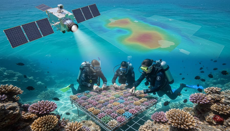
The team used thermal satellite imagery to map temperature fluctuations across potential restoration sites, avoiding areas prone to heat stress while identifying thermally stable zones. This coral reef restoration approach increased transplant survival rates by 40% compared to sites selected without satellite guidance. Remote monitoring also allowed the team to respond quickly when unusual warming events appeared, relocating nursery corals to cooler depths before heat stress occurred.
Today, over 15,000 coral fragments thrive across these satellite-selected sites, with volunteer divers assisting in monthly monitoring efforts. This success demonstrates how space-based technology can empower grassroots conservation, making sophisticated environmental data accessible to on-the-ground restoration teams.
How One Team Mapped 20,000 Acres of Hidden Seagrass
Dr. Maya Chen remembers the moment satellite data transformed her team’s understanding of Tampa Bay’s underwater landscape. “We’d spent months conducting traditional diving surveys, but we were only seeing a fraction of the picture,” she recalls. When her team at the Florida Marine Conservation Society integrated satellite imagery analysis in 2021, they discovered something remarkable: over 20,000 acres of previously unmapped seagrass meadows scattered across shallow coastal waters.
The project combined multispectral satellite data with ground-truthing expeditions, where divers validated what satellites detected from space. “The imagery revealed seagrass beds in murky water conditions where we’d never thought to look,” Maya explains. This comprehensive mapping allowed the team to prioritize restoration sites strategically, identifying degraded areas adjacent to healthy meadows that could serve as natural seed sources.
The discovery mobilized an unprecedented restoration effort. Local volunteers, trained through weekend workshops, now monitor these newly mapped meadows quarterly. “Satellite sensing didn’t just show us where seagrass existed,” Maya reflects. “It showed us where hope existed—thousands of acres worth of ecosystems we can now actively protect and restore.”
Watching Mangroves Reclaim Coastal Waters
Along the coast of Vietnam’s Mekong Delta, satellite imagery has captured a remarkable transformation. What appeared as eroding mudflats in 2015 now shows vibrant green corridors of mangrove forests thriving in 2024. This documented recovery showcases how remote sensing technology provides invaluable data for tracking marine habitat restoration efforts over extended periods.
Dr. Linh Nguyen, a marine ecologist who has monitored this restoration project, explains how satellite data revolutionized their approach. “Before satellites, we could only assess small sections at a time. Now we can measure the entire 50-kilometer restoration zone monthly, tracking canopy density, root system expansion, and water quality improvements simultaneously.”
The data reveals measurable progress: mangrove coverage increased from 120 hectares to over 800 hectares within seven years. These forests now filter sediment, protect communities from storm surge, and support returning fish populations. Multispectral satellite imaging even identifies which mangrove species thrive in specific areas, allowing restoration teams to refine planting strategies.
This success story demonstrates how satellite technology transforms restoration from hopeful planting exercises into data-driven conservation science, enabling teams to adapt strategies and demonstrate tangible environmental recovery to funders and communities alike.
The Challenges That Still Keep Conservationists Up at Night
When the Data Needs a Human Touch
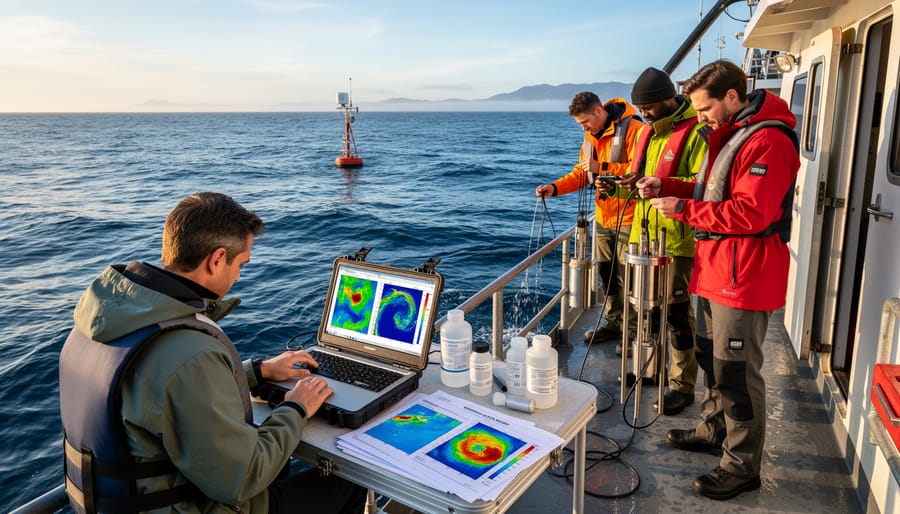
Satellite imagery offers an incredible bird’s-eye view of our oceans, but these data points tell only part of the story. Think of satellites as providing the headlines, while scientists on the ground and in the water fill in the critical details. Temperature readings from space might indicate coral bleaching, but marine biologists diving at the site can assess the severity, identify which species are most affected, and understand local factors like water quality or human activity that satellites can’t detect.
Dr. Maria Chen, a marine ecologist with fifteen years of field experience, explains it this way: “Satellites showed us widespread seagrass loss in our study area, but it took boots on the ground—or rather, fins in the water—to discover that specific restoration techniques worked better in shallow versus deep zones.” This combination of remote sensing and traditional fieldwork, called ground truthing, ensures restoration efforts target the right locations with appropriate methods.
Volunteers play a vital role in this validation process. Citizen scientists collecting water samples, photographing species, or documenting coastal changes provide essential data points that make satellite observations actionable. This partnership between technology and human observation creates a more complete, accurate picture of ocean health.
How You Can Join the Satellite-Powered Conservation Movement
Volunteer Opportunities That Make a Difference
Ready to put your satellite expertise to work? Several accessible programs welcome volunteers of all experience levels to contribute meaningfully to marine conservation through satellite data analysis.
NASA’s GLOBE Observer program invites citizen scientists to collect ground-truthing data that validates satellite measurements of ocean color, water quality, and coastal conditions. Using just a smartphone app, you can photograph ocean surfaces, record observations, and upload data that helps scientists calibrate satellite sensors. Marine biologist Dr. Elena Rodriguez notes, “Every observation volunteers submit helps us understand what satellites are actually seeing, making our conservation efforts more accurate.”
Zooniverse hosts multiple projects where volunteers analyze satellite imagery to identify coral reefs, track marine debris, and map coastal habitats. The Floating Forests project, for example, tasks volunteers with marking kelp forest boundaries in satellite images, creating datasets that would take researchers decades to compile alone. No special training required—the platform provides tutorials and your classifications directly support published research.
For those seeking hands-on experience, organizations like Ocean Conservancy and local marine sanctuaries regularly organize ground-truthing expeditions where volunteers join field teams to verify satellite observations with on-site measurements. These opportunities combine meaningful data collection with unforgettable experiences exploring coastal ecosystems.
Whether you contribute fifteen minutes or fifteen hours monthly, your efforts help build the comprehensive datasets that drive effective marine restoration worldwide.
Free Tools That Let You Explore Ocean Data Yourself
You don’t need expensive software or advanced technical training to explore ocean satellite data yourself. Several free, user-friendly platforms now put this incredible technology at your fingertips, making ocean exploration accessible to everyone from curious students to dedicated citizen scientists.
Google Earth Engine offers an impressive collection of satellite imagery and geospatial datasets spanning decades. Through its public interface, you can observe changes in coastal ecosystems, track algal blooms, and monitor sea surface temperatures over time. The platform’s time-lapse feature is particularly powerful, revealing dramatic shifts in marine environments that unfold over years.
NASA’s Worldview provides near real-time satellite imagery from multiple sources, updated within hours of observation. Its intuitive interface lets you compare different data layers, zoom into specific ocean regions, and download images for your projects. The tool is especially valuable for tracking dynamic events like harmful algal blooms or sediment plumes.
ESA’s Sentinel Hub gives access to Europe’s Copernicus program satellites, offering high-resolution ocean color and sea surface data. Their custom visualization tools let you create tailored views of marine features, making it easier to spot changes in water quality or coastal development.
These platforms transform satellite data from exclusive scientific resources into tools for community engagement and environmental awareness.
The Future Is Already Here (And It’s Brighter Than You Think)
The pace of innovation in satellite technology is accelerating in ways that would have seemed impossible just a decade ago. Today’s satellites aren’t just capturing prettier pictures—they’re becoming smarter, more responsive, and exponentially more powerful in their ability to protect our oceans.
AI-enhanced satellite analysis is transforming how we process the massive amounts of data streaming down from space. Machine learning algorithms can now identify subtle changes in ocean color that indicate phytoplankton blooms, detect illegal fishing vessels in near real-time, and even predict where coral bleaching events are likely to occur before they happen. What once took marine scientists weeks to analyze manually can now be processed in hours, allowing for rapid response to emerging threats.
The next generation of satellites launching over the coming years will carry hyperspectral sensors capable of detecting dozens of wavelengths of light, revealing details about ocean chemistry, pollution levels, and ecosystem health with unprecedented precision. Companies and space agencies are deploying satellite constellations that will provide coverage of every ocean region multiple times per day, creating essentially a continuous monitoring system for our blue planet.
Perhaps most exciting is the integration happening between satellite systems and on-the-ground technologies. When satellites detect a concerning change, they can now trigger deployments of underwater sensors and drones to investigate further, creating a comprehensive monitoring network that spans from space to the seafloor.
Dr. Elena Torres, a conservation technologist working with satellite data, puts it beautifully: “We’re building an immune system for the ocean—one that can detect threats early and mobilize responses quickly. Every volunteer who helps interpret this data strengthens that system.”
Remember those researchers in the kelp forest, surveying what seemed like an endless underwater landscape? Today, they’re no longer working in the dark. What once required months of diving and rough estimates now takes days, with satellite imagery revealing the precise health and extent of kelp beds from space. This transformation from guesswork to precise science represents a turning point in how we approach marine restoration.
Satellite technology has given us something unprecedented: the ability to monitor our oceans at a scale that matches the enormity of the challenges they face. From tracking coral bleaching events as they unfold to mapping seagrass meadows that sequester carbon, remote sensing has become the eyes we’ve always needed but never had. Marine biologist Dr. Chen Rodriguez puts it simply: “We can finally see the whole picture, and that changes everything about how we protect it.”
But technology alone won’t save our oceans. The data streaming down from satellites needs passionate people to act on it. Conservation organizations worldwide are seeking volunteers to help analyze satellite imagery, participate in ground-truthing missions, and support restoration projects identified through remote sensing. Whether you’re a student, scientist, or simply someone who cares about marine life, there’s a role for you in this revolution.
The future of our oceans depends on this powerful combination: cutting-edge technology guided by human compassion and action. Together, we’re not just observing change from above—we’re creating it from within our communities, one restored ecosystem at a time.

jessica
Ava Singh is an environmental writer and marine sustainability advocate with a deep commitment to protecting the world's oceans and coastal communities. With a background in environmental policy and a passion for storytelling, Ava brings complex topics to life through clear, engaging content that educates and empowers readers. At the Marine Biodiversity & Sustainability Learning Center, Ava focuses on sharing impactful stories about community engagement, policy innovations, and conservation strategies. Her writing bridges the gap between science and the public, encouraging people to take part in preserving marine biodiversity. When she’s not writing, Ava collaborates with local initiatives to promote eco-conscious living and sustainable development, ensuring her work makes a difference both on the page and in the real world.