Marine Biodiversity Science Center

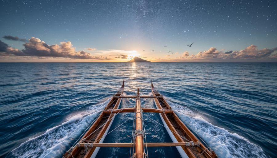
Learning to navigate by stars, waves, and wildlife allows you to read the ocean as generations of Pacific Islanders, Polynesian voyagers, and maritime cultures have for millennia. These wayfinding techniques require no instruments beyond your senses and careful observation, though mastering them demands patience, mentorship, and hundreds of hours at sea. The foundational method combines celestial navigation (tracking star paths and their rising and setting points), wave pattern reading (interpreting how swells bend around islands and reefs), and natural sign interpretation (following seabird flight paths, cloud formations, and bioluminescence).
Traditional navigational arts are experiencing a revival in 2026, driven by marine conservation communities who recognize that these skills deepen our connection to ocean ecosystems. When you learn to navigate without GPS, you’re not just acquiring a backup system. You’re training yourself to notice subtle shifts in water color that signal depth changes, to identify the species of birds overhead and what their behavior tells you about nearby land, to feel how currents move against your vessel. This heightened awareness transforms sailors into more effective ocean stewards.
The ocean tales of master navigators like Mau Piailug, who guided the Hokule’a canoe from Hawaii to Tahiti using only traditional methods in 1976, prove these techniques work across thousands of miles of open water. Modern practitioners report that wayfinding sharpens their understanding of marine weather patterns, seasonal fish migrations, and the interconnected rhythms of ocean life.
This guide walks you through the core skills step by step, from identifying your star compass to reading fetch and swell direction. You’ll learn verification methods to check your progress and discover pathways to connect with experienced navigators who can mentor your journey from shore-based practice to blue-water voyaging.
Understanding the Foundations of Traditional Wayfinding
Traditional wayfinding rests on a radically different premise than modern navigation: instead of imposing a grid onto the ocean, navigators position themselves within an interconnected web of natural phenomena. Pacific Island voyagers developed sophisticated systems over millennia by observing how stars, swells, marine life, and atmospheric patterns relate to each other and to specific geographic locations. This approach doesn’t treat navigation as a problem of calculating coordinates; it’s about maintaining constant awareness of your relationship to the environment through continuous observation and interpretation.
The foundation involves three interconnected skill sets working simultaneously. First, celestial observation establishes your position relative to star paths that arc across fixed points in the night sky. Second, ocean reading interprets the behavior of deep swells as they interact with islands, reefs, and underwater topography, swells bend around landmasses in predictable ways, creating detectable patterns dozens of miles offshore. Third, wildlife indicators leverage the fact that seabirds, fish, and marine mammals follow consistent routines tied to feeding grounds, nesting sites, and seasonal migrations. A navigator synthesizes these inputs rather than relying on any single source.
This holistic framework demands intimate knowledge of marine ecosystems. Recognizing which seabird species return to land each evening versus those that range far offshore requires understanding their breeding ecology and feeding strategies. Interpreting bioluminescent plankton concentrations or sudden dolphin activity means recognizing how ocean currents, upwelling zones, and reef structures create biodiversity hotspots. The ocean stories embedded in these patterns become navigation tools, making every voyage an active dialogue with the living ocean rather than passage through empty space.
What distinguishes traditional wayfinding from casual observation is systematic pattern recognition developed through deliberate practice. Navigators learn reference frameworks, mental models of how specific star positions correspond to known islands, or how particular swell combinations indicate distance from archipelagos. These frameworks transform scattered observations into reliable positional data. The cognitive work happens continuously: you’re always updating your mental map based on sensory input, comparing current conditions against expected patterns, and adjusting course accordingly.
Essential Tools and Natural Materials for Wayfinding
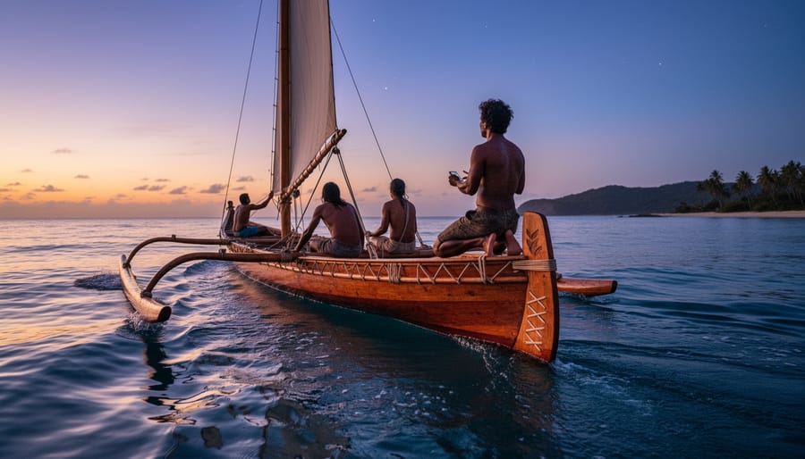
Traditional wayfinding operates on a minimalist principle that contrasts sharply with modern navigation’s reliance on electronics. Indigenous Pacific navigators carried no instruments, only accumulated knowledge encoded in their minds and shared through apprenticeship. This low-impact approach aligns naturally with marine conservation values, observing rather than extracting, learning from patterns rather than altering them.
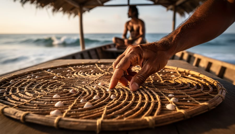
What you actually need depends on your commitment level. Historical navigators used stick charts in Micronesia, carefully constructed frameworks of palm ribs showing wave patterns around islands, but these were teaching aids rather than voyage equipment. Once sailors internalized the patterns, they left the charts ashore. Modern learners benefit from similar physical models during early training, though you’ll eventually progress beyond them.
For contemporary practice that respects traditional methods while ensuring safety, consider gathering these resources:
- Observation journal, waterproof notebook for recording celestial positions, wave behaviors, and wildlife patterns across multiple voyages
- Star compass knowledge, diagrams or apps showing rising and setting points of key navigational stars throughout the year
- Wave pattern guides, illustrations or photographs demonstrating swell refraction, reflection, and crossing patterns around land masses
- Marine life identification resources, field guides for seabirds, fish, and cetaceans whose behaviors serve as directional indicators
- Mentorship connections, contact with experienced traditional navigators or maritime heritage organizations offering instruction
Your journal becomes the most valuable tool. Record everything during practice voyages: which stars appeared where, how waves changed approaching coastlines, which bird species you encountered and their flight directions. These observations build your personal reference library, training your eye to recognize patterns that instruments miss. Over time, your mental maps replace written notes.
You don’t need a traditional double-hulled canoe, though any vessel allowing direct sensory contact with ocean conditions works better than enclosed cabins. Kayaks, small sailboats, and open motorboats all permit the wave-feeling and horizon-scanning essential to wayfinding. What matters is positioning yourself to observe, standing occasionally to scan the full circle of ocean, feeling hull movement through swell patterns, maintaining clear sight lines to celestial references.
Preparation means studying at home before attempting offshore practice. Learn star positions from your backyard, understand moon phases and tidal relationships from shore, study wave mechanics in coastal shallows where you can safely observe and verify patterns. This foundation reduces risk when you begin integrating these signs during actual passages.
Safety Considerations and Prerequisites
Before you venture onto the water to develop wayfinding skills, understand that traditional navigation is a supplement to modern safety practices, not a replacement. Learning these ancient arts demands respect for both the ocean environment and your own limitations as a novice practitioner.
Start your learning journey in familiar coastal waters where you already know the landmarks, currents, and typical weather patterns. This baseline knowledge lets you focus on observing natural indicators without the added stress of navigating truly unfamiliar territory. Choose calm conditions for your early practice sessions, winds under 10 knots and good visibility give you the mental space to notice subtle signs without fighting rough seas.
Never practice traditional navigation alone while you’re still developing these skills. Bring an experienced sailor who can monitor conditions and verify your observations. Carry all standard safety equipment: VHF radio, GPS, charts, compass, flares, life jackets, and emergency supplies. Your GPS becomes a teaching tool in the early stages, allowing you to check your position estimates against actual coordinates and learn what accuracy looks like as you interpret natural signs.
Weather awareness takes on heightened importance when you’re relying partly on natural indicators. Check marine forecasts before every outing and understand how quickly conditions can shift in your practice area. If visibility drops, winds pick up unexpectedly, or you feel uncertain about your position, default immediately to modern instruments and return to shore. There’s no shame in recognizing when conditions exceed your current skill level.
Environmental safety matters equally. As you observe seabirds, marine mammals, and other wildlife for navigational clues, maintain respectful distances that don’t alter their natural behavior. Approaching too closely to check a bird’s flight path or following whales for directional information can stress animals and disrupt essential activities like feeding or resting. Use binoculars for observation rather than closing distance with your vessel, and never chase or surround wildlife.
Step-by-Step Process: Learning to Navigate by Natural Signs
Step 1: Master Celestial Navigation Basics
Start with the stars themselves. Before you attempt any navigation at sea, you need to recognize at least a dozen reference stars as reliably as you’d recognize familiar faces. Focus first on the brightest navigational stars in your hemisphere, Sirius, Canopus, Arcturus, Vega, and the pointer stars of major constellations. Spend at least twenty clear nights observing from the same location, noting which stars rise where on the horizon and where they set.
For latitude finding, Northern Hemisphere navigators should master Polaris location using the Big Dipper’s pointer stars, which always aim toward the North Star. Southern Hemisphere sailors must learn the Southern Cross method: draw an imaginary line through the cross’s long axis and extend it four-and-a-half times its length to find the south celestial pole, even though no bright star marks that spot. The angle between either pole star (or pole point) and your horizon gives you latitude, measurable by hand-spans at arm’s length.
Creating a mental star compass means dividing your horizon into directional houses. Traditional celestial navigation using stars relies on memorizing which stars rise in each compass direction throughout the year. Begin by marking eight horizon points at shore, north, northeast, east, and so forth, then note which stars rise and set at each point during different months.
Practice nightly bearing checks: face a known direction, identify the star directly ahead, then turn and name the star behind you. This drill builds the automatic recognition you’ll need when surrounded by featureless ocean.
Step 2: Read Wave Patterns and Ocean Swells
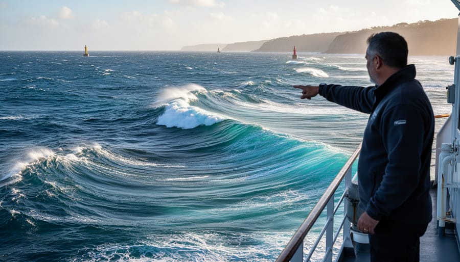
Wind waves look chaotic, short, choppy, irregular, while deep ocean swells move with steady rhythm. Swells are born from distant storms, often hundreds of miles away, and roll through the sea with consistent period and direction long after the wind that created them has died. Learning to feel the difference through your body, the gentle, predictable lift of a swell versus the sharp slap of wind chop, is your first task.
Stand in shallow water on a calm day and watch both. Swells travel in organized sets, their crests evenly spaced. Wind waves react immediately to local conditions, shifting direction as breezes change. Count the seconds between wave crests. Swells maintain intervals of eight to twelve seconds or more; wind waves arrive faster and less predictably.
Now comes the real magic: swell refraction. As deep swells approach shallow water near an island or reef, they slow down and bend around the obstacle. Watch for converging wave patterns on the leeward side of land, these refracted swells wrap around islands, creating distinctive crossing patterns visible from miles away. Where swells from different directions meet, they form interference patterns: smooth triangular water or confused cross-chop marking the island’s “shadow.”
Reflected swells bounce back from steep coastlines and underwater cliffs. These bounced waves cross the incoming swells at angles, creating a clapotis, standing waves that jump irregularly. Experienced navigators read these reflections to gauge proximity to land even in darkness or fog. The wave surface becomes a three-dimensional map, revealing what lies beneath and beyond.
Step 3: Observe Marine Life as Navigation Indicators
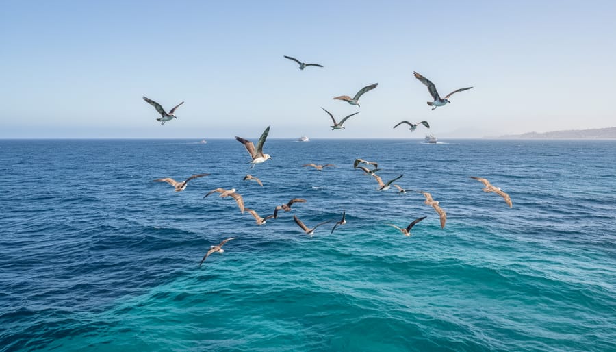
Marine life offers some of the most reliable navigation clues available to traditional wayfinders, but reading these signs requires patience and a deep respect for the creatures you’re observing. Birds provide the most accessible starting point. Seabirds like terns, noddies, and boobies fly out to feed at dawn and return to their nesting islands before dusk, creating predictable flight paths that point toward land. Watch their departure angles in the morning, these lines remain consistent and can guide you even when the island lies beyond the horizon. Frigatebirds, which cannot land on water, never venture more than about sixty miles from shore, making their presence itself a proximity indicator.
Fish behavior tells a different story. Schools of tuna or dolphinfish often congregate near current convergences and upwelling zones, which traditional navigators used as reference points along established routes. Notice how baitfish leap from the water when pursued by predators, the direction of these disturbances can reveal underwater structure or current edges that define invisible ocean highways.
Whale migrations follow ancient pathways tied to seasonal feeding and breeding grounds. Gray whales traveling along continental margins or humpbacks crossing ocean basins stick to routes navigators have tracked for generations. Their regular appearance in specific waters during particular months creates temporal and spatial waypoints.
At night, bioluminescence patterns reveal subsurface features. Dinoflagellates glow when disturbed, illuminating shallow reefs, sandbars, or strong currents in the darkness. This living light maps what you cannot see.
The key principle: observe without interference. Never chase birds, approach marine mammals closely, or disturb feeding behavior. Your role is witness, not participant.
Step 4: Integrate Cloud Formations and Atmospheric Signs
Clouds reveal land long before you can see it. Islands create their own weather patterns, generating stationary cloud formations that persist even as surrounding clouds drift past. Look for cumulus clouds that remain fixed in position, these often form over mountainous islands where warm air rises and condenses. In contrast, moving clouds indicate open ocean.
The color of the horizon tells a different story. A greenish tint reflected on low clouds suggests shallow lagoons or coral reefs beneath. Over deep ocean, cloud undersides appear darker gray. At dawn and dusk, islands create distinctive color bands where the sky meets the sea, a brighter, sometimes yellowish glow compared to the uniform darkness over empty water.
Atmospheric moisture patterns matter too. A line of increased humidity or a sudden freshness in the air can indicate land upwind, where vegetation releases moisture. Rain showers often cluster around islands even when surrounding seas remain clear.
The key is layering these atmospheric observations with everything you’ve already learned. When wave refraction patterns align with stationary clouds and bird flight paths, you’re reading multiple confirming signals simultaneously. This redundancy builds confidence and accuracy in your mental map.
Step 5: Practice Mental Mapping and Dead Reckoning
Mental mapping and dead reckoning represent the cognitive heart of traditional wayfinding, the ability to hold your position, track movement, and project your course entirely in your mind. This skill integrates everything you’ve learned: star positions, wave angles, wildlife patterns, and atmospheric clues must all feed into a constantly updating mental picture of where you are and where you’re headed.
Start by building this capacity through graduated practice:
- Spend thirty minutes on a headland observing a familiar stretch of coast, mentally noting landmarks, wave directions, and current patterns without writing anything down, then sketch what you remember
- Track a short sail between two visible points while consciously noting your speed (by wave sound and boat feel), estimating time elapsed, and calculating distance covered before checking against reality
- Navigate a two-hour coastal passage using only natural indicators, maintaining continuous awareness of position by integrating star bearings, swell direction, and seabird flight paths
- Attempt a half-day voyage with GPS available but covered, mentally dead-reckoning your position every thirty minutes based on accumulated observations before verifying accuracy
- Undertake an overnight passage where you hold your entire route as a mental construct, star paths marking time, wave sets indicating drift, cloud formations confirming proximity to predicted landfalls
The key is developing what Pacific navigators call the “moving island” concept: rather than thinking of your vessel traveling across the ocean, imagine your canoe stationary while islands, stars, and currents flow past you. This perspective shift makes it easier to track multiple reference points simultaneously. Keep a post-voyage journal noting which indicators proved most reliable and where your mental model diverged from reality, these discrepancies reveal gaps in your observational skills that need refinement.
Verifying Your Position and Building Confidence
Accurate wayfinding requires synthesizing multiple natural indicators simultaneously. When star positions suggest you’re tracking north but wave patterns indicate a different heading, one observation is wrong, or you’ve misread conditions. Cross-reference at least three independent signs before trusting your position estimate. If celestial bearings, swell direction, and bird flight paths all align, your confidence should increase. Discordance signals you need to reassess.
In early practice, check your traditional estimates against GPS every two to four hours. Record both positions in your journal, note the difference, then analyze which natural signs you misinterpreted. Over time, patterns emerge: maybe you consistently misjudge swell angles by ten degrees, or you rely too heavily on cloud formations in certain weather. This self-correction sharpens your observational accuracy far faster than hoping you’re right.
Document every navigation session thoroughly. Note sea state, visibility, your predicted position, actual position, and which indicators you weighted most heavily. After a dozen outings, review these logs to identify your reliable strengths and persistent errors. You’ll notice your margin of error tightening, perhaps from twenty miles to five, then to two.
Consider yourself ready for reduced GPS reliance when you consistently estimate position within five miles over multi-hour passages in varied conditions, when you can explain why indicators conflict, and when you instinctively notice environmental changes that affect navigation. Most practitioners need two years of regular practice before achieving this reliability. Even then, experienced wayfinders maintain backup systems. The ocean’s patterns never stop teaching, confidence grows not from eliminating all error, but from understanding the precision limits of natural navigation and knowing when to verify against modern tools.
Connecting Wayfinding to Marine Conservation Efforts
Traditional wayfinding builds observational skills that directly support marine ecosystem monitoring. When you learn to read ocean swells, track bird migrations, and interpret bioluminescence patterns, you’re not just navigating, you’re gathering data about marine health. Every voyage becomes an opportunity to notice changes in species distribution, water temperature patterns, and seasonal variations that signal ecosystem shifts.
Dr. Alanna Chen, a marine biologist at the University of Hawaii, uses traditional observation methods alongside her research equipment. “Indigenous navigators taught me to notice subtle changes in water color that indicate phytoplankton blooms,” she explains. “I was collecting samples and running lab analyses, but missing what was happening at the surface level. Traditional techniques made me a better scientist because they forced me to engage all my senses.” Her work tracking humpback whale corridors now combines satellite data with the same visual tracking methods Polynesian navigators used for centuries.
This knowledge intersects with marine folklore that often encoded ecological observations. Stories about particular fish runs, dangerous currents, or seasonal changes weren’t just mythology, they represented generations of careful environmental monitoring passed through oral tradition.
Wayfinders become citizen scientists by default. When you navigate by observing seabirds returning to nesting sites at dusk, you’re documenting behavior patterns. When you track the angle of dominant swells, you’re recording ocean current data. These observations, logged consistently, contribute valuable information about baseline conditions and changing patterns that matter for marine conservation.
The practice also builds personal investment in ocean health. You can’t navigate successfully through a dead zone depleted of the marine life you rely on for directional cues. Traditional methods create immediate awareness of ecosystem degradation because your ability to wayfind depends on biodiversity thriving.
Next Steps: Advancing Your Skills and Getting Involved
Once you’ve built foundational skills, the journey into traditional wayfinding deepens through community connection and sustained practice. The knowledge carriers of these arts, from Pacific Islander navigators to maritime anthropologists, emphasize that learning happens through mentorship and shared experience, not isolation.
Your next practical steps include:
- Join a traditional voyaging society or canoe club that practices indigenous navigation methods
- Volunteer with maritime cultural programs preserving navigational heritage
- Commit to regular observation sessions in your local coastal environment, tracking seasonal patterns
- Connect with indigenous navigation practitioners through workshops and cultural exchange programs
- Document ocean patterns, wildlife behavior, and atmospheric signs specific to your region
Several organizations offer structured pathways for advancing these skills in 2026. Traditional navigation workshops run by Pacific cultural centers combine classroom instruction with actual sea time under experienced wayfinders. These immersive programs, typically lasting one to two weeks, teach the integration of multiple natural indicators while emphasizing the spiritual and cultural dimensions of wayfinding.
The Marine Biodiversity Science Center has begun incorporating traditional ecological knowledge into its volunteer programs, recognizing that indigenous observation techniques enhance marine ecosystem monitoring. Their coastal stewardship initiatives welcome participants interested in learning how ancestral navigation skills inform modern conservation practice. Marine biologist Keanu Nakamura, who trains volunteers in traditional observation methods, notes that wayfinders often detect subtle environmental changes, shifts in current patterns, early migration timing, that standard monitoring might miss.
Look for mentorship opportunities through indigenous cultural organizations, university maritime programs, or sailing associations with traditional navigation components. Many knowledge keepers actively seek students committed to respectful learning and preservation of these ancestral arts. Your growing skills serve both personal enrichment and the broader goal of maintaining navigational wisdom that’s inseparable from ocean stewardship.
Frequently Asked Questions About Traditional Maritime Navigation
How long does it take to learn traditional wayfinding skills?
Basic observation techniques can be practiced within weeks, but developing reliable navigation ability typically requires 2-3 years of consistent study and sea time. Mastery comes from accumulating experience across different seasons, weather conditions, and ocean regions.
Are traditional navigation methods still practical in modern sailing?
While GPS provides precise positioning, traditional techniques offer irreplaceable skills when electronics fail and deepen your understanding of ocean patterns that technology can’t teach. Many experienced sailors use both systems, with natural indicators providing context modern instruments miss.
Does climate change affect the reliability of natural navigation indicators?
Yes, shifting weather patterns, altered migration routes, and changing sea temperatures impact some traditional signs. However, the fundamental skill of reading multiple indicators in concert remains valid, navigators simply adapt by observing how patterns change rather than relying on static knowledge.
Do I need a traditional vessel or canoe to practice these techniques?
No special vessel is required. You can learn observation skills from any boat, kayak, or even shore-based practice sessions. The techniques focus on reading natural signs, not the craft you sail.
How do I balance traditional methods with modern safety requirements?
Always carry functioning GPS, charts, and communication equipment as backup while learning. Use electronic navigation to verify your traditional readings initially, gradually increasing reliance on natural signs as your confidence and accuracy grow over time.
Can learning wayfinding contribute to marine conservation efforts?
Absolutely. The heightened observation skills you develop make you more attuned to changes in marine ecosystems, wildlife behavior, and ocean health, awareness that supports conservation monitoring and can inform citizen science initiatives.
These questions reflect genuine concerns from people beginning their wayfinding journey. The learning curve feels daunting at first, but remember that traditional navigators didn’t develop these skills overnight. Start with shore observations, practice identifying stars and reading waves from familiar coastlines, then gradually extend your range.
The intersection between traditional knowledge and modern conservation work runs deeper than many realize. Museums and cultural centers increasingly recognize wayfinding as both maritime heritage and a living practice connected to ecosystem stewardship, sometimes presenting it alongside ocean conservation art that celebrates indigenous relationships with the sea. Your observations of bird migrations, fish behavior, and seasonal patterns contribute valuable data about marine environments.
Don’t let perfectionism delay your start. Every navigator began by looking up at unfamiliar stars and feeling overwhelmed. The difference between someone who masters these arts and someone who gives up isn’t innate talent, it’s consistent practice and willingness to learn from mistakes.
Traditional navigational arts transform how we understand and interact with the ocean. By learning to read stars, waves, and wildlife behavior, you develop an intimate awareness of marine ecosystems that no modern instrument can replicate. This knowledge doesn’t just guide voyages, it reveals the subtle patterns of ocean health, seasonal shifts in marine life, and the interconnected rhythms that sustain biodiversity.
These ancient techniques remain remarkably relevant for modern seafarers. Whether you’re planning coastal passages or simply spending time on the water, wayfinding skills sharpen your environmental observation and deepen your appreciation for the living ocean around you. You begin noticing bird migrations, understanding how reefs shape wave patterns, and recognizing the signs of healthy versus stressed marine environments.
The path forward starts with simple observation. Spend time watching the night sky from shore, noting how stars move across seasons. Study wave patterns at your local beach. Document bird behavior in coastal areas. These foundational practices cost nothing and require no special equipment, yet they build the awareness that traditional navigators relied upon for millennia.
The Marine Biodiversity Science Center offers programs that connect traditional knowledge with modern conservation efforts. Through volunteer opportunities and educational workshops, you can contribute to preserving both these navigational arts and the marine ecosystems they help us understand. Your journey into wayfinding becomes part of a larger mission to protect the ocean’s extraordinary diversity for future generations.

jessica
Ava Singh is an environmental writer and marine sustainability advocate with a deep commitment to protecting the world's oceans and coastal communities. With a background in environmental policy and a passion for storytelling, Ava brings complex topics to life through clear, engaging content that educates and empowers readers. At the Marine Biodiversity & Sustainability Learning Center, Ava focuses on sharing impactful stories about community engagement, policy innovations, and conservation strategies. Her writing bridges the gap between science and the public, encouraging people to take part in preserving marine biodiversity. When she’s not writing, Ava collaborates with local initiatives to promote eco-conscious living and sustainable development, ensuring her work makes a difference both on the page and in the real world.