Marine Biodiversity Science Center
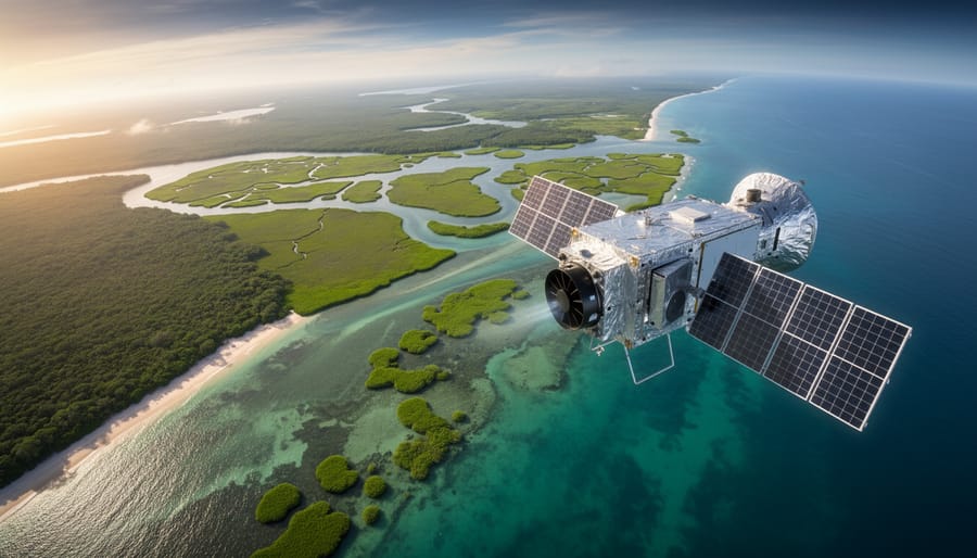
From hundreds of miles above Earth, satellites are revolutionizing how we protect and monitor coastal blue carbon ecosystems—mangroves, seagrasses, and salt marshes that store carbon at rates up to 40 times faster than terrestrial forests. These orbital sentinels capture detailed imagery and data that would take decades to collect through traditional fieldwork, transforming coastal conservation from guesswork into precision science.
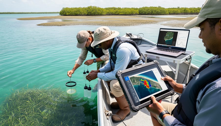
Ocean remote sensing combines multiple satellite technologies to track vital signs of marine ecosystems. Optical sensors measure water color and vegetation health, revealing changes in seagrass meadows or mangrove canopy cover. Radar instruments penetrate cloud cover and darkness to map coastal flooding patterns and wetland structure. Thermal sensors detect water temperature shifts that signal ecosystem stress. Together, these tools create comprehensive portraits of coastal habitats changing over time.
The practical applications are transforming conservation efforts worldwide. Scientists now map carbon stocks in coastal wetlands with unprecedented accuracy, establishing baselines essential for climate mitigation projects. Restoration practitioners monitor whether replanted mangroves are thriving or struggling, adjusting strategies in real-time rather than waiting years for ground surveys. Governments track illegal coastal development and respond before irreversible damage occurs. Carbon credit programs verify that protected blue carbon ecosystems genuinely store the promised amounts, bringing credibility to nature-based climate solutions.
What makes this particularly exciting is the democratization of this technology. Many satellite datasets are freely available, and user-friendly platforms allow educators, students, and citizen scientists to explore coastal ecosystems from their computers. You don’t need a PhD to contribute—volunteers worldwide are helping classify satellite images, training algorithms that improve automated monitoring systems.
This convergence of space technology and community engagement creates unprecedented opportunities to safeguard the coastal ecosystems our planet desperately needs.
What Is Ocean Remote Sensing and Why Does It Matter?
The Eyes in the Sky: How Remote Sensing Works
Imagine having a vantage point hundreds of kilometers above Earth, continuously watching our oceans pulse with life and change. This is precisely what satellite monitoring technology enables us to do, revolutionizing how we understand and protect marine environments.
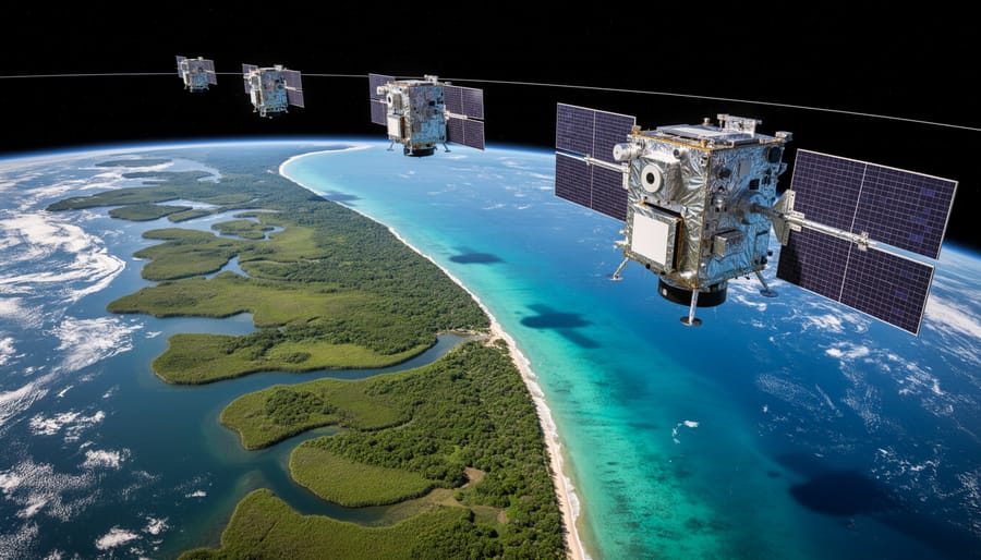
Remote sensing works through satellites positioned in specific orbits around Earth. Some follow geostationary orbits, remaining fixed above one location, while others use polar orbits, circling the planet to capture data from every corner of our oceans. These orbiting platforms carry sophisticated sensors that measure different types of energy reflected or emitted from the ocean surface.
Optical sensors function much like digital cameras, detecting visible and infrared light. They excel at measuring water color, which reveals phytoplankton concentrations, sediment loads, and coastal water quality. However, clouds can block their view, limiting observations during overcast conditions.
Radar sensors overcome this limitation by sending their own microwave signals toward Earth and measuring what bounces back. These active sensors penetrate clouds and work day or night, making them invaluable for monitoring sea surface height, wave patterns, and even detecting oil spills.
LiDAR technology uses laser pulses to create detailed three-dimensional maps of coastal areas, measuring everything from shoreline erosion to the structure of mangrove forests with remarkable precision. Together, these sensor types provide marine scientists with comprehensive, real-time data that would be impossible to gather through traditional ship-based surveys alone, opening new frontiers in ocean conservation.
From Pixels to Protection: Turning Data Into Action
Raw satellite images of coastal areas might look like abstract art—swirls of green, blue, and brown captured from space. But through sophisticated processing, these pixels become powerful conservation tools. Scientists transform this data using specialized algorithms that detect different wavelengths of light reflected from the ocean surface and coastal zones. For example, healthy mangrove forests absorb light differently than degraded ones, while seagrass meadows have distinct spectral signatures that reveal their density and health.
The processing journey begins when ground stations receive satellite transmissions containing millions of data points. Researchers apply atmospheric corrections to remove cloud interference and account for seasonal variations in sunlight. Machine learning algorithms then analyze patterns across multiple images taken over weeks, months, or years, detecting changes invisible to the human eye—a shrinking salt marsh here, expanding kelp forest there.
Dr. Elena Vasquez, a marine ecologist working with coastal communities in Southeast Asia, explains: “When we show fishing communities satellite time-series revealing their local seagrass beds declining, it transforms the conversation. Suddenly, abstract conservation becomes personal protection of their livelihoods.” This processed information feeds directly into management decisions, restoration planning, and carbon accounting frameworks that support climate action.
The Blue Carbon Connection: Ecosystems Worth Protecting
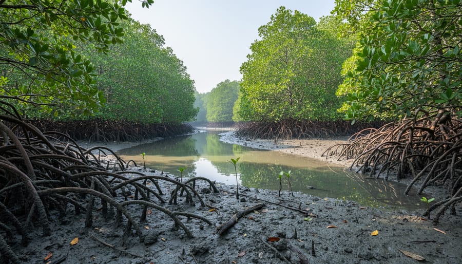
Mangrove Forests: The Coastal Carbon Giants
Mangrove forests stand as nature’s coastal guardians, thriving where land meets sea and storing carbon at rates up to four times higher than terrestrial forests. These remarkable ecosystems capture carbon dioxide not only in their twisted roots and dense canopy but also in the waterlogged soils beneath, where organic matter accumulates over centuries without decomposing.
Remote sensing mangroves presents unique challenges and opportunities. Their structural complexity, tidal flooding patterns, and location in optically shallow coastal waters require specialized approaches. Satellite sensors combining optical imagery with radar technology prove especially effective, as radar can penetrate dense canopy and detect beneath-surface root structures regardless of cloud cover—a critical advantage in tropical regions.
Marine biologist Dr. Elena Rodriguez shares her experience: “When I started mapping mangroves in Indonesia, satellite data revealed restoration sites we’d never have found through ground surveys alone. We then engaged local fishing communities as volunteer monitors, creating a network that combines space-age technology with traditional ecological knowledge.”
This fusion of advanced sensing and community participation exemplifies how technology empowers conservation action, enabling precise carbon accounting while supporting coastal communities who depend on these irreplaceable ecosystems.
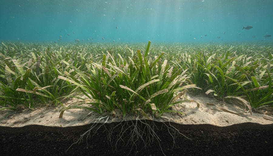
Seagrass Meadows: The Ocean’s Hidden Heroes
Seagrass meadows are remarkable carbon storage powerhouses, capturing carbon up to 35 times faster than tropical rainforests while providing critical nursery habitat for countless marine species. These underwater grasslands cover less than 0.2% of the ocean floor yet account for approximately 10% of the ocean’s annual carbon burial.
Remote sensing has transformed our ability to map and monitor these vital ecosystems, though water clarity presents unique challenges. Satellites equipped with multispectral sensors can detect seagrass in clear, shallow waters by analyzing how different wavelengths of light penetrate and reflect from the seafloor. Scientists combine satellite data with acoustic surveys and underwater photography to create comprehensive seagrass maps.
Marine biologist Dr. Elena Martinez shares her experience: “Using remote sensing, we discovered previously unknown seagrass beds along our coastline. This technology allows us to track meadow health over time and identify areas needing restoration before serious decline occurs.”
Citizen scientists play an essential role in validating satellite observations through snorkeling surveys and water quality monitoring. These ground-truthing efforts ensure mapping accuracy while engaging communities in seagrass conservation. By combining technology with community involvement, we’re building a clearer picture of seagrass distribution and guiding effective protection strategies worldwide.
Salt Marshes: Resilient Carbon Reservoirs
Salt marshes rank among our most productive carbon-storing ecosystems, sequestering carbon at rates up to forty times faster than terrestrial forests. These coastal wetlands trap organic matter in their oxygen-poor soils, creating carbon reservoirs that can persist for centuries. Yet rising sea levels, coastal development, and storm damage threaten these vital ecosystems globally.
Remote sensing provides an essential monitoring tool for tracking salt marsh health and extent. Satellite platforms like Landsat and Sentinel-2 detect changes in vegetation coverage through spectral signatures that reveal plant density and species composition. Researchers use normalized difference vegetation index measurements to assess marsh productivity and identify areas experiencing stress or dieback.
Marine biologist Dr. Elena Rodriguez shares her perspective: “Flying drones over our local salt marshes revealed erosion patterns we’d completely missed from ground surveys. The aerial perspective helped us prioritize restoration sites and secure funding for critical intervention.”
Synthetic aperture radar penetrates cloud cover and darkness, measuring marsh surface elevation changes that indicate subsidence or accretion. This technology helps scientists predict which marshes can keep pace with sea-level rise and which require conservation intervention.
Citizen scientists can contribute by participating in coastal monitoring programs, documenting marsh boundaries, and supporting restoration projects that protect these resilient carbon reservoirs.
Remote Sensing MRV: The Framework Behind the Technology
Monitoring: Keeping Watch Over Vast Coastal Areas
Imagine trying to monitor the health of mangrove forests stretching across thousands of miles of coastline by walking every shoreline. It would take years, if not decades, and by the time you finished, conditions at your starting point would have changed dramatically. This is where satellite remote sensing transforms coastal conservation.
Satellites orbit Earth multiple times daily, capturing consistent observations of the same coastal areas on regular schedules. A single satellite image can cover hundreds of square kilometers in moments, providing a synoptic view impossible to achieve through ground surveys alone. This repeatability means scientists can track changes in blue carbon ecosystems over days, seasons, and years with remarkable precision.
For example, marine biologist Dr. Elena Rodriguez shares how satellite monitoring helped her team detect early signs of mangrove dieback along a remote Indonesian coastline. “We would never have caught this degradation in time without satellite data,” she explains. “Ground surveys happened only once yearly, but satellites showed us changes happening between visits.”
This technology democratizes monitoring too. Conservation organizations with limited budgets can access satellite data to track their restoration sites, while volunteer citizen scientists can contribute by validating satellite observations during coastal surveys, connecting space-based technology with boots-on-the-ground conservation efforts.
Reporting: Creating Credible Carbon Accounts
Transforming satellite observations into credible carbon accounts requires robust protocols that meet international standards. Remote sensing data undergoes careful validation through ground-truthing, where field teams physically measure carbon stocks in coastal ecosystems to verify satellite estimates. This dual approach ensures accuracy before data enters carbon credit markets or national climate inventories.
Organizations like Verra and the Gold Standard have developed specific methodologies for blue carbon projects, incorporating remote sensing as a primary monitoring tool. These frameworks require regular satellite assessments documenting ecosystem extent, health, and carbon sequestration rates over time. The data feeds into standardized reporting formats aligned with the UNFCCC’s requirements for climate action plans.
Dr. Maria Santos, a marine ecologist working with coastal communities in the Philippines, shares how this process empowers local conservation: “When fishers see satellite images showing mangrove recovery they’ve protected translating into verified carbon credits, it validates their stewardship. These aren’t just numbers—they represent real environmental restoration.”
Transparency remains paramount. Many programs now publish their remote sensing datasets and methodologies publicly, allowing independent verification. This openness builds trust with investors, governments, and communities while advancing the science behind blue carbon accounting, ultimately strengthening global climate mitigation efforts.
Verification: Building Trust Through Independent Assessment
Independent satellite verification has become essential in ensuring blue carbon projects deliver on their promises. Unlike ground-based assessments that cover limited areas, remote sensing provides continuous, transparent monitoring that anyone can access and verify. This objectivity is crucial for preventing greenwashing, where organizations might exaggerate their conservation impact without demonstrable results.
Dr. Maria Chen, a marine conservation scientist working with coastal communities in Indonesia, shares how satellite data transformed their mangrove restoration project: “When we could show investors real-time satellite imagery proving our mangroves were thriving and expanding, funding increased dramatically. The data spoke for itself.”
Third-party verification platforms now use freely available satellite imagery from missions like Landsat and Sentinel to independently assess carbon project claims. These platforms compare project reports against actual vegetation changes, coastal erosion patterns, and water quality indicators visible from space. This transparency builds credibility with carbon credit buyers and ensures that conservation funds support genuine ecosystem recovery rather than misleading claims. For students and volunteers interested in contributing, several citizen science initiatives now train participants to help validate satellite data through ground-truthing efforts, creating opportunities to directly support accountability in blue carbon markets.
Revolutionary Technologies Changing What We Can See
Synthetic Aperture Radar: Seeing Through Clouds and Darkness
Unlike optical sensors that rely on sunlight, Synthetic Aperture Radar (SAR) sends out its own microwave pulses and measures the returning signals, allowing it to collect data regardless of cloud cover or time of day. This capability proves invaluable for monitoring coastal blue carbon ecosystems in tropical regions where persistent clouds often obscure traditional satellite imagery for weeks at a time.
SAR technology detects changes in surface structure and moisture content, making it particularly effective for tracking mangrove deforestation, mapping wetland extent, and monitoring coastal erosion. The radar signals penetrate through vegetation canopy to some degree, providing information about forest structure and biomass that complements optical measurements.
Marine conservationist Dr. Elena Rodriguez, who has worked extensively with SAR data in Southeast Asian mangrove restoration projects, shares her perspective: “SAR has transformed our ability to monitor restoration sites during monsoon season. We can now detect illegal clearing activities within days rather than waiting months for clear skies, allowing rapid response to protect these critical carbon sinks.”
This all-weather monitoring capability ensures continuous surveillance of coastal ecosystems, supporting both conservation enforcement and accurate carbon accounting throughout the year.
Hyperspectral Imaging: Reading the Ocean’s Signature
Hyperspectral imaging represents a breakthrough in ocean observation, functioning like a sophisticated color reader that detects hundreds of narrow wavelength bands across the light spectrum. While standard cameras capture just three color channels, hyperspectral sensors distinguish subtle variations in reflected light that reveal what’s happening beneath the ocean’s surface.
These advanced instruments can identify individual phytoplankton species by their unique light signatures, measure chlorophyll concentrations with remarkable precision, and detect early signs of ecosystem stress before they’re visible to conventional satellites. In seagrass meadows and mangrove forests, hyperspectral data helps scientists map species composition and monitor plant health—critical information for blue carbon assessments.
Marine biologist Dr. Elena Martinez recalls the moment hyperspectral imaging revealed unexpected phytoplankton diversity in what appeared to be uniform waters: “We could suddenly see the ocean’s invisible architecture, understanding which species were thriving and why.”
For conservation efforts, this technology enables targeted interventions by pinpointing areas needing protection. Citizen scientists can now access processed hyperspectral datasets through online platforms, contributing to global monitoring efforts and helping researchers validate findings from their local coastal waters.
Artificial Intelligence: Making Sense of Massive Datasets
Modern satellites generate petabytes of ocean data daily—far more than human analysts could ever process manually. This is where artificial intelligence transforms ocean monitoring. Machine learning algorithms can rapidly analyze satellite imagery to identify mangrove forests, seagrass meadows, and salt marshes, tracking changes in their extent and health across vast coastal areas. AI-powered analysis detects subtle patterns invisible to the human eye, such as early signs of ecosystem stress or illegal coastal development.
Dr. Maria Santos, a marine ecologist working with satellite monitoring programs, shares her experience: “What once took our team months to analyze manually, AI now processes in hours. We can identify dying seagrass beds before they’re visible from boats, giving us precious time to investigate causes and intervene.”
These systems learn from millions of images, continuously improving their accuracy at predicting carbon storage potential, forecasting coastal erosion, and estimating blue carbon ecosystem recovery rates. This rapid processing enables timely conservation decisions and helps communities respond quickly to emerging threats.
Real-World Success Stories: Remote Sensing in Action
Restoring Mangroves in Southeast Asia
Along the Mekong Delta coastline, Dr. Linh Nguyen witnessed firsthand how satellite imagery transformed mangrove restoration from guesswork into precision conservation. “We initially planted saplings based on rough estimates of degraded areas,” she recalls. “Remote sensing changed everything.”
Using freely available Sentinel-2 satellite data, her team mapped exactly where mangrove forests had declined over the previous decade. The thermal and near-infrared bands revealed subtle differences between healthy mangroves, degraded patches, and areas suitable for restoration that weren’t visible to the naked eye. This guided planting efforts to locations with the highest survival potential.
The real breakthrough came in monitoring success. Rather than relying on sporadic field visits across hundreds of hectares, monthly satellite passes tracked canopy growth, identified struggling sections needing intervention, and documented carbon sequestration rates for climate reporting. After three years, the data showed 78% survival rates and measurable biomass increases.
“What excites me most is democratizing this technology,” Dr. Nguyen explains. “Local communities now access the same satellite tools we use, becoming citizen scientists tracking their own coastlines.” Volunteers receive basic training in interpreting imagery, connecting traditional ecological knowledge with cutting-edge monitoring. This partnership between technology and community engagement creates resilient, data-driven restoration that benefits both climate and coastal livelihoods.
Protecting Seagrass Meadows Through Better Data
Seagrass meadows, which store carbon up to 40 times faster than terrestrial forests, have suffered dramatic declines worldwide. In the Mediterranean, satellite remote sensing transformed conservation efforts by providing the comprehensive data needed to establish effective marine protected areas. Using multispectral imaging from satellites like Sentinel-2, researchers mapped extensive seagrass beds along coastal regions, identifying both healthy meadows and degraded zones invisible from shore-based surveys alone.
Dr. Elena Martínez, a marine ecologist working in Spain’s coastal waters, recalls the breakthrough moment: “We suspected these meadows were larger than we knew, but the satellite data revealed three times more coverage than our underwater surveys had documented. That evidence convinced policymakers to expand protection zones significantly.”
The continuous monitoring capabilities of satellites now track recovery progress in real-time. In protected areas where boat anchoring restrictions were implemented, satellite imagery documented a 23% increase in seagrass density over five years. This data not only validates conservation strategies but also quantifies carbon sequestration gains, strengthening the case for blue carbon initiatives globally. Volunteers can contribute to ground-truthing efforts by participating in coastal biodiversity surveys that verify satellite observations.
How You Can Contribute: Citizen Science Opportunities
You don’t need a PhD to contribute to ocean remote sensing research. Several exciting citizen science programs welcome volunteers to help validate satellite observations and strengthen our understanding of coastal ecosystems.
NASA’s GLOBE Observer program lets you use a smartphone app to photograph water bodies and record observations that scientists compare against satellite data. These ground-truthing efforts are invaluable for calibrating sensors and confirming what satellites detect from space. Similarly, Floating Forests invites volunteers to identify kelp forests in satellite images, helping researchers track changes in these vital blue carbon ecosystems over time.
Marine biologist Dr. Elena Rodriguez shares her experience: “Citizen scientists provide essential boots-on-the-ground data that we simply couldn’t collect otherwise. Their observations have helped us identify mangrove restoration sites and track coastal changes across regions we rarely visit.”
Whether you’re photographing seagrass beds during coastal walks, classifying satellite images from home, or participating in beach surveys, your contributions directly support conservation efforts. These programs require no special equipment beyond enthusiasm and attention to detail. By joining, you become part of a global network monitoring our ocean’s health and carbon-storing capacity.
Challenges on the Horizon: What Still Needs to Improve
Despite remarkable advances, ocean remote sensing still faces important limitations that researchers and conservationists are actively working to overcome. Understanding these challenges helps us appreciate both the technology’s current capabilities and the innovations needed to unlock its full potential for marine conservation.
One of the most significant constraints involves water depth penetration. While satellites excel at monitoring surface conditions and shallow coastal waters, their ability to see beneath the ocean’s surface remains limited. Most optical sensors can only penetrate a few meters in clear water, and even less in turbid coastal environments where blue carbon ecosystems often thrive. This means we still need complementary methods, including ground validation through field surveys and in-water sensors, to build complete pictures of ecosystem health.
Resolution constraints present another hurdle. While improving steadily, many freely available satellite images still lack the fine-scale detail needed to detect small changes in seagrass meadows or distinguish between different mangrove species. Higher resolution commercial imagery exists but comes with substantial costs, creating barriers for conservation organizations and researchers in developing nations where blue carbon ecosystems are often most abundant and vulnerable.
Dr. Maria Santos, a marine ecologist working in the Philippines, shares this reality: “We have incredible coastal ecosystems to monitor, but accessing high-quality satellite data consistently strains our budget. We’ve learned to combine free lower-resolution imagery with targeted field surveys, but it requires creativity and collaboration.”
The financial divide remains particularly concerning. Developing coastal nations, home to vast blue carbon resources, often lack the infrastructure, technical expertise, and funding to fully utilize remote sensing technology for their conservation priorities.
However, optimism is warranted. Open-access data programs are expanding, cloud-based processing platforms are democratizing analysis capabilities, and international partnerships are bridging knowledge gaps. Each challenge being addressed today brings us closer to truly global, equitable ocean monitoring that serves both science and conservation.
As our planet faces accelerating climate change, ocean remote sensing has emerged as an indispensable tool in protecting blue carbon ecosystems that stand between us and further warming. These satellite technologies offer unprecedented visibility into mangrove forests, seagrass meadows, and salt marshes that collectively store billions of tons of carbon while supporting extraordinary marine biodiversity. The transformative potential lies not just in monitoring these ecosystems, but in empowering communities worldwide to take meaningful conservation action.
Dr. Sarah Chen, a marine biologist working in coastal Indonesia, shares how satellite data changed her restoration work: “We used to guess where degraded mangroves needed replanting. Now, remote sensing shows us exactly where to focus our efforts, and we can track every tree’s survival rate. It’s revolutionized our success from 40% to nearly 85%.”
The technology connecting satellites orbiting 700 kilometers above Earth to boots-on-the-ground conservation demonstrates that solving climate challenges requires both innovation and human dedication. While sensors capture data on vegetation health and carbon stocks, it’s people who transform that information into protected habitats and restored ecosystems.
This is where your involvement becomes crucial. marine conservation programs across the globe need volunteers for citizen science projects, restoration events, and advocacy efforts. Whether you’re analyzing satellite imagery through online platforms, participating in seagrass monitoring, or supporting policy initiatives for blue carbon protection, every contribution matters.
The convergence of cutting-edge technology and collective action offers genuine hope. Remote sensing provides the eyes; conservation programs provide the hands; and together, we can safeguard these vital ecosystems for future generations. The question isn’t whether technology can help us protect blue carbon ecosystems, but whether we’ll answer the call to action.
jessica
Ava Singh is an environmental writer and marine sustainability advocate with a deep commitment to protecting the world's oceans and coastal communities. With a background in environmental policy and a passion for storytelling, Ava brings complex topics to life through clear, engaging content that educates and empowers readers. At the Marine Biodiversity & Sustainability Learning Center, Ava focuses on sharing impactful stories about community engagement, policy innovations, and conservation strategies. Her writing bridges the gap between science and the public, encouraging people to take part in preserving marine biodiversity. When she’s not writing, Ava collaborates with local initiatives to promote eco-conscious living and sustainable development, ensuring her work makes a difference both on the page and in the real world.