Marine Biodiversity Science Center
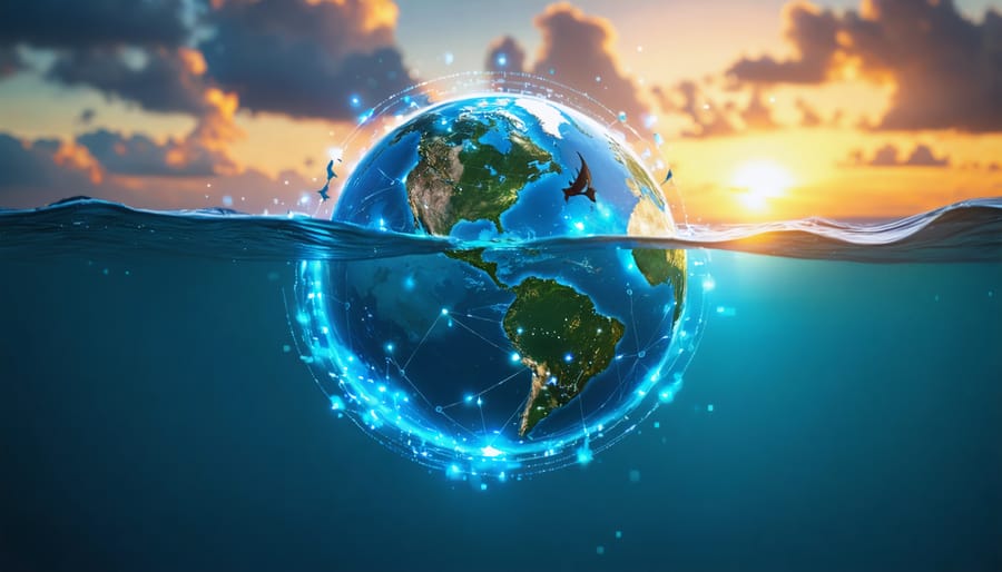
In the vast expanse of our world’s oceans lies an intricate web of life, monitored and documented through an unprecedented digital revolution in marine science. The Ocean Biodiversity Information System (OBIS) stands as a global alliance of scientists, researchers, and institutions, working together to create the world’s most comprehensive marine biodiversity observation network. This digital repository transforms millions of observations into actionable insights, enabling scientists to track species distributions, monitor ecosystem health, and predict environmental changes across our blue planet. As climate change and human activities increasingly impact marine ecosystems, OBIS serves as both a sentinel and a solution – providing real-time data that guides conservation efforts, informs policy decisions, and empowers a new generation of ocean stewards. Through its open-access platform, OBIS democratizes marine biodiversity data, making it possible for researchers, students, and citizen scientists worldwide to contribute to and benefit from this growing knowledge base, ultimately strengthening our collective ability to protect and preserve ocean life for future generations.
What is OBIS and Why It Matters
Core Features and Capabilities
OBIS serves as a comprehensive marine biodiversity data repository, offering powerful tools for data visualization, analysis, and sharing. At its core, the system maintains a vast database of species occurrences, ecological observations, and environmental parameters, with over 100 million records from thousands of datasets worldwide.
The platform excels in spatial mapping capabilities, allowing users to generate detailed distribution maps of marine species across different temporal and geographical scales. Its advanced filtering tools enable researchers to sort data by various parameters including depth, temperature, and sampling methods.
OBIS supports multiple data formats and follows international biodiversity data standards, making it compatible with other global biodiversity initiatives. The system features real-time quality control checks that help maintain data accuracy and reliability. Users can access both raw data downloads and processed analytics through user-friendly interfaces.
A standout feature is the taxonomic backbone integration, which automatically validates species names and provides updated classification information. The platform also offers APIs for programmatic data access, enabling seamless integration with external applications and research tools.
For collaborative research, OBIS provides workspaces where teams can share datasets, conduct joint analyses, and coordinate marine biodiversity monitoring efforts.
Global Network and Partners
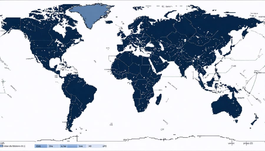
OBIS thrives through a dynamic network of regional nodes and international partnerships spanning every continent. This collaborative framework includes over 1,000 institutions from 56 countries, working together to share marine biodiversity data and expertise. Each regional node serves as a hub for local data collection, quality control, and capacity building, while maintaining strong connections with the global OBIS community.
Key partnerships include collaborations with UNESCO’s Intergovernmental Oceanographic Commission (IOC), the Global Ocean Observing System (GOOS), and various marine research institutions worldwide. These relationships enable OBIS to maintain standardized data protocols and ensure comprehensive coverage of marine ecosystems across different geographical regions.
The network also engages with citizen science initiatives and local conservation groups, creating opportunities for broader community participation in marine biodiversity monitoring. Regular international workshops, training sessions, and conferences facilitate knowledge exchange and strengthen the global OBIS community. This interconnected system allows for rapid response to emerging marine conservation challenges and ensures that biodiversity data remains accessible to researchers, policymakers, and conservation practitioners worldwide.
Data Integration and Standards

Data Collection Methods
The Ocean Biodiversity Information System employs multiple methods to track ocean biodiversity, combining traditional sampling techniques with cutting-edge technology. Scientists use specialized nets and trawls to collect physical specimens, while underwater cameras and ROVs (Remotely Operated Vehicles) capture visual data from depths unreachable by human divers.
Environmental DNA (eDNA) sampling has revolutionized marine data collection, allowing researchers to detect species presence through genetic material left behind in water samples. This non-invasive technique provides insights into elusive species and helps monitor population changes over time.
Acoustic surveys using hydrophones and sonar systems help track marine mammals and fish populations, while satellite tracking devices monitor migration patterns of larger species. Citizen science initiatives engage recreational divers and coastal communities in data collection through mobile apps and online platforms, contributing valuable observations to the global database.
Research vessels conduct regular transect surveys, measuring everything from water chemistry to plankton abundance. Fixed monitoring stations, including buoys and underwater observatories, provide continuous data streams on environmental conditions and species movements.
These diverse collection methods ensure comprehensive coverage of marine ecosystems, from coastal wetlands to deep-sea environments. The data is standardized, verified, and integrated into the system, creating a robust foundation for marine conservation efforts and scientific research.
Quality Control and Validation
Data quality is paramount in marine biodiversity research, and ocean biodiversity information systems employ rigorous verification processes to ensure accuracy and reliability. These systems utilize both automated and manual validation methods to maintain data integrity throughout the collection and sharing process.
The quality control process begins at data entry, where automated checks flag potential errors such as impossible coordinates, unusual date formats, or species names that don’t match accepted taxonomic databases. Geographic validation ensures that marine species aren’t incorrectly reported on land, while temporal checks identify anomalies in sampling dates and seasonal patterns.
Expert reviewers, including marine taxonomists and data managers, regularly assess submitted datasets for accuracy and completeness. They examine species identification records, verify sampling methodologies, and evaluate metadata quality. This human oversight is crucial for maintaining high scientific standards and identifying subtle errors that automated systems might miss.
Version control systems track all changes made to datasets, creating a transparent audit trail. Quality indicators and flags help users understand the reliability level of different data points, enabling informed decisions about data usage in research and conservation projects.
The validation process also incorporates feedback from the user community. Scientists and researchers who discover potential errors can submit correction requests, creating a collaborative environment for continuous data improvement. This community-driven approach helps maintain the system’s accuracy while fostering engagement among marine science professionals.
Research Applications and Success Stories
Conservation Planning
OBIS data has been instrumental in numerous successful conservation initiatives worldwide. In the Caribbean, researchers used OBIS datasets to identify critical habitats for endangered sea turtle species, leading to the establishment of protected marine corridors that have shown a 40% increase in turtle populations over five years.
The Great Barrier Reef Marine Park Authority regularly utilizes OBIS data to monitor coral reef biodiversity and adjust conservation strategies. Their adaptive management approach, powered by OBIS’s comprehensive species distribution data, has helped identify resilient reef systems and prioritize protection efforts in the face of climate change.
A remarkable success story comes from the Mediterranean, where OBIS data helped marine protected area (MPA) managers track the recovery of monk seal populations. By analyzing historical records and current sightings through OBIS, conservationists optimized the placement of new MPAs, resulting in the first documented increase in monk seal numbers in decades.
In the North Atlantic, OBIS information supported the designation of the Sargasso Sea as an Ecologically or Biologically Significant Marine Area (EBSMA). The data revealed the area’s importance as a spawning ground for endangered European eels and helped establish international cooperation for its protection.
These cases demonstrate how OBIS’s vast database enables evidence-based conservation planning and measurable conservation outcomes, making it an invaluable tool for marine protection efforts worldwide.
Scientific Discoveries
Through OBIS, researchers have made groundbreaking discoveries about marine biodiversity patterns and species distribution. One notable finding revealed previously unknown deep-sea coral communities in the Atlantic Ocean, leading to the establishment of new marine protected areas. Scientists using OBIS data have also identified over 1,000 new marine species in the past decade alone.
In 2019, researchers leveraging OBIS databases discovered significant shifts in species migration patterns due to changing ocean temperatures. This breakthrough helped explain why certain fish populations were appearing in unexpected locations, providing crucial insights for fisheries management and conservation efforts.
The system has enabled scientists to map previously unknown connections between different marine ecosystems. For example, OBIS data helped identify important migration corridors for endangered sea turtles, leading to enhanced protection measures along these routes.
Another significant discovery involves the documentation of rapid biodiversity changes in polar regions. By analyzing long-term data sets, researchers found that Arctic species are moving northward at an average rate of 50 kilometers per decade, affecting entire food webs and ecosystem dynamics.
OBIS has also contributed to understanding marine species behavior patterns. A collaborative study using OBIS data revealed complex social networks among marine mammals, showing how different species interact and communicate across vast ocean distances. These findings have revolutionized our approach to marine conservation and habitat protection strategies.
Future Developments and Opportunities
The future of ocean biodiversity information systems holds exciting possibilities for marine conservation and research. As technology continues advancing, we’re seeing artificial intelligence and robotics revolutionizing ocean monitoring capabilities, promising more accurate and comprehensive data collection than ever before.
Upcoming developments include enhanced machine learning algorithms for species identification, which will significantly improve the accuracy of automated biodiversity assessments. Real-time data streaming capabilities are being developed to provide instant updates on marine ecosystem changes, allowing for faster response to environmental threats.
Citizen science initiatives are expanding, with new mobile apps and user-friendly interfaces making it easier for everyone to contribute to marine biodiversity data collection. These tools will enable anyone with a smartphone to become a citizen scientist, recording species sightings and environmental observations during beach visits or diving expeditions.
There are numerous ways to get involved with these emerging developments. Researchers can contribute by sharing datasets, developing new analytical tools, or participating in collaborative projects. Students and educators can access educational resources and participate in training workshops to learn how to use these systems effectively.
For those passionate about marine conservation, volunteering opportunities include data validation, species identification assistance, and community outreach programs. Regular webinars and online training sessions are being planned to help users maximize the potential of these evolving systems.
The future success of ocean biodiversity information systems depends on continued collaboration between scientists, technology developers, and concerned citizens worldwide. Together, we can build a more comprehensive understanding of our ocean ecosystems and work toward their preservation.
The Ocean Biodiversity Information System stands as a testament to humanity’s commitment to understanding and protecting our marine ecosystems. As we face unprecedented environmental challenges, OBIS serves as both a vital scientific resource and a beacon of hope for marine conservation efforts worldwide. By providing free, open access to millions of species records, it empowers researchers, policymakers, and conservationists to make informed decisions about protecting our oceans.
The success of OBIS depends on continued support from the global community. Whether you’re a citizen scientist contributing observations, a researcher sharing datasets, or an organization providing funding, every contribution helps build a more comprehensive understanding of marine life. Students and educators can utilize OBIS resources for learning and research, while conservationists can leverage its data to identify critical areas for protection.
As our oceans face mounting pressures from climate change, pollution, and overexploitation, the role of OBIS becomes increasingly crucial. By supporting and engaging with this valuable platform, we all play a part in safeguarding marine biodiversity for future generations. The time to act is now – explore, contribute, and help preserve the remarkable diversity of life in our oceans.
jessica
Ava Singh is an environmental writer and marine sustainability advocate with a deep commitment to protecting the world's oceans and coastal communities. With a background in environmental policy and a passion for storytelling, Ava brings complex topics to life through clear, engaging content that educates and empowers readers. At the Marine Biodiversity & Sustainability Learning Center, Ava focuses on sharing impactful stories about community engagement, policy innovations, and conservation strategies. Her writing bridges the gap between science and the public, encouraging people to take part in preserving marine biodiversity. When she’s not writing, Ava collaborates with local initiatives to promote eco-conscious living and sustainable development, ensuring her work makes a difference both on the page and in the real world.