Marine Biodiversity Science Center
Marine technology is revolutionizing how we protect and understand our oceans, transforming traditional conservation methods into sophisticated digital solutions. In marine protected areas, cutting-edge tools like autonomous underwater vehicles, advanced sonar systems, and real-time monitoring networks are creating unprecedented opportunities for marine scientists and conservationists.
From tracking endangered species with satellite telemetry to mapping deep-sea ecosystems using 3D imaging, these innovative programs are bridging the gap between conservation goals and practical implementation. Students and professionals entering this dynamic field now have access to specialized training that combines traditional marine biology with emerging technologies, preparing them for careers at the forefront of ocean conservation.
The integration of artificial intelligence, machine learning, and remote sensing capabilities has opened new frontiers in marine research and protection efforts. These technological advances not only enhance our understanding of marine ecosystems but also improve our ability to protect them through more efficient monitoring, faster response times to environmental threats, and better-informed conservation strategies.
As we face increasing challenges in ocean conservation, marine technology programs represent a crucial intersection of innovation and environmental stewardship, offering hope for the future of our marine ecosystems.
Smart Monitoring Systems Transform Conservation
Underwater Drone Networks
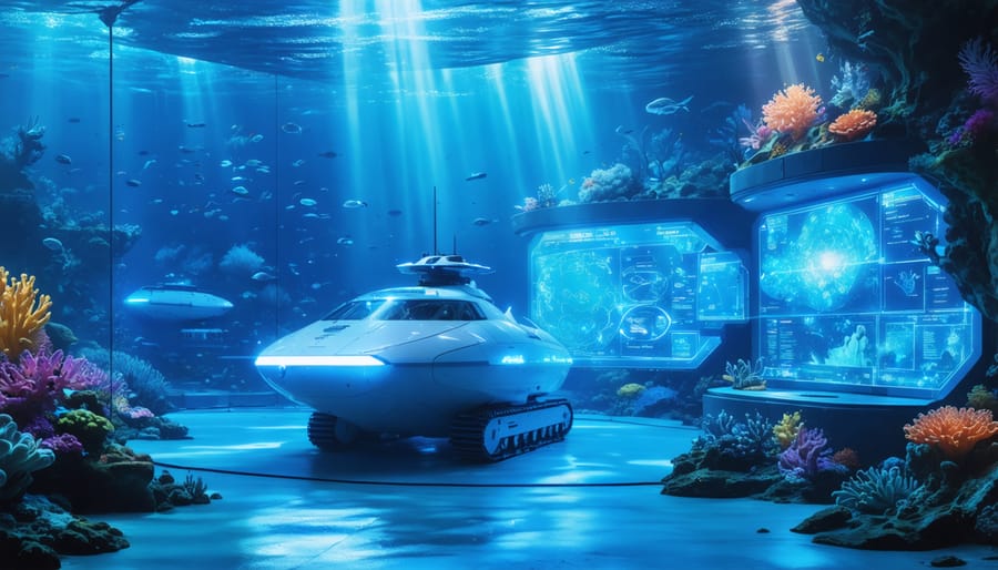
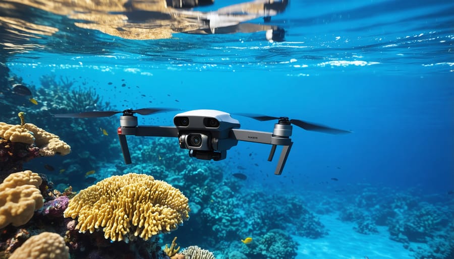
Underwater drone networks represent a revolutionary advancement in marine research and conservation, combining autonomous technology with sophisticated data collection capabilities. These unmanned vehicles, equipped with high-definition cameras, sonar systems, and various sensors, operate in coordinated groups to monitor vast ocean areas that would be challenging or impossible for human divers to access regularly.
These networks typically consist of multiple autonomous underwater vehicles (AUVs) that communicate with each other and surface stations using acoustic signals. They can operate continuously for weeks or even months, collecting crucial data about marine ecosystems, water quality, and animal behavior patterns. The drones work together to create comprehensive 3D maps of underwater environments and track changes in marine populations over time.
Marine scientists and conservation teams use these networks for various applications, from monitoring coral reef health to detecting illegal fishing activities. The drones can operate at different depths simultaneously, providing a complete picture of the water column and its inhabitants. Some advanced models even feature artificial intelligence capabilities that allow them to identify and track specific marine species or detect unusual patterns that might indicate environmental concerns.
What makes these networks particularly valuable is their ability to gather data in challenging conditions, such as during storms or in deep-water environments. The information they collect helps researchers understand marine ecosystem dynamics and supports evidence-based conservation strategies, making them an indispensable tool in modern marine protection efforts.
AI-Powered Species Recognition
Artificial intelligence has revolutionized the way we approach monitoring marine wildlife, offering unprecedented accuracy and efficiency in species identification and tracking. Machine learning algorithms, trained on vast databases of marine species images, can now identify and classify marine organisms in real-time with remarkable precision.
These AI systems process data from underwater cameras, sonar equipment, and acoustic sensors, enabling researchers to catalog species diversity and population dynamics without disturbing marine ecosystems. The technology is particularly valuable in remote or deep-water environments where traditional observation methods are challenging or impossible.
Marine biologists are using these tools to detect subtle changes in species behavior, migration patterns, and habitat preferences. For example, deep learning models can distinguish between different whale species based on their vocalizations, while computer vision algorithms track fish populations by analyzing thousands of underwater photographs within minutes.
Citizen scientists are also contributing to these efforts through mobile apps that use AI to help identify marine species. When someone photographs a marine organism, the AI instantly suggests possible species matches, making marine biology more accessible to the public while simultaneously expanding scientific databases.
The integration of AI with other technologies, such as autonomous underwater vehicles and environmental DNA sampling, is creating a more comprehensive understanding of marine ecosystems and helping conservationists make data-driven decisions to protect vulnerable species.
Data Collection and Analysis Platforms
Real-time Environmental Monitoring
Modern marine technology programs rely heavily on sophisticated sensor networks that provide continuous, real-time data about ocean conditions and marine ecosystems. These monitoring systems combine various sensors to track essential environmental parameters, including water temperature, salinity, pH levels, dissolved oxygen, and turbidity.
Advanced buoy networks equipped with multiple sensors form the backbone of these monitoring systems, transmitting data to research stations 24/7. Marine scientists can now detect subtle changes in ocean chemistry and physical conditions that might impact marine life, allowing for rapid response to environmental threats.
Underwater acoustic sensors play a crucial role in monitoring marine mammal movements and tracking fish populations. These devices can detect and record various marine species’ vocalizations, helping researchers understand migration patterns and behavioral changes in response to environmental shifts.
Cutting-edge autonomous underwater vehicles (AUVs) complement fixed sensor networks by conducting mobile monitoring missions. These robots can navigate predetermined paths while collecting data about water quality, capturing high-resolution imagery of coral reefs, and mapping seafloor habitats.
The integration of satellite technology with in-situ sensors provides a comprehensive view of marine ecosystems. This combination allows scientists to correlate local measurements with broader oceanic patterns, creating a more complete picture of marine environmental health.
Data collected through these monitoring systems is often made available through public platforms, enabling citizen scientists and students to participate in marine research and conservation efforts. This democratization of environmental data has created new opportunities for public engagement in marine science and conservation initiatives.
Predictive Analytics for Conservation
Predictive analytics has emerged as a powerful tool in marine conservation, combining big data analysis with machine learning to forecast potential threats to ocean ecosystems. By processing vast amounts of environmental data, including water temperature, salinity levels, and marine species movements, scientists can now anticipate and prevent various ecological challenges before they become critical.
Marine biologists and data scientists work together to develop sophisticated algorithms that analyze historical patterns and current data streams. These systems can predict coral bleaching events up to four months in advance, giving conservation teams crucial time to implement protective measures. Similarly, these tools help track changes in fish migration patterns, enabling better management of protected areas and fishing quotas.
Dr. Sarah Chen, a marine conservation data scientist, explains: “We’re now able to predict harmful algal blooms with 85% accuracy, giving coastal communities and marine park managers time to prepare and protect vulnerable species.” This technology has already prevented several mass die-offs of endangered species in protected marine areas.
The integration of satellite data with ocean sensors provides real-time monitoring of ocean conditions, helping identify potential pollution events or illegal fishing activities. Conservation teams use these predictions to optimize patrol routes and resource allocation, making protection efforts more efficient and effective.
Citizen scientists also play a crucial role by contributing observations through mobile apps, enriching the data sets used in predictive models. This collaborative approach has created a more comprehensive understanding of marine ecosystem dynamics and improved the accuracy of conservation forecasting.
Enforcement and Protection Technologies
Satellite Tracking Systems
Satellite tracking systems represent a revolutionary advancement in marine conservation efforts, enabling real-time monitoring of vessel movements across vast ocean expanses. These sophisticated systems combine GPS technology, satellite communications, and automated identification systems (AIS) to create a comprehensive vessel monitoring network.
The primary component, Vessel Monitoring Systems (VMS), requires fishing vessels to install transmitters that regularly broadcast their location, speed, and heading. This data helps authorities track vessel activities and identify suspicious behavior patterns that might indicate illegal fishing operations. When integrated with radar and AIS data, these systems create a detailed picture of maritime traffic in protected areas.
Conservation teams use this technology to detect potential violations, such as vessels entering no-take zones or operating during closed seasons. The data collected also helps identify “dark vessels” – those attempting to evade detection by turning off their tracking devices. Machine learning algorithms analyze movement patterns to flag unusual behavior, enabling rapid response from enforcement vessels.
Recent innovations include the integration of satellite imagery with tracking data, allowing authorities to verify vessel activities and detect unauthorized fishing operations. This combination has proven particularly effective in remote areas where traditional patrol methods are impractical. Success stories include the identification and prosecution of illegal fishing operations in marine protected areas, with some regions reporting up to 80% reduction in unauthorized fishing activities since implementing these systems.
Smart Buoy Networks
Smart buoy networks represent a revolutionary advancement in marine protected area management, combining GPS technology, environmental sensors, and wireless communication systems to create an intelligent boundary marking system. These interconnected floating sentinels serve dual purposes: clearly demarcating protected zones while actively monitoring for unauthorized vessel intrusions.
Each smart buoy is equipped with advanced sensor arrays that detect vessel movement through radar and acoustic monitoring. When vessels approach restricted areas, the buoys can automatically transmit warning signals to both the approaching vessel and monitoring stations on shore. This early warning system has proven particularly effective in preventing accidental zone violations by recreational boaters and fishing vessels.
Environmental scientists have praised these networks for their additional capability to collect real-time oceanographic data. The buoys continuously monitor water temperature, salinity, wave height, and other crucial parameters, creating valuable datasets for marine research and conservation efforts. Some advanced systems even incorporate underwater cameras and hydrophones to track marine life movements and document ecosystem changes.
The implementation of smart buoy networks has significantly improved enforcement efficiency in marine protected areas worldwide. For example, in the Great Barrier Reef Marine Park, these systems have helped reduce unauthorized entries by over 60% since their introduction. Park rangers can now respond more quickly to potential threats, while the collected data helps optimize patrol routes and resource allocation.
Community engagement programs often involve local fishing communities and tour operators in maintaining and monitoring these buoy networks, fostering a sense of shared responsibility for marine conservation.
Community Engagement Through Technology
Citizen Science Apps
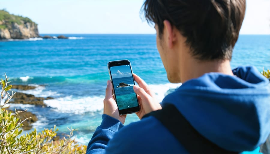
Citizen science apps have revolutionized marine research by enabling anyone with a smartphone to contribute valuable data to scientific studies. Popular apps like iNaturalist and Reef Life Survey allow users to document marine species sightings, helping researchers track biodiversity changes and species distribution patterns across global waters.
The NOAA CrowdMag app turns your phone into a magnetic field sensor, contributing to marine navigation data collection, while apps like Marine Debris Tracker enable citizens to document and map ocean pollution. These collaborative platforms have created vast databases that would be impossible for scientists to compile alone.
For whale enthusiasts, Whale Alert helps prevent ship strikes by allowing users to report whale sightings in real-time. The Ocean Sanctuaries app focuses specifically on shark identification and population monitoring, engaging citizen scientists in critical conservation efforts.
Many of these apps include educational components, teaching users about marine species identification and ecosystem health while they contribute data. The combination of user-friendly interfaces and scientific rigor has made these platforms invaluable tools for both research and public engagement in marine conservation.
Remember, every observation counts – whether you’re a seasoned marine biologist or an occasional beachgoer, these apps make it possible for everyone to participate in meaningful marine science research.
Virtual Reality Education Programs
Virtual reality (VR) has revolutionized marine education by offering immersive experiences that transport students and researchers beneath the waves without getting wet. These cutting-edge programs utilize 360-degree video footage, computer-generated environments, and interactive simulations to create realistic underwater scenarios.
Students can explore coral reefs, study marine species behavior, and witness deep-sea phenomena through VR headsets. The technology allows learners to observe delicate marine ecosystems up close, understand complex oceanographic processes, and practice research techniques in a safe, controlled environment.
Many marine institutes now incorporate VR into their curriculum, enabling students to conduct virtual dissections, simulate underwater equipment operation, and experience different marine habitats worldwide. This technology proves particularly valuable when physical access to marine environments is limited by weather, location, or resources.
The immersive nature of VR education has shown impressive results in knowledge retention and student engagement. Learners can interact with marine life, practice conservation techniques, and understand the impacts of climate change through vivid, memorable experiences. Some programs even facilitate virtual collaboration between students and marine scientists across the globe, creating unique opportunities for mentorship and real-time learning.
Marine technology programs have revolutionized our approach to ocean conservation and research, creating unprecedented opportunities for understanding and protecting marine ecosystems. These programs have transformed data collection, making it more accurate, comprehensive, and accessible than ever before. The integration of AI, robotics, and advanced sensing technologies has enabled scientists to explore previously unreachable depths and monitor marine life with minimal disruption.
Looking ahead, the future of marine technology programs appears increasingly promising. Emerging technologies like autonomous underwater vehicles, advanced satellite tracking systems, and environmental DNA analysis are opening new frontiers in marine research. These innovations are not only enhancing our scientific understanding but also improving our ability to protect vulnerable marine species and habitats.
The impact extends beyond scientific research, fostering greater public engagement and awareness. Through citizen science initiatives and educational outreach programs, marine technology is helping bridge the gap between scientific communities and the public. This democratization of marine science has created a more informed and engaged global community committed to ocean conservation.
As we face growing environmental challenges, marine technology programs will play an increasingly vital role in conservation efforts. The continued development of cost-effective, efficient monitoring systems and the integration of real-time data analysis will be crucial for addressing threats like climate change, ocean acidification, and overfishing. By investing in these programs and supporting their expansion, we can ensure a more sustainable future for our oceans and the countless species that depend on them.
jessica
Ava Singh is an environmental writer and marine sustainability advocate with a deep commitment to protecting the world's oceans and coastal communities. With a background in environmental policy and a passion for storytelling, Ava brings complex topics to life through clear, engaging content that educates and empowers readers. At the Marine Biodiversity & Sustainability Learning Center, Ava focuses on sharing impactful stories about community engagement, policy innovations, and conservation strategies. Her writing bridges the gap between science and the public, encouraging people to take part in preserving marine biodiversity. When she’s not writing, Ava collaborates with local initiatives to promote eco-conscious living and sustainable development, ensuring her work makes a difference both on the page and in the real world.