Marine Biodiversity Science Center

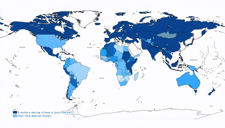
Climate resilience maps are revolutionizing how we protect our coastal communities and marine ecosystem biodiversity in the face of escalating climate challenges. These sophisticated digital tools integrate real-time environmental data, predictive modeling, and local knowledge to create dynamic visualizations of climate vulnerabilities and adaptation opportunities across marine landscapes. By mapping critical factors such as sea-level rise, storm surge patterns, and ecosystem health indicators, these innovative systems enable communities and conservation managers to make informed decisions about resource allocation and protective measures. From small island nations to sprawling coastal metropolises, climate resilience mapping has emerged as an indispensable instrument in the global toolkit for climate adaptation, offering a data-driven approach to safeguarding our marine resources and coastal infrastructure for future generations. As climate patterns become increasingly unpredictable, these mapping technologies serve as crucial navigational aids in charting a course toward sustainable and resilient marine resource management.
Understanding Climate Resilience Maps
Key Components and Data Layers
Climate resilience maps integrate multiple layers of data to provide a comprehensive view of environmental vulnerabilities and adaptive capacities. At their core, these maps typically include baseline environmental data such as temperature patterns, precipitation levels, and sea-level measurements. These fundamental layers are overlaid with critical ecosystem indicators like coral reef health, mangrove coverage, and seagrass distribution.
Socioeconomic factors form another essential component, incorporating population density, infrastructure locations, and economic activities in coastal areas. This data helps identify communities most vulnerable to climate impacts and areas requiring immediate adaptation strategies.
Physical vulnerability indicators make up a crucial layer, featuring coastal erosion rates, storm surge potential, and flood-prone zones. These are complemented by biological resilience markers, including species diversity indices and habitat connectivity measures, which help assess ecosystem adaptability.
The maps also integrate climate projection data, showing predicted changes in temperature, precipitation, and sea levels under various climate scenarios. This forward-looking component enables planners to anticipate future challenges and develop appropriate responses.
Resource availability data, including emergency response facilities, evacuation routes, and water management infrastructure, forms the final key layer. This information is vital for disaster preparedness and response planning.
All these components work together to create a dynamic tool that helps communities understand their climate risks and plan effective adaptation strategies. Regular updates ensure the maps remain relevant as environmental conditions change and new data becomes available.
Technology Behind the Mapping
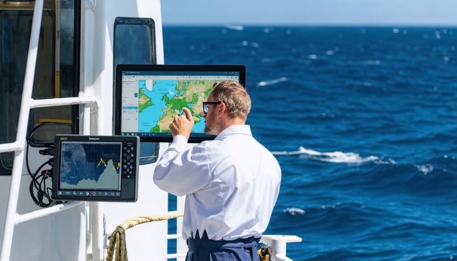
Modern climate resilience mapping relies on a sophisticated blend of technologies, combining satellite imagery, machine learning algorithms, and real-time data collection systems. The foundation of these maps is built upon Geographic Information Systems (GIS) platforms, which integrate with the climate resilience toolkit to process and visualize complex environmental data.
Remote sensing technologies, including LiDAR and multispectral imaging, capture detailed information about coastal topography, ocean temperatures, and vegetation patterns. These data streams are enhanced by a network of IoT sensors deployed across marine environments, providing continuous monitoring of key environmental indicators.
Cloud computing platforms enable rapid processing of massive datasets, while artificial intelligence algorithms help identify patterns and predict future climate impacts. Citizen science applications contribute valuable ground-truth data, allowing community members to report real-time observations through user-friendly mobile interfaces.
The mapping system’s architecture incorporates APIs that facilitate data sharing between different environmental organizations and research institutions, ensuring that the most current information is always available to decision-makers and conservation planners.
Applications in Marine Resource Management
Identifying Vulnerable Marine Areas
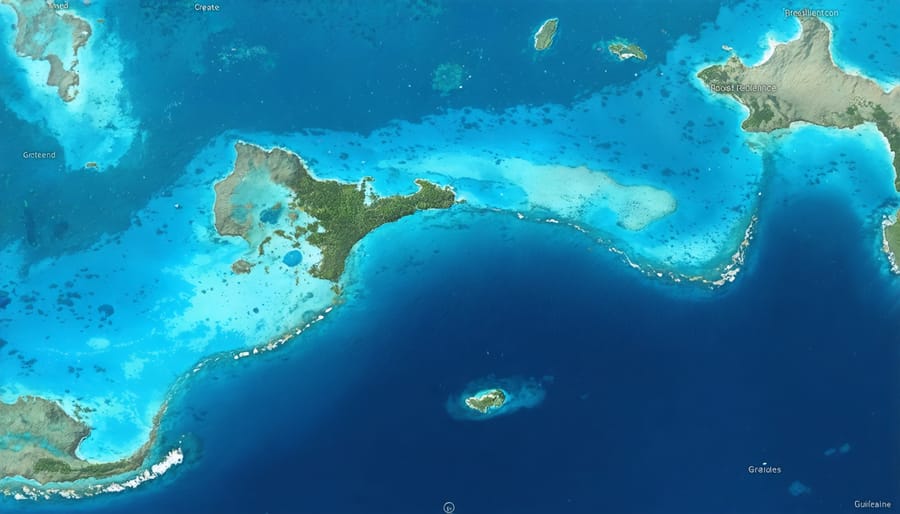
Climate resilience maps serve as crucial tools in identifying marine areas most susceptible to climate change impacts. By overlaying multiple data layers – including sea surface temperatures, ocean acidification levels, and species distribution patterns – scientists can pinpoint regions that require immediate conservation attention.
These maps combine satellite imagery, oceanographic data, and field observations to create detailed vulnerability assessments. For example, coral reef systems are carefully monitored through these mapping techniques, revealing areas experiencing frequent bleaching events or showing signs of reduced calcification due to changing ocean chemistry.
Coastal zones particularly benefit from this mapping approach, as they often face multiple climate-related threats simultaneously. By analyzing patterns of sea-level rise, storm intensity, and habitat degradation, researchers can identify “climate hotspots” where marine ecosystems face the greatest risks.
Marine protected area managers use these maps to prioritize conservation efforts and allocate resources effectively. The visual representation of vulnerable areas helps communicate complex environmental data to stakeholders and policymakers, facilitating more informed decision-making in marine resource management.
Through continuous monitoring and mapping, scientists can also track changes over time, providing valuable insights into the effectiveness of conservation measures and helping predict future impacts on marine ecosystems.
Planning Protected Marine Zones
Marine protected areas (MPAs) serve as crucial safeguards for ocean biodiversity, and climate resilience mapping has revolutionized how we plan and manage these vital zones. By overlaying multiple data layers – including species distribution, ocean currents, temperature patterns, and human activity – scientists can identify the most critical areas for protection.
These digital mapping tools help marine conservationists analyze connectivity between different ecosystems, ensuring protected areas function as an integrated network rather than isolated patches. For instance, mapping tools have revealed important migration corridors for endangered species and helped identify areas that act as climate refugia – locations where marine life can better withstand changing conditions.
Conservation teams use these maps to track the effectiveness of existing MPAs and identify gaps in protection. The technology has proven particularly valuable in designing reserve networks that can adapt to shifting species distributions caused by climate change. Through detailed habitat mapping, scientists can also predict how marine ecosystems might respond to future climate scenarios.
Successful examples include the Great Barrier Reef Marine Park zoning plan, where mapping tools helped establish a comprehensive network of protected areas that balance conservation needs with sustainable use. These mapping capabilities have transformed MPA planning from a static, boundary-focused approach to a dynamic, ecosystem-based management system that better serves both marine life and coastal communities.
Adaptive Management Strategies
Climate resilience maps serve as dynamic decision-making tools that enable marine resource managers to implement responsive and forward-thinking strategies. By integrating real-time data with predictive modeling, these maps help identify areas requiring immediate intervention while supporting long-term ocean sustainability efforts.
These adaptive management tools facilitate three crucial functions: monitoring environmental changes, evaluating intervention effectiveness, and adjusting conservation strategies accordingly. When coral bleaching events are detected, for instance, managers can quickly implement protective measures in vulnerable areas while simultaneously monitoring the success of existing conservation initiatives.
The maps’ layered approach allows managers to track multiple variables simultaneously, from water temperature and acidification levels to species migration patterns. This comprehensive view enables rapid response to emerging threats and helps identify resilient areas that may serve as marine refugia.
Marine protected area (MPA) managers particularly benefit from these tools, using them to adjust boundaries and protection levels based on changing conditions. The maps also help coordinate cross-jurisdictional responses, ensuring that conservation efforts remain effective even as marine ecosystems adapt to climate change.
Through continuous monitoring and assessment, these mapping systems support an iterative management approach that evolves with our understanding of marine ecosystem dynamics and climate impacts.
Success Stories and Case Studies
The Great Barrier Reef Initiative
The Great Barrier Reef Initiative stands as a pioneering example of climate resilience mapping in marine ecosystems. In 2018, marine scientists and conservation experts launched an ambitious project to map resilient coral communities across the 2,300-kilometer reef system. Using advanced remote sensing technology and data collected by citizen scientists, researchers identified areas showing remarkable adaptation to rising ocean temperatures and acidification.
The mapping project revealed several “super sites” where corals demonstrated enhanced resistance to bleaching events. These resilient zones, primarily located in the reef’s northern and central sections, became priority areas for conservation efforts. Local marine biologists discovered that these regions hosted specific coral species with genetic variations that enabled better heat tolerance.
Community engagement played a crucial role in the initiative’s success. Local dive operators, indigenous rangers, and volunteer reef monitors contributed valuable observations and data points, creating a comprehensive understanding of reef health patterns. This collaborative approach not only enhanced the accuracy of resilience mapping but also fostered a sense of stewardship among local communities.
The initiative’s findings have revolutionized reef management strategies. Conservation resources are now strategically directed toward protecting these resilient zones while supporting the recovery of more vulnerable areas. The project also established a network of early warning stations that monitor environmental conditions, allowing rapid response to potential threats.
Today, the Great Barrier Reef’s resilience mapping serves as a model for similar initiatives worldwide, demonstrating how scientific innovation and community participation can work together to protect marine ecosystems.
Mediterranean Conservation Success
The Mediterranean Sea has emerged as a beacon of hope in marine conservation, demonstrating how climate resilience mapping can lead to tangible results. A collaborative effort between scientists, local communities, and policymakers has successfully identified and protected crucial marine habitats across the region, resulting in a 30% increase in biodiversity within protected areas over the past decade.
In the waters off the coast of Spain and Italy, researchers mapped thermal refugia – areas naturally resistant to temperature fluctuations – which now serve as sanctuaries for heat-sensitive species like the Mediterranean red coral and various seagrass meadows. These mapped zones have become priority conservation areas, with local fishing communities actively participating in their protection.
The success story of the Posidonia oceanica seagrass restoration project particularly stands out. Using climate resilience mapping, scientists identified areas where these vital marine plants could thrive despite changing conditions. The resulting restoration efforts have led to a 45% recovery of seagrass meadows in targeted areas, providing essential habitat for marine life and serving as natural carbon sinks.
Marine biologist Dr. Elena Santos, who led the mapping initiative, notes: “By combining traditional ecological knowledge with advanced mapping technologies, we’ve created a blueprint for sustainable marine conservation that other regions can adapt and implement.”
Future Developments and Opportunities
Emerging Technologies
Recent technological advancements have revolutionized the way we develop and utilize climate resilience maps. Machine learning algorithms now process vast amounts of environmental data to identify resilient ecosystems with unprecedented accuracy. Satellite imagery combined with AI-powered analysis tools can track changes in coastal landscapes and marine ecosystems in real-time, providing crucial insights for conservation planning.
Digital twin technology is emerging as a powerful tool for resilience mapping, creating virtual replicas of marine ecosystems that enable scientists to simulate various climate scenarios and their impacts. These simulations help in identifying vulnerable areas and testing different adaptation strategies before implementation.
Blockchain technology is being integrated into mapping systems to ensure data transparency and create immutable records of environmental changes. This helps in tracking conservation efforts and verifying the effectiveness of resilience-building measures.
Mobile applications and citizen science platforms are democratizing data collection, allowing community members to contribute valuable observations about local ecosystem changes. These crowd-sourced inputs, when combined with professional scientific data, create more comprehensive and locally relevant resilience maps.
Drone technology and underwater autonomous vehicles are expanding our ability to map previously inaccessible marine areas, providing high-resolution data about coral reefs, seagrass beds, and other critical marine habitats that serve as natural buffers against climate impacts.
Community Involvement
Scientists and community members play crucial roles in developing and maintaining climate resilience maps through various collaborative efforts. Research institutions actively seek partnerships with local communities, recognizing that traditional ecological knowledge and day-to-day observations are invaluable for creating accurate, comprehensive mapping systems.
Citizen science programs enable volunteers to contribute data through mobile apps and web platforms, recording changes in coastal environments, marine species distributions, and weather patterns. These contributions, when combined with scientific measurements, create a more detailed picture of climate impacts and resilience patterns.
Many successful local community conservation initiatives have emerged from these mapping collaborations, where fishers, indigenous communities, and coastal residents work alongside researchers to monitor and protect vulnerable areas.
To participate, interested individuals can:
– Join local environmental monitoring programs
– Contribute observations through dedicated mobile apps
– Attend community workshops on climate mapping
– Partner with research institutions
– Share traditional ecological knowledge
– Participate in coastal restoration projects
These collaborative efforts not only improve the accuracy and relevance of climate resilience maps but also foster a sense of environmental stewardship and community engagement in marine conservation efforts.
Climate resilience maps represent more than just data visualization tools – they are crucial instruments for building a sustainable and climate-ready future. By providing detailed insights into vulnerabilities and adaptation opportunities, these maps empower communities, policymakers, and scientists to make informed decisions that protect both human settlements and natural ecosystems.
The importance of these mapping tools cannot be overstated in our rapidly changing climate. They serve as bridges between scientific understanding and practical action, helping us identify areas that need immediate attention while highlighting regions that may prove resilient in the face of climate change. This knowledge is invaluable for developing targeted conservation strategies and ensuring the efficient allocation of resources.
As we face increasing environmental challenges, the role of climate resilience mapping will only grow in significance. However, the effectiveness of these tools depends on continued data collection, technological innovation, and most importantly, active participation from diverse stakeholders – from scientific communities to local residents.
You can contribute to this vital work by engaging with local environmental organizations, participating in citizen science projects, or sharing climate resilience data from your region. Every contribution, no matter how small, helps build a more comprehensive understanding of our changing planet and strengthens our collective ability to adapt and thrive.
The future of climate resilience mapping lies in our hands. By embracing these tools and working together, we can create more resilient communities and ecosystems that will withstand the challenges of climate change.
jessica
Ava Singh is an environmental writer and marine sustainability advocate with a deep commitment to protecting the world's oceans and coastal communities. With a background in environmental policy and a passion for storytelling, Ava brings complex topics to life through clear, engaging content that educates and empowers readers. At the Marine Biodiversity & Sustainability Learning Center, Ava focuses on sharing impactful stories about community engagement, policy innovations, and conservation strategies. Her writing bridges the gap between science and the public, encouraging people to take part in preserving marine biodiversity. When she’s not writing, Ava collaborates with local initiatives to promote eco-conscious living and sustainable development, ensuring her work makes a difference both on the page and in the real world.